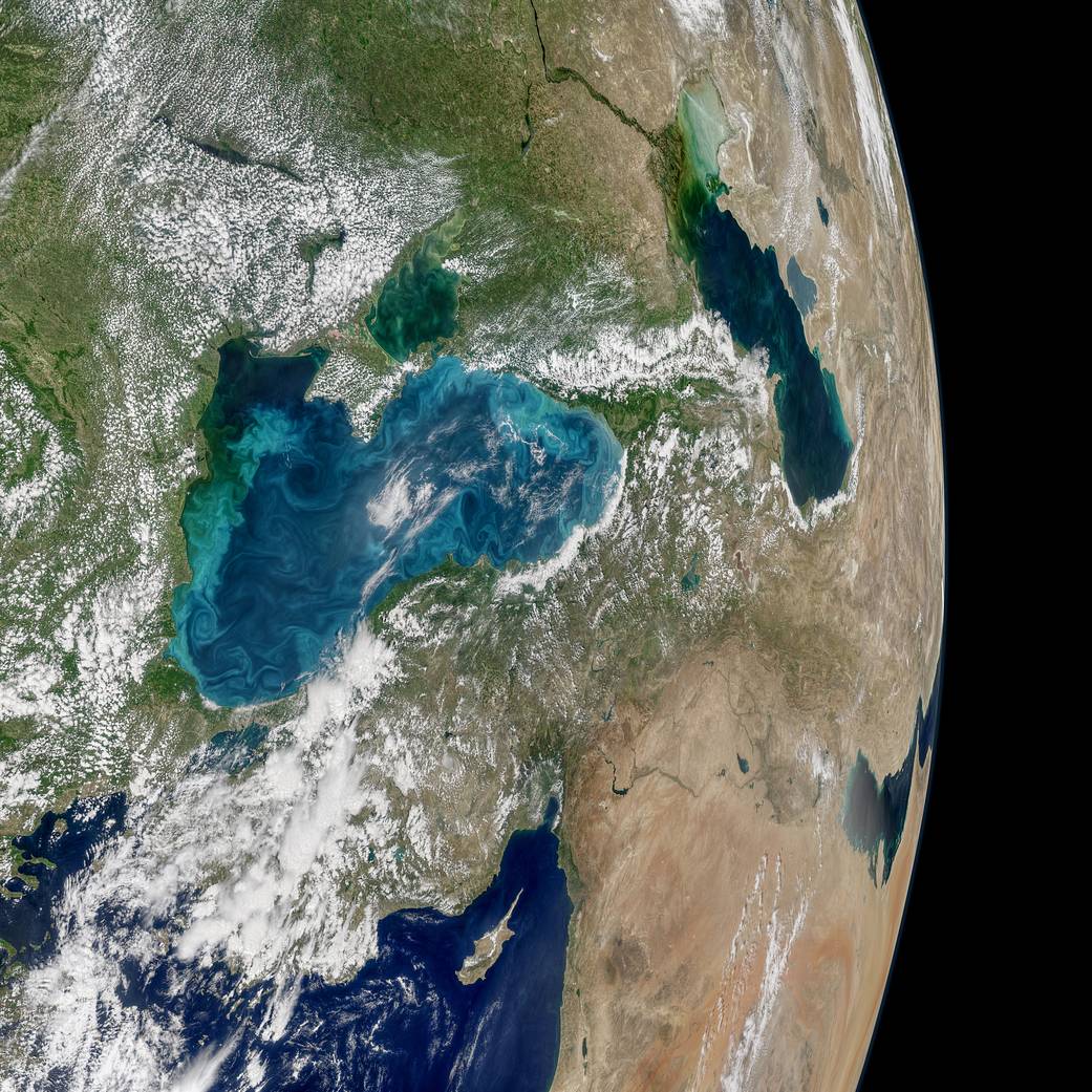
Most summers, jewel-toned hues appear in the Black Sea, a result of phytoplankton that trace the flow of water currents and eddies. The Moderate Resolution Imaging Spectroradiometer (MODIS) on NASA's Aqua satellite recently collected imagery of such an ongoing phytoplankton bloom.
Great Barrier Reef
The European Space Agency (ESA) Copernicus Sentinel-2A satellite collected an image of part of the Great Barrier Reef off Australia's northeast coast on April 1, 2017.
Monitoring Grasslands for Agricultural Subsidies
Grasslands cover approximately 37 percent of Earth's land surface when calculated with shrub-lands and savannas. In Western Europe, grasslands comprise 40 percent of agricultural land. And now European Space Agency (ESA) Copernicus Sentinel satellites are being used to detect and better evaluate management practices of grasslands in Estonia.
Satellite Spies Desert Festival in India
The European Space Agency (ESA) Sentinel-2A satellite collected this image over western India: a seasonal salt marsh known as the Rann of Kutch.
16th Century Dutch Star-Shaped ˜Moat Fort'
Fort Bourtange is a star-shaped moat fort, located in the village of Bourtange in the east of Groningen in the Netherlands near the German border. This fort was built in 1593 to create a border around the only road between Germany and Groningen, which was was occupied by Spaniards around the time of the Eighty Years War.
Shadows Across Arctic Iceberg
The shadow of NASA’s P-3 aircraft is seen over an iceberg on a May 8, 2017, flight supporting NASA’s Operation IceBridge mission. IceBridge began its final week of Arctic Spring 2017 surveys with a glacier-packed mission in Greenland.
Complexities of the Bering Sea
The European Space Agency (ESA) Copernicus Sentinel-3A satellite collected this image of the Bering Sea, north of the Alaska Peninsula, on March 26, 2017.
EagleView Accelerates Machine Learning Development with Acquisition of OmniEarth
Bothell, WA – EagleView®, the leading provider of aerial imagery and data analytics for government and commercial industries, is proud to announce the acquisition of OmniEarth, developer of machine learning technologies and decision-making tools for the water...
Record-Low Sea Ice
On Feb. 13, 2017, the combined Arctic and Antarctic sea-ice numbers were at their lowest point since satellites began to continuously measure sea ice in 1979.
Vertical Images: From Film Making to Inspection, and Why the Future of Drones Doesn't Lie in Flying
Successful drone entrepreneur Petr LnÄ›niÄka went from award-winning filmmaker to drone inspection leader in his native Czech Republic. Here he lays out 3 pieces of advice and explains why for him, the transition seemed logical, and why he believes the future of drone mapping services will place less and less emphasis on drones and more and more weight on mapping data.