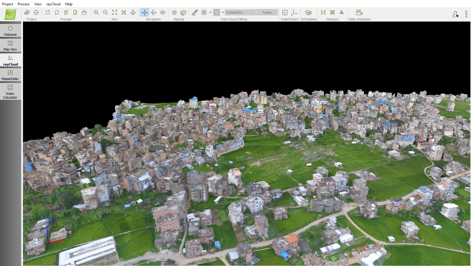
Humanitarian UAV Network founder Patrick Meier led a weeklong UAV training mission in Nepal, teaching engineering students at Kathmandu University how to use drones and image-processing software for humanitarian and disaster-response scenarios.
Humanitarian UAV Network founder Patrick Meier led a weeklong UAV training mission in Nepal, teaching engineering students at Kathmandu University how to use drones and image-processing software for humanitarian and disaster-response scenarios.
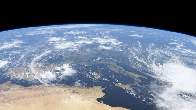
The European Space Agency (ESA) introduced a free online course, featuring scientists and experts from ESA and other European research centers, to educate people about the science behind Earth observation (EO), and how it can help detect and monitor global climate change.
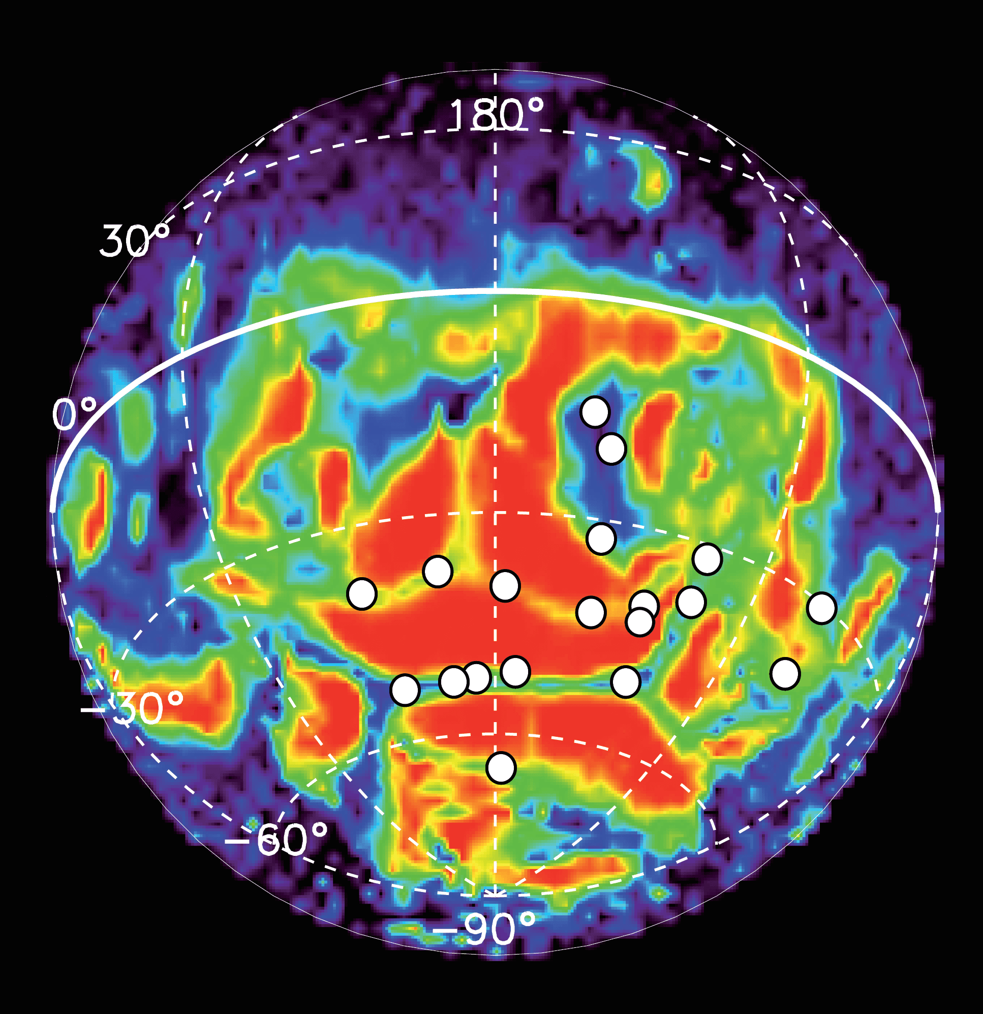
The European Space Agency's Mars Express satellite has been able to detect ultraviolet auroras on the planet by combining remote observations with in situ measurements of electrons hitting the atmosphere, and a new study looks at 10 years of such observations.
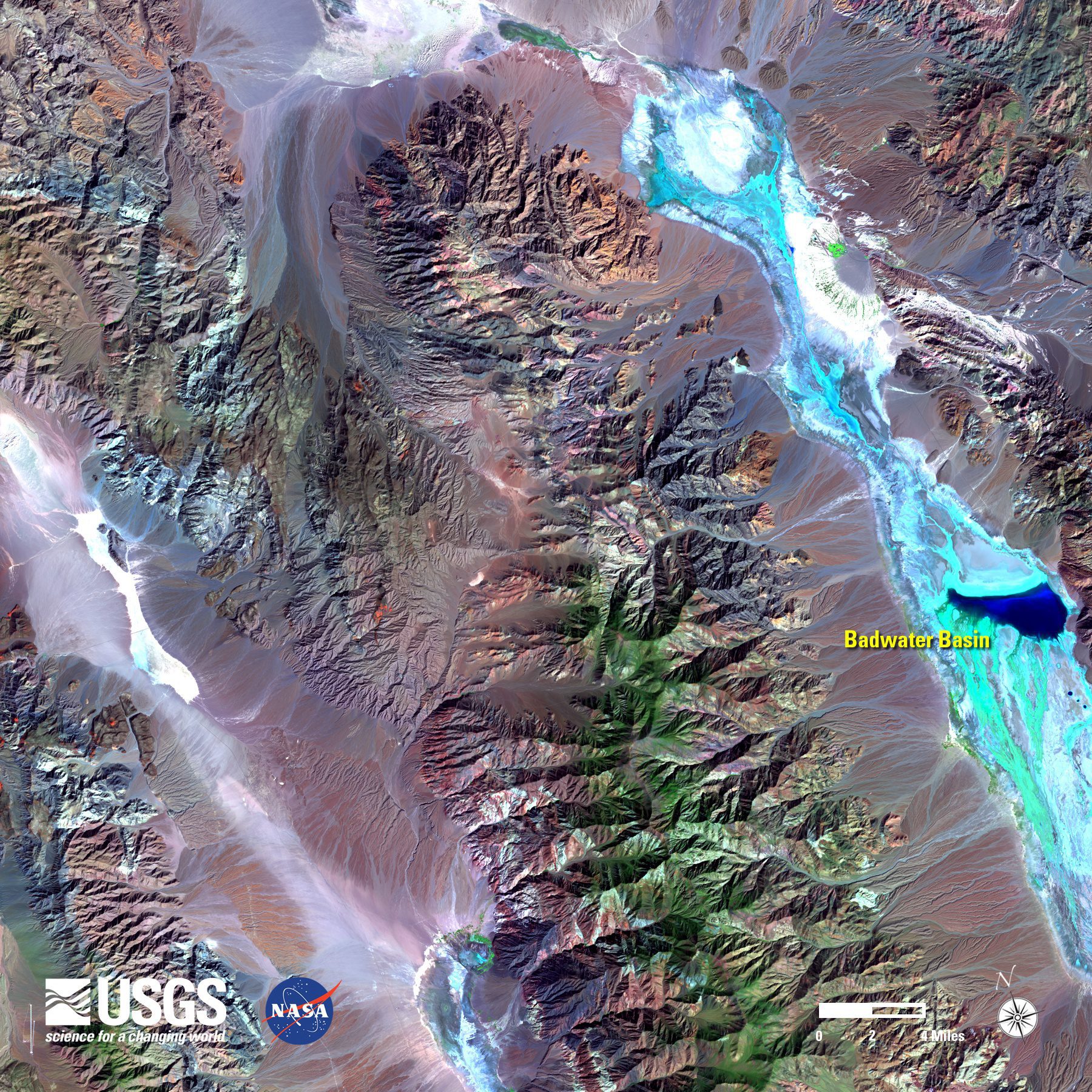
In October 2015, a system of storms caused significant flooding in most of California's Death Valley National Park. Flash floods from the storm destroyed roads and utilities, and damaged several historical structures.
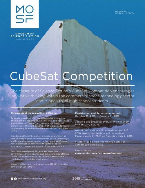
Cornell University, The Museum of Science Fiction and NASA Space Grant consortia grantees are hosting a competition for high-school students to get CubeSat projects they develop launched into space.

The Greenland ice sheet's flow toward the ocean is controlled by several factors, but how surface meltwater drains through the three-kilometer-thick sheet to the ground below and the effect this has on the speed of ice flow is poorly understood.
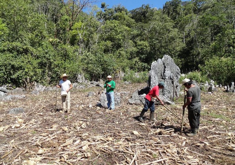
An international project lead by sustainability software and data firm Ecometrica and funded by the UK Space Agency’s International Partnership Space Programme helped local organizations in Mexico secure funding of more than $1 million from the Global Environment Facility to support conservation of the El Ocote Biosphere Reserve in the state of Chiapas.

The National Geospatial-Intelligence Agency (NGA) introduced a commercial GEOINT strategy that outlines the agency's plans to deliver commercial geospatial intelligence products and services by leveraging greater persistence from its traditional as well as new and emerging GEOINT providers.
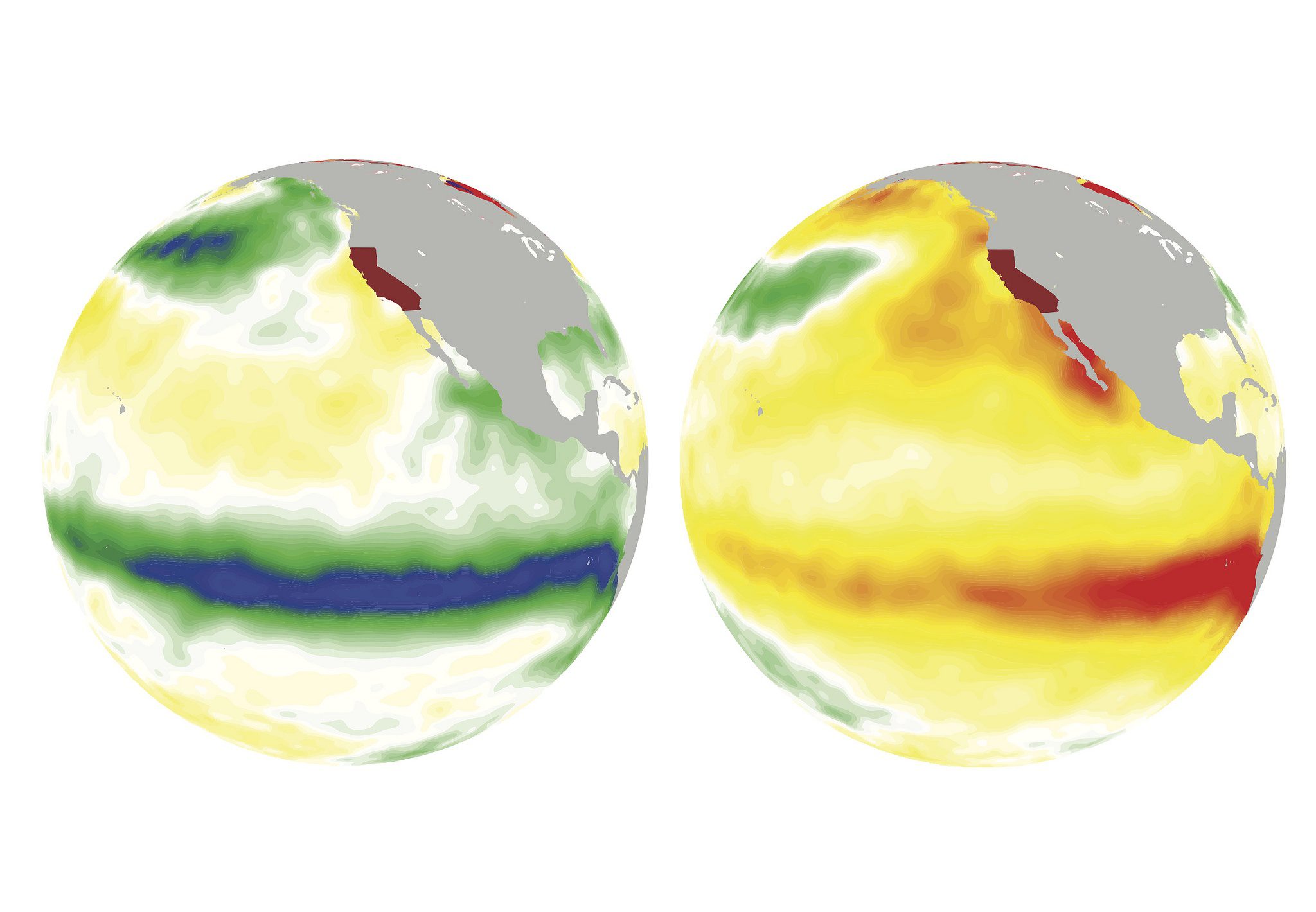
A study published in Nature Communications suggests that El Niño and La Niña weather patterns could lead to at least a doubling of extreme droughts and floods in California later this century. The study also predicts more-frequent extreme weather events.
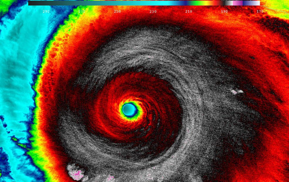
Hurricane Patricia made landfall on Oct. 24, 2015, along the southwestern coast of Mexico. NASA's Aqua satellite captured Patricia making landfall, while the Global Precipitation Measurement mission core satellite added up Patricia's high rain totals, which exceeded more than 409 millimeters (16.1 inches) over open waters.
