Bruchsal, Germany – GfK has released new 2019 CRESTA zones that give insurers, reinsurers, modelers, regulators and other industry professionals a common standard for analyzing, aggregating and exchanging risk-related insights. Available for 137 countries, the 2019...
DigEplan Integrates Electronic Plan Review to Cityworks Platform
DigEplan, a leading integrated electronic plan review solution, and GIS-centric public asset management solution firm, Cityworks have worked to combine platforms, bringing Cityworks customers the powerful functionality of an integrated tool for electronic plan review....
Golden Software Streamlines Gridding Functionality in Surfer
GOLDEN, Colorado – Golden Software, a developer of affordable 2D and 3D scientific modeling packages, has enhanced Gridding and other key workflows in the latest release of its Surfer® software. Used by 100,000 clients worldwide, Surfer is a gridding, contouring...
Terra Drone India partners with Canadian CAD/GIS market leader Geo-Plus to serve AEC sector in India
Hyderabad, India – Leading industrial drone solutions provider, Terra Drone India, has announced that it is joining forces with Canada-based geomatics pioneer Geo-Plus. This partnership makes Terra Drone India an official reseller of Geo-Plus’ innovative land...
Developer Paul McKee, Jr./M Property Services Advance Vision for St. Louis Geospatial Intelligence Hub with NGA Groundbreaking
St. Louis, MO – St. Louis Developer Paul McKee, Jr. and his real estate development company M Property Services (MPS) took a huge step last week toward fulfilling a vision to turn St. Louis into a worldwide geospatial intelligence hub with construction starting on a...

GA-ASI Assists California Air National Guard with Fire Season
General Atomics Aeronautical Systems Inc. (GA-ASI) is supporting the California Air National Guard (CA ANG) as they provide real-time reconnaissance for California's Department of Forestry and Fire Protection (CAL FIRE) firefighting operations in Southern California.
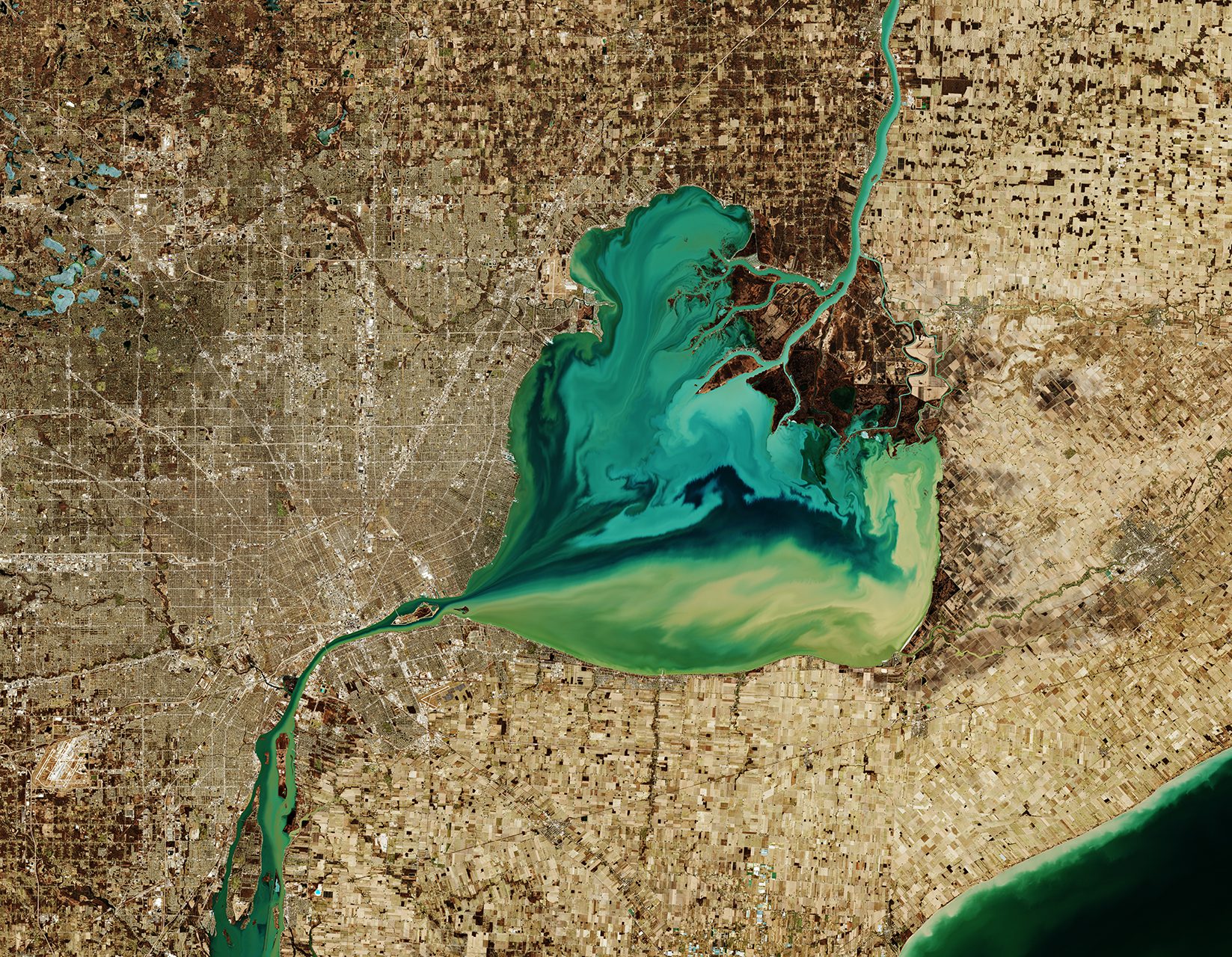
Lake St. Clair
The Copernicus Sentinel-2 mission takes us over Lake St. Clair, forming the border between Ontario, Canada, to the east, and Michigan to the west.
SimActive Introduces New LiDAR Workflow
Montreal, Canada, December 3rd, 2019 – SimActive Inc., a world-leading developer of photogrammetry software, announces a new LiDAR workflow integrated in its Correlator3D™ product. The capability allows to import a point cloud in the software and to perform...
Free Consumer Spending Data for Maptitude Mapping Software (or as Shapefile)
NEWTON, MASSACHUSETTS (USA) - Caliper is excited to announce the release of free consumer expenditure data for the USA. This new tract-level map layer includes average annual household expenditure estimates for nearly 400 different products. These purchases can be...
EUROSENSE expands its mapping capabilities
EUROSENSE, one of the major suppliers of geospatial data solutions in Europe, is significantly expanding its international mapping capabilities! Investing in 2019 in the brand new cutting-edge Riegl VQ-1560 II 4MHz LiDAR scanning system with the PhaseOne iXM-RS150F...
