Accented by dramatic shadows, this photograph shows canyons and prominent topography around Comb Ridge, as observed by an astronaut aboard the International Space Station (ISS).
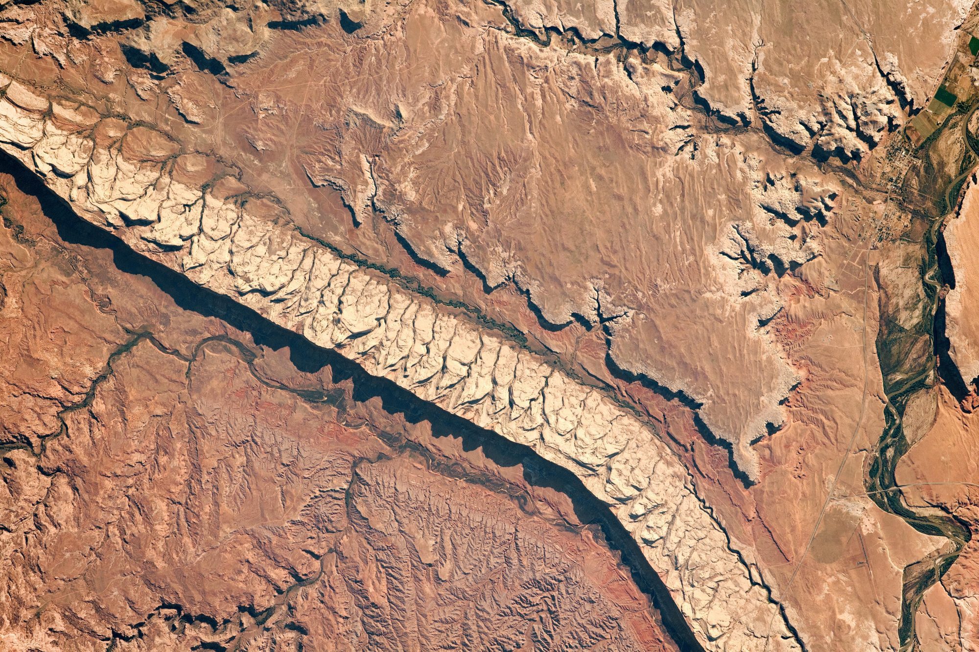
Accented by dramatic shadows, this photograph shows canyons and prominent topography around Comb Ridge, as observed by an astronaut aboard the International Space Station (ISS).
LAS VEGAS - Topcon Positioning Group announces a new strategy through their Topcon Solutions Store retail channel. Together with Autodesk, and as an Autodesk Platinum Tier Partner, the Topcon Solutions Store retail channel plans to expand top-tier service to...
REDLANDS, California – Today at Dreamforce, Esri, the global leader in mapping and location intelligence, announced that Salesforce has selected Esri as the key geospatial partner for Salesforce Maps. Salesforce is integrating Esri’s ArcGIS Living Atlas, the...
In the midst of what has been called the planet’s sixth mass extinction, many scientists describe the rate of species loss on earth as having reached crisis levels. Faced with the epic challenge to halt, or at least slow, the disappearance of species,...
NACKA STRAND, Sweden - Hexagon AB, a global leader in sensor, software and autonomous solutions, today announced the signing of an agreement to acquire Volume Graphics, a market leader in the industrial computed tomography (CT) software industry. Volume Graphics...
Berlin - Polosoft Technologies announced that their GIS data collection application(https://bit.ly/2ZdfaIO) has included the ED-50 zone to its features. ED-50 is a geodetic datum. There’s a different datum shift for the Universal Transverse Mercator grid. Germany,...
DIN Innovation Award for Prof. Dr. Peter Baumann Never before has so much information about the Earth been available to mankind. Every day, satellites provide an enormous amount of data, for example on the climate, on changes in the atmosphere, or land use. The...
The Association of State Floodplain Managers (ASFPM) announced that Deborah Mills, CFM, has been named a Foundation Fellow. The ASFPM Foundation began its Fellows Program to provide an opportunity for long-standing supporters to remain engaged and active in supporting...
Industry-first tool enables geoscientists to find what’s hidden faster with seamless integration of subsurface drilling and borehole data into ArcGIS Pro CHRISTCHURCH, NZ - Target for ArcGIS Pro was released today to bring advanced understanding of mining and...
Fort Collins, Colo. – Schneider Electric, the industry leader in Geographic Information System (GIS) solutions for utilities and communication providers, announced the release of ArcFM Designer 11.1.4. This release is at the forefront of new ArcGIS platform...
