The Columbia Glacier descends from an ice field 10,000 feet (3,050 meters) above sea level, down the flanks of the Chugach Mountains, and into a narrow inlet that leads into Prince William Sound in southeastern Alaska.
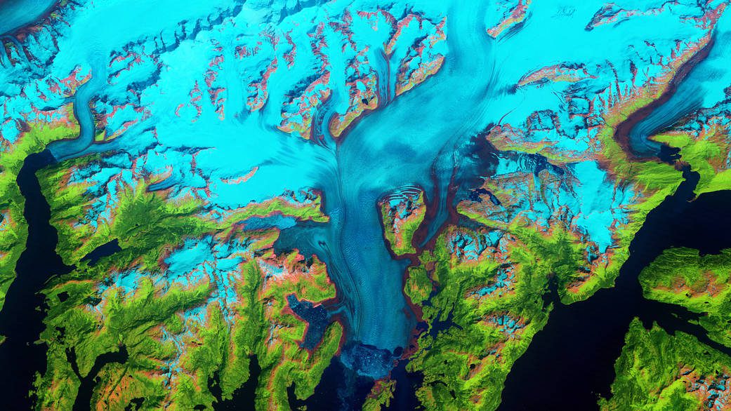
The Columbia Glacier descends from an ice field 10,000 feet (3,050 meters) above sea level, down the flanks of the Chugach Mountains, and into a narrow inlet that leads into Prince William Sound in southeastern Alaska.
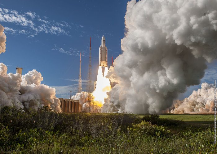
Europe's next four Galileo satellites lifted off on July 25, 2018, from Europe's Spaceport in French Guiana atop an Ariane 5 launcher.
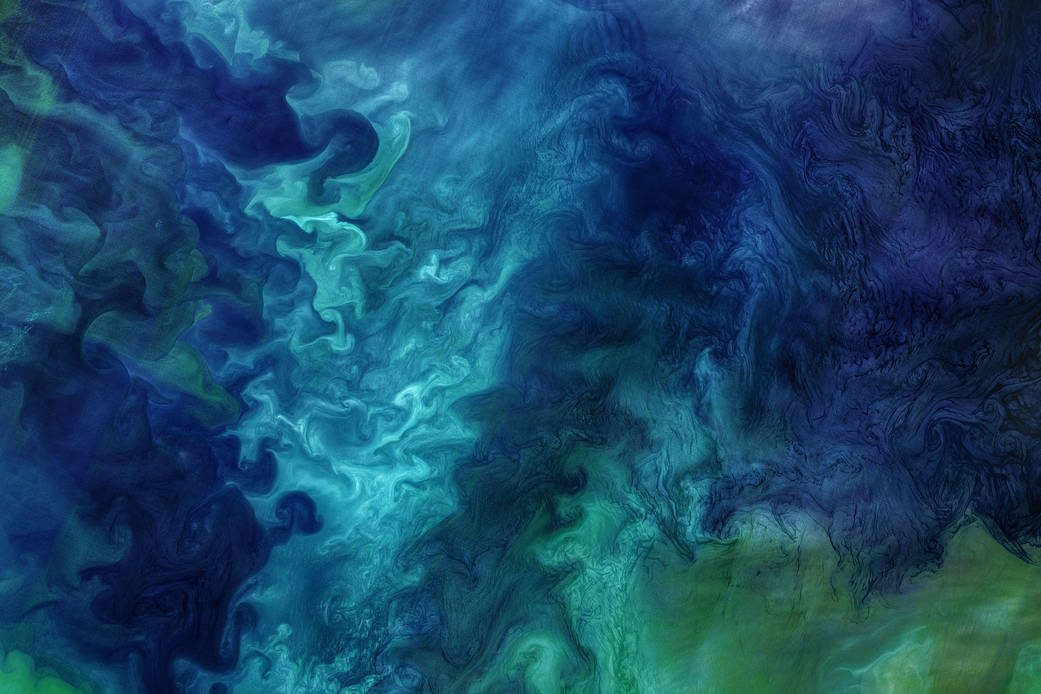
Regardless the amount of winter ice cover, the waters off the Alaskan coast usually come alive each spring with blooms of phytoplankton.
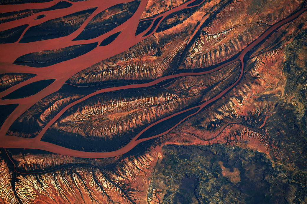
As the International Space Station flew overhead, NASA astronaut Ricky Arnold captured this photograph of a changing landscape in the heart of Madagascar.
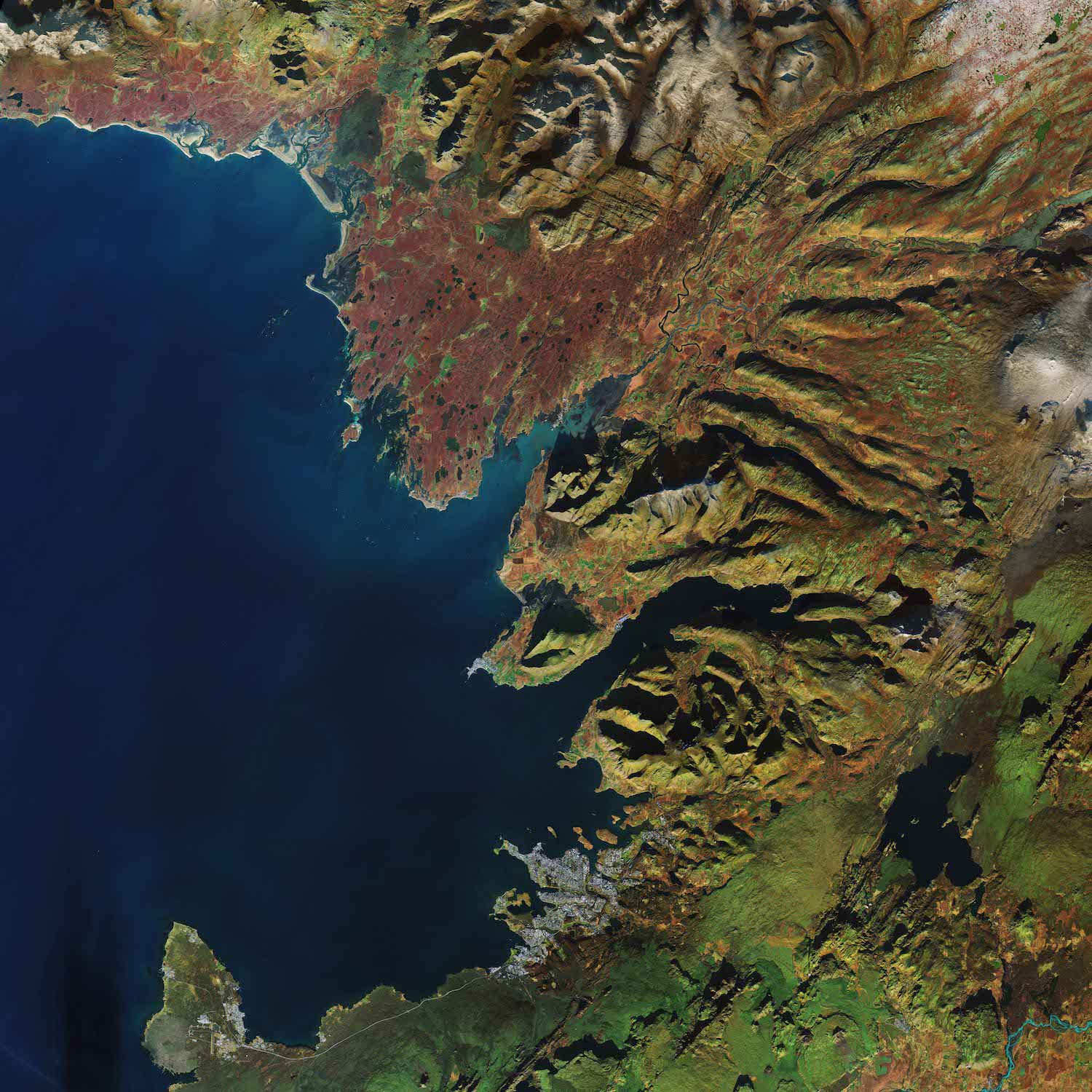
The Copernicus Sentinel-2A satellite takes us over Reykjavik, the capital of Iceland.
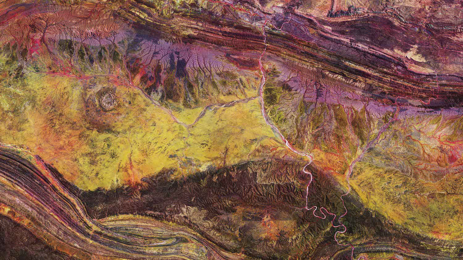
The Copernicus Sentinel-2A satellite takes us over the Gosses Bluff crater in the Northern Territory of Australia.
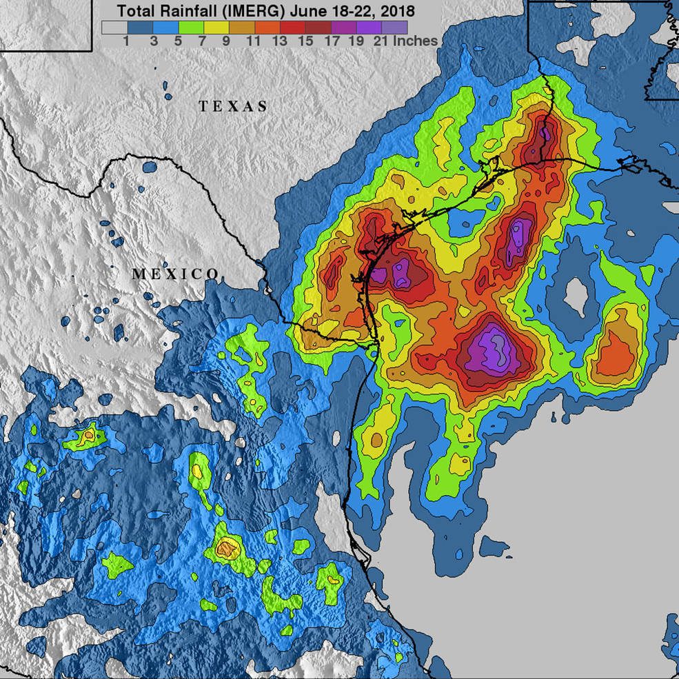
As Tropical Storm Bud was lashing parts of western Mexico and causing flooding that extended into the American Southwest, a tropical disturbance was spinning over the Gulf of Mexico and straddling southeastern Texas.
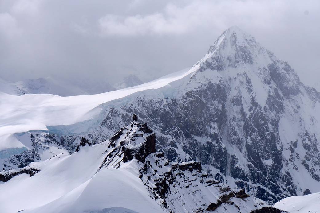
Over the years, scientists have captured spectacular photographs while mapping ice during NASA's Operation IceBridge mission
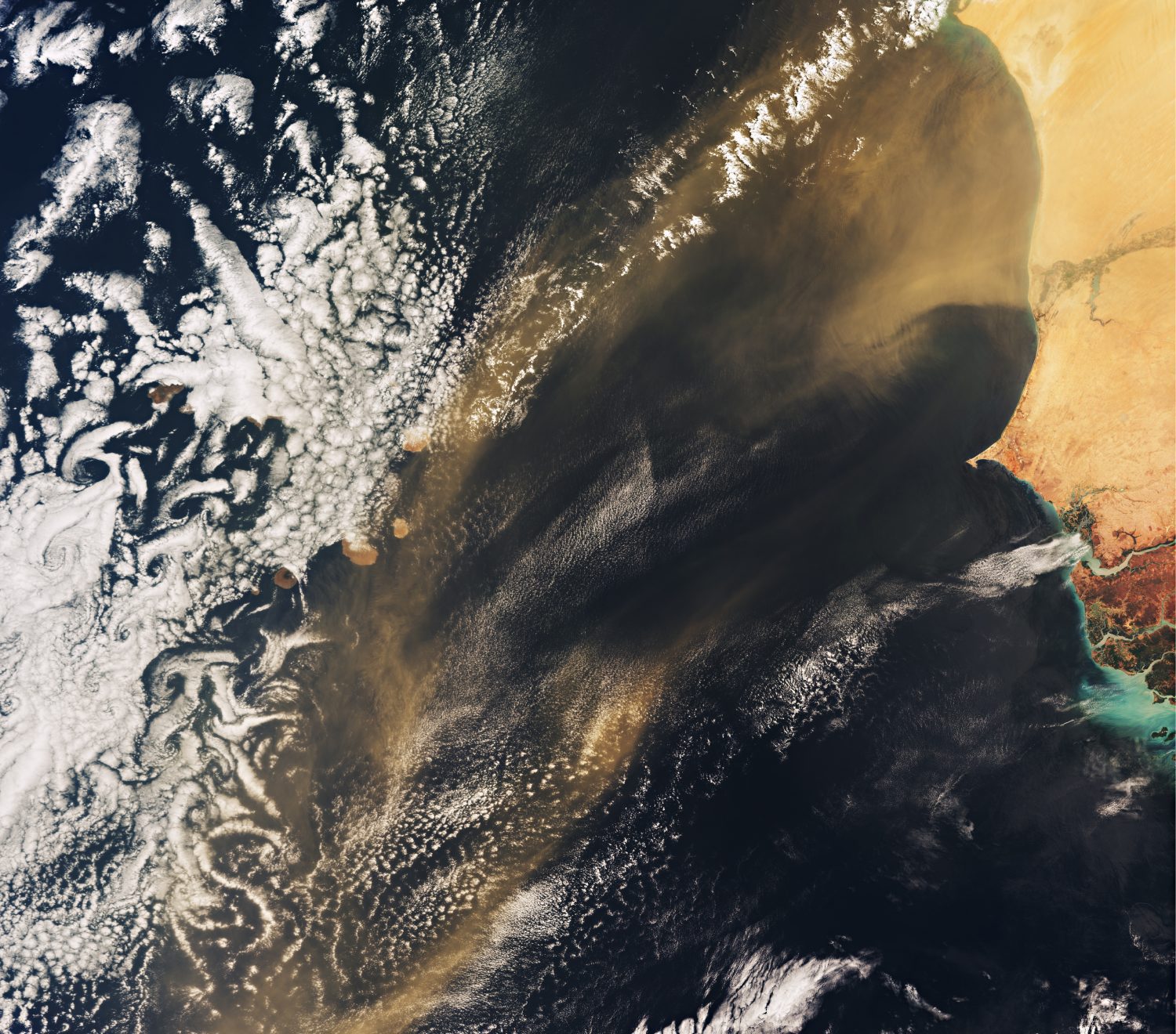
Celebrating World Oceans Day on June 8, 2018, the Copernicus Sentinel-3A satellite takes us over the Atlantic Ocean and the Republic of Cabo Verde.
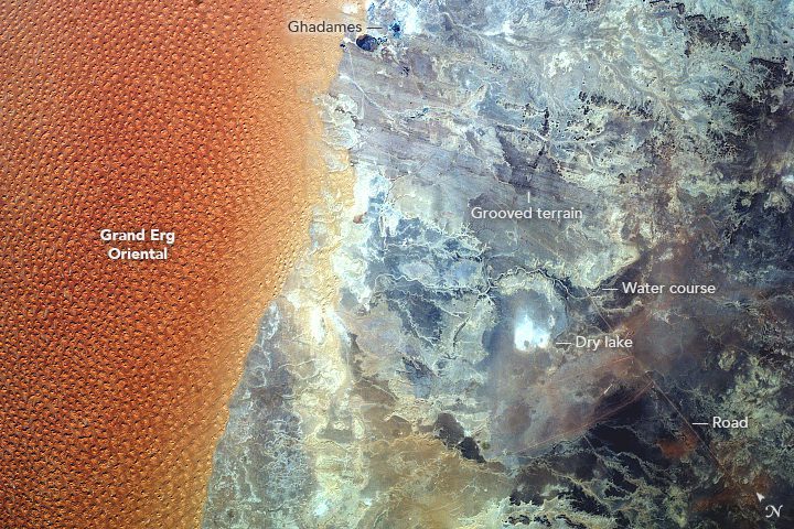
Taken through a window on the International Space Station by the EarthKAM camera, this photograph shows the boundary between a major dune field and dark hills along the border between Algeria and Libya.
