• About
  • Contact
  • Advertise
  • Subscribe
  • Home
  • News
    • Business
    • Products
    • People and Events
      • Drone World Expo Exhibitor Map
      • URISA GIS-Pro & NWGIS 2015 Exhibitor Map
    • Industry Insights & Trends
    • Top Stories
    • Imagery in the News
  • Opinions
    • Data Analysis
    • Defense Watch
    • From the Field
    • Industry Insights
    • Industry Overview
    • Monitoring Resources
    • UAS Innovations
    • Interviews
  • Magazine
    • Table of Contents
    • Digital Flipbooks
  • Image Gallery
  • Market Guide
    • Aerial Imagery
    • Aerospace
    • Cloud Computing
    • Data Storage/Retrieval
    • Education/Training
    • GIS Software
    • Hardware/Peripherals
    • Hyperspectral Imagery
    • Image Compression Software
    • Image Processing Software
    • LiDAR
    • Mapping Services
    • Mobile Mapping
    • Optical Satellite Imagery
    • Photogrammetry
    • Radar Satellite Imagery
    • Smallsats
    • Stereo Viewing Systems
    • Topographic Maps/Nautical Charts/Atlases/Art Prints
    • Unmanned Aircraft Systems
    • Visualization Software/Models
  • Resources
    • Sensor Spotlight
    • Smallsat Company and Sensor Guide
    • Mobile LIDAR Guide
    • Optical Satellite Imagery Resources
    • Aerial Imaging Resource Guide
    • Homeland Security
Breaking News
  • Trimble and Kyivstar Partner to Provide GNSS Correction Services for Geospatial, Agriculture and Construction Applications in Ukraine
  • HERE Technologies and Eco-Movement partner to improve the EV charging experience for drivers globally
  • IDS GeoRadar launches Chaser XR ground-penetrating radar
  • Bluestone Archaeology Adopts PointMan to Map Roman Archaeological Remains in UK
  • ESP Associates Announces Acquisition of CivilCorp and Ditesco, Accelerating its Expansion in Texas and Colorado Markets
Infrared Imagery Monitors U.S. Cold Snap

Infrared Imagery Monitors U.S. Cold Snap

by [email protected] | Dec 13, 2016

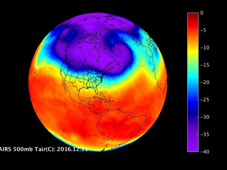
Imagery from the Atmospheric Infrared Sounder (AIRS) instrument aboard NASA’s Aqua satellite showed the movement of cold, Arctic air over the United States from Dec. 1-11, 2016.

NASA UAS Monitors Pacific Storms

NASA UAS Monitors Pacific Storms

by [email protected] | Feb 22, 2016

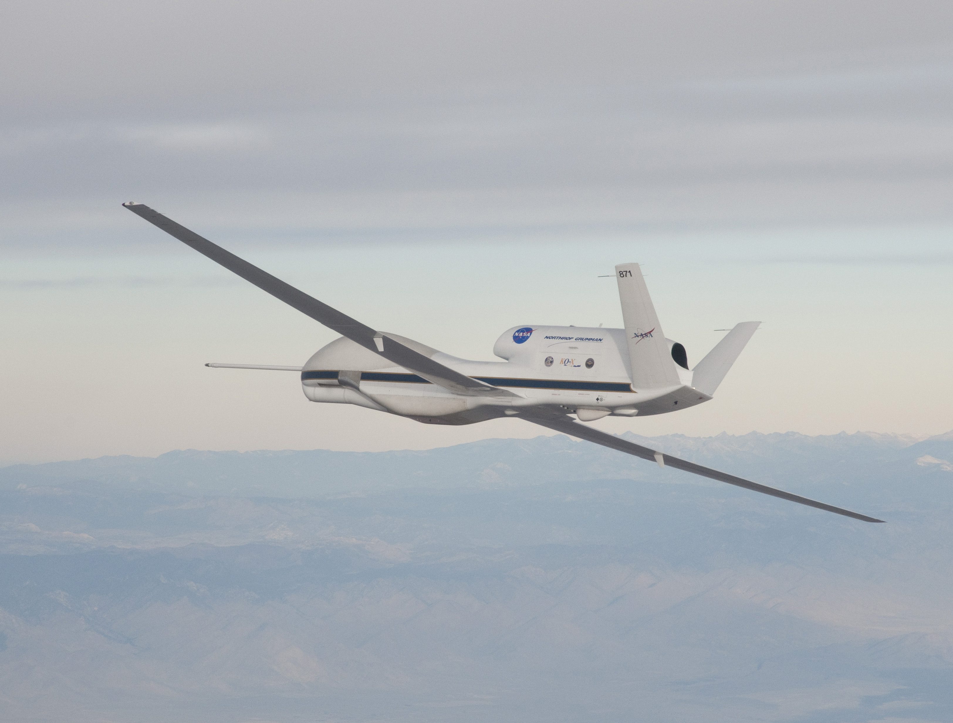
Extreme weather predictions on the U.S. West Coast could become more accurate with help from NASA’s Global Hawk unmanned aircraft system (UAS).

California's Future Likely Includes More Droughts and Floods

California's Future Likely Includes More Droughts and Floods

by [email protected] | Oct 27, 2015

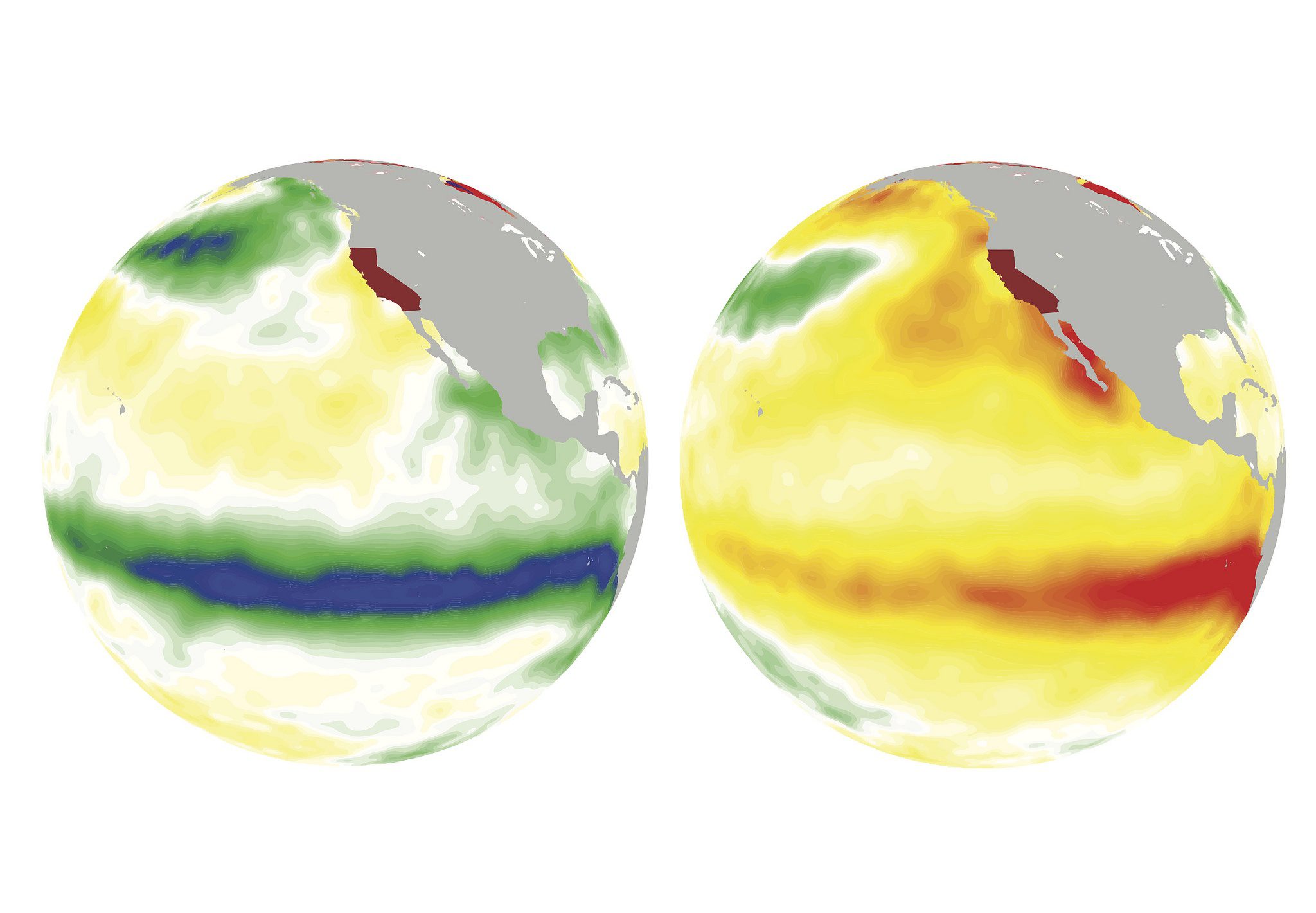
A study published in Nature Communications suggests that El Niño and La Niña weather patterns could lead to at least a doubling of extreme droughts and floods in California later this century. The study also predicts more-frequent extreme weather events.

Receive our FREE publication and weekly e-mail newsletter.
NEWEST V1 MEDIA PUBLICATION

Third Annual Sustainable Engineering Issue 2023
  • About
  • Contact
  • Advertise
  • Subscribe
Copyright © 2007-2023 • V1 Media. All Rights Reserved.