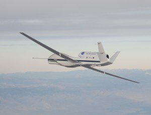
NASA’s Global Hawk UAS is part of a mission to track storms developing in the Pacific Ocean to better predict severe West Coast weather. (Credit: NASA Photo/Carla Thomas)
Extreme weather predictions on the U.S. West Coast could become more accurate with help from NASA’s Global Hawk unmanned aircraft system (UAS). Global Hawk flights to look at Pacific storms as they develop began Feb. 12, 2016.
The mission hopes to show how Global Hawk could augment satellites and routinely fly large areas of the ocean, according to Robbie Hood, director of the National Oceanic and Atmospheric Administration (NOAA) UAS program.
NOAA, NASA and the National Weather Service are partnering on an El Niño field research campaign “to get data in the hands of forecasters and for our weather models,” said Robert Webb, Physical Science Division director of the Office of Ocean and Atmospheric Research for NOAA.
The observation flights are part of NOAA's Sensing Hazards with Operational Unmanned Technology (SHOUT) program, a multiyear mission to show how autonomous vehicles can fill in gaps in weather modeling and as a potential backup in case a satellite is unable to capture data.
Click here for more information.

