Fitchburg, MA, February 15, 2016 — Headwall Photonics, Inc., the leading provider of spectral imaging solutions, has introduced a new, powerful data processing unit specifically designed for UAV airborne applications requiring sensor fusion. The small size and...
SimActive Strengthens its Enterprise UAV Offering with Version 6.3
Montreal, Canada, November 10, 2015 — SimActive Inc., a world-leading developer of photogrammetry software, is pleased to announce Correlator3D™ version 6.3 with an expanded UAV enterprise offering. A new floating licensing option allows computers on the same...
Orbit GT to Showcase New UAS Mapping Product at UAS Expo, Las Vegas
Lokeren, Belgium, October 7, 2015 — Orbit GT will be showcasing its new UAS Mapping product at the UAS Expo in Las Vegas, this week. “We’ve been in the UAV business for over 8 years now, and we’ve seen it grown from scratch.â€, says Peter Bonne, CEO of Orbit...
Dyan Gibbens to Deliver Keynote on Future of UAVs for Global Asset Owners at Commercial UAV Expo
September 24, 2015, Portland, Maine — Dyan Gibbens, CEO and Founder of Trumbull Unmanned, will deliver the keynote “UAVs: A Vision for Global Asset Owners†at Commercial UAV Expo on October 6, 2015 in Las Vegas. Several of the world’s largest oil companies...
YellowScan, the Lightest All-In-One LiDAR System, Operates on Dozens of Different Aerial Vehicles
Montferrier-sur-Lez, France, September 14, 2015 — Since its commercial launch in 2014, YellowScan® has been used extensively on multiple UAV platforms in order to meet customer demands and various mission requirements. Thanks to its unmatched versatility and...
Commercial UAV Expo Issues Report on UAVs and Construction
Portland, Maine, USA, August 27, 2015 — The organizers of Commercial UAV Expo today announced the release of their most recent report, titled “Progressive Construction Firms Mobilize to Put UAVs to Work.†This free report provides key insights into how UAV...
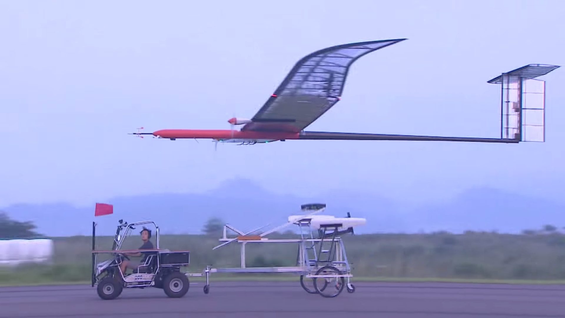
Solar-Powered UAV Flies in Stratosphere
On Aug. 11, 2015, the Korea Aerospace Research Institute (KARI) announced that its EAV-3, a high-altitude UAV powered by solar cells, succeeded in flying into Earth's stratosphere at 14 kilometers above sea level during its nine-hour flight.
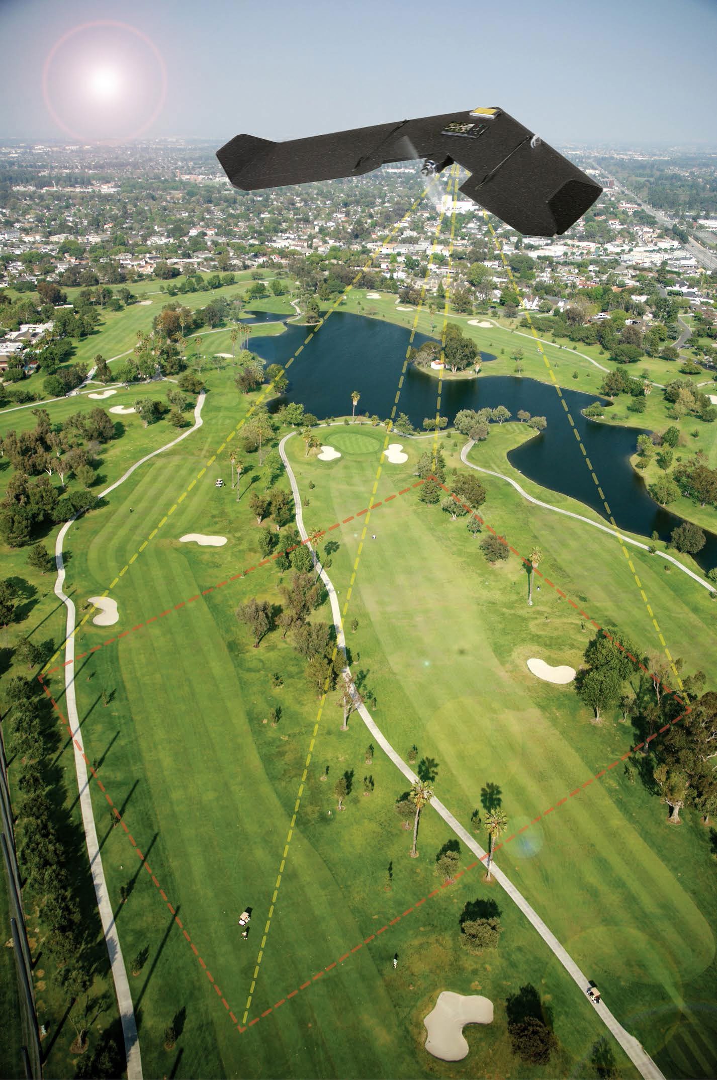
Maiden Fight Pushes Boundaries in Surveying
August 5, 2015 — The Routescene® proposition to transform the approach to surveys across the world is taking hold. Collaborating with Hanseatic Aviation Solutions we have jointly developed an integrated ï¬xed-wing Unmanned Aerial Vehicle (UAV) and LidarPod®...
Bluesky Introduces Prototype UAV Flight-Restriction Map
Aerial mapping company Bluesky produced a prototype map showing where it may be unsafe or even illegal to fly Unmanned Aerial Vehicles (UAVs), commonly referred to as drones. Bluesky combined expertise in flight planning and 3D aerial mapping with various geographic datasets to come up with the concept of a UAV Flight-Restriction Map for the United Kingdom (UK).
MEMSIC to Showcase its Latest Sensing Solutions at Sensors Expo and Conference 2015
Andover, MA, May 29, 2015 — MEMSIC, Inc. plans to demonstrate its latest advanced technologies at the Sensors Expo and Conference, to be held June 10-11 2015 at the Long Beach Convention Center, CA, booth number 245. MEMSIC products, including semiconductors and...
