This multicolored image taken by astronauts onboard the International Space Station captures a multitude of striking colors, textures and geometric patterns.
This multicolored image taken by astronauts onboard the International Space Station captures a multitude of striking colors, textures and geometric patterns.
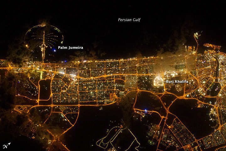
The city of Dubai”the largest metropolitan area within the emirate of Dubai”is a favorite subject of astronaut photography largely due to the unique island developments situated directly offshore in the Persian Gulf. These artificial archipelagos have been built such that their full design is only visible from aircraft or an orbiting spacecraft such as the International Space Station (ISS). Advancements in handheld camera technology and capabilities are also improving the ISS crew's ability to capture detailed night imagery.
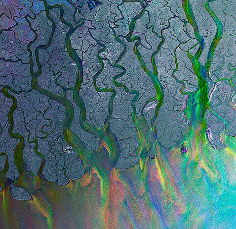
On March 1, 2002, the largest Earth observation satellite ever built soared into orbit from the European Space Agency's launch base in Kourou, French Guiana. For a decade, Envisat has been keeping watch over our planet. This week we present not just one, but 10 intriguing images captured by Envisat.
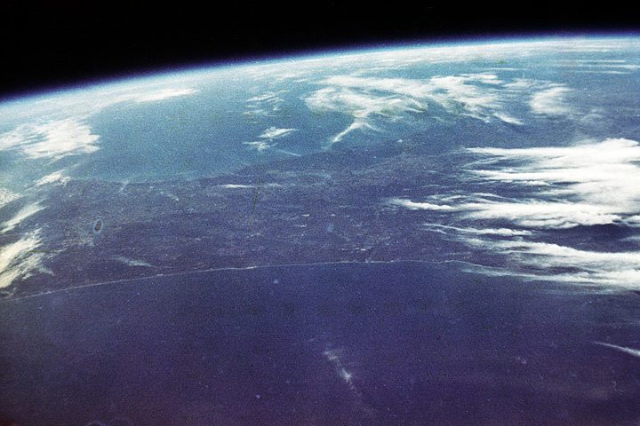
It looks real fine from up here. I can see the whole state of Florida just laid out like on a map. Beautiful. Those were astronaut John Glenn's words as he began his third orbit around Earth 50 years ago on Feb. 20, 1962. Glenn was the first American to orbit Earth and one of the first humans to study the planet from space. Glenn truly connected with our home planet in a new way, and his descriptive observations are as engaging today as they were 50 years ago.
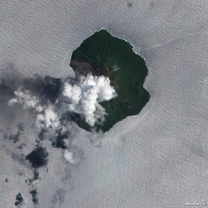
Tinakula is a small, uninhabited volcanic island in the South Pacific, located about 2,300 kilometers (1,400 miles) northeast of Brisbane, Australia. A volcanic eruption around 1840 reportedly eradicated the island's small population. Then in 1951, around 130 Polynesians settled on the island but were evacuated when the volcano erupted 20 years later. This natural-color satellite image shows a plume of volcanic gas, rising above the island's summit on Feb. 14, 2012.
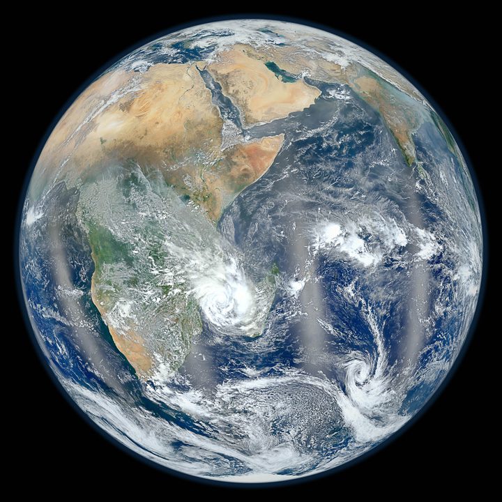
People love images of the full disk of Earth as it would appear from space. During the last week of January 2012, NASA science colleague Norman Kuring took some fresh data from the agency's newest Earth observation satellite, projected them onto a disk and voila”3 million people viewed the image in a week! The wave of interest is still spreading across the Internet and social media, but have you ever wondered how these images are made?

This astronaut photograph from the International Space Station highlights the large island of Majorca, on which the provincial capital of Palma is located. Like the other Balearic Islands, Majorca is a popular European holiday destination, with tourism forming a major part of the island's economy.
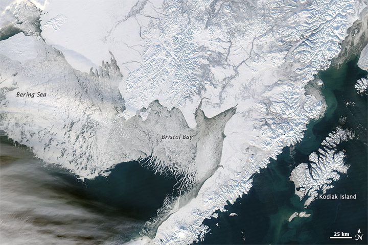
Snow painted the land surface a powdery white as ice rested on the sea surface in southwestern Alaska during mid-January 2012. The Moderate Resolution Imaging Spectroradiometer (MODIS) sensor on NASA's Aqua satellite captured this natural-color image on Jan. 15 that shows snow blanketing the mountains and plains, while ice tendrils branch into Bristol Bay.
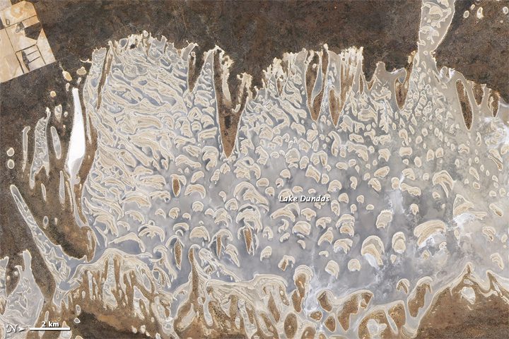
Salt lakes of assorted sizes occur throughout southwestern Australia, and one of the larger ones is Lake Dundas. Located about 130 kilometers (80 miles) inland from the coastal city of Esperance, Lake Dundas occupies a region of low rainfall and abundant sunshine. This salt-encrusted lake presents a complex face to Earth observation satellites, with plentiful islands poking above the water line.
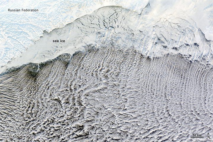
Most of us prefer our winter roads free of ice, but cloud streets depend on it. The cloud formations shown in this satellite image developed over the Bering Sea partly because of the snow and ice blanketing the land and partly due to the sea ice clinging to the coast. The resulting cloud formations resemble streets.
