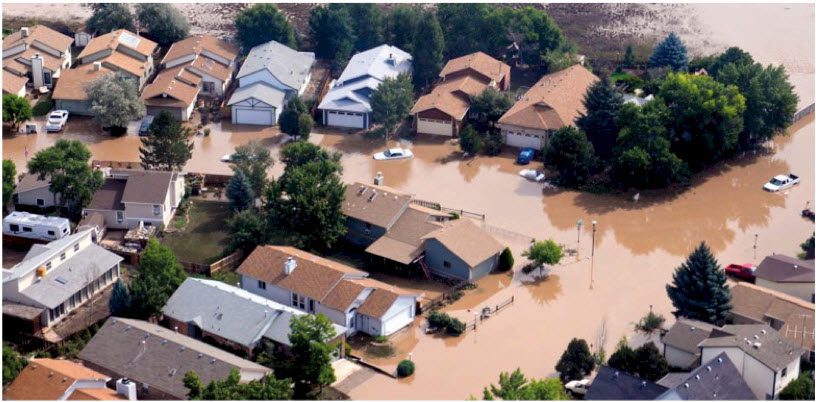
By Tim Little, Office of Corporate Communications, National Geospatial-Intelligence Agency (www.nga.mil), Bethesda, Md. When floods devastated parts of Colorado in September 2013, the Federal Emergency Management Agency (FEMA), the lead federal agency for Colorado...
Moving from Pixels to Products
WorldView-3 promises to enhance automated information extraction and change detection in remotely sensed imagery. By Kumar Navulur, Bill Baugh, Greg Hammann and Vic Leonard, DigitalGlobe (www.digitalglobe.com), Longmont, Colo. After more than 40 years, the remote...
Exploring the Benefits of Active vs. Passive Spaceborne Systems
By Simon Hennig, application development manager, Astrium Services, GEO-Information (www.astrium-geo.com), Friedrichshafen, Germany. A growing number of commercial Earth observation satellite platforms can be divided into two classes: active sensors and passive...
Disaster Management: Staying Ahead of the Storm
Comprehensive geospatial data integration underpins effective disaster management. By Mladen Stojic, vice president, Geospatial, Intergraph (www.intergraph.com), Norcross, Ga. We live in a world where natural disasters increasingly impact massive populations. Natural...
Intriguing Images of 2013
Earth imagery is elevating our understanding of today’s interconnected world. The images below highlight a few of the many ways remote sensing helped chronicle some of 2013’s noteworthy events and innovations. First LDCM Images “Great Right out of the Boxâ€...
Conservation International Does Nature Right
Conservation International is proving to the world that social and economic benefits don’t need to come at the expense of nature. Nature is fundamentally essential to future prosperity. By Max Wright, remote sensing and geospatial modeling analyst, and Melissa Rosa,...
Is Activity-Based Intelligence a Modern Crystal Ball?
Making accurate predictions remains a human-based activity, but this powerful new paradigm is sweeping the U.S. intelligence community. By Rob Mott, vice president of Geospatial Solutions, Intergraph Government Solutions...
Data Fusion Empowers Geospatial Analysis
Tremendous value and insights are achieved when all available data—raster, vector, numerical data and even subjective cultural aspects—are fused together into models that can identify spatial patterns. By Greg Hammann, Amanda Marchetti and Kumar Navulur,...
Crouching Tiger, Hidden Danger
Tigers have nearly disappeared in Indochina, signalling danger signs for many other species. Â In a race to preserve critical wildlife habitat, geospatial tools are essential to success. By Victoria Caplin, a freelance writer based in London. The Nam Et-Phou Louey...
Managing Big Data
NASA Tackles Complex Data Challenges The agency’s EOSDIS program manages some of the most intricate and diverse datasets on the planet. By Hampapuram Ramapriyan, assistant project manager, Earth Science Data and Information System (ESDIS), NASA Goddard Space...