PALO ALTO, Calif.- Orbital Insight, the leader in geospatial analytics, announced today that it has acquired FeatureX, a privately-held, Boston-based artificial intelligence company. The acquisition brings new talent to Orbital Insight’s expert team and expands the...
USACE Names Woolpert to $49M AEG Mapping Contract
MOBILE, Ala. — Woolpert was selected for a $49 million shared capacity contract for architecture and engineering services to provide survey and mapping for the U.S. Army Corps of Engineers (USACE), South Atlantic Division, Mobile District. This contract will support...
The Emergency Communications District of Shelby County, Tennessee, Improves 911 Call Plotting and GIS Data Using Nearmap's Aerial Imagery
SOUTH JORDAN, Utah - The Shelby County, Tennessee, Emergency Communications District has implemented Nearmap high-resolution aerial imagery to geocode and plot new addresses and developments into the 911 mapping systems to help fire and rescue, emergency medical...
Red Cat Propware Drone Analytics Opens for Beta Testing
Red Cat Propware, a global developer of drone analytics announced today the launch of its beta program for its Black Box Data Analytics platform. The Company will also be offering beta pilots a chance to earn Red Cat Tokens through bug bounty programs and features...
Surya University of Indonesia Selected for Additional UNOOSA/JAXA KiboCUBE Opportunity
The United Nations Office for Outer Space Affairs (UNOOSA) and the Japan Aerospace Exploration Agency (JAXA) have selected a team from Surya University in Indonesia for the UNOOSA-JAXA KiboCUBE programme. The KiboCUBE programme was launched in 2015 by UNOOSA and JAXA...
U.S. Army Corps of Engineers Announces an Online Trafficability Inundation Mapping Tool
WASHINGTON - The U.S. Army Corps of Engineers (USACE) announced today the publishing of the online Trafficability Inundation Mapping Tool that provides the public with information on what regions are affected by the flood waters from Hurricane Florence. The online...
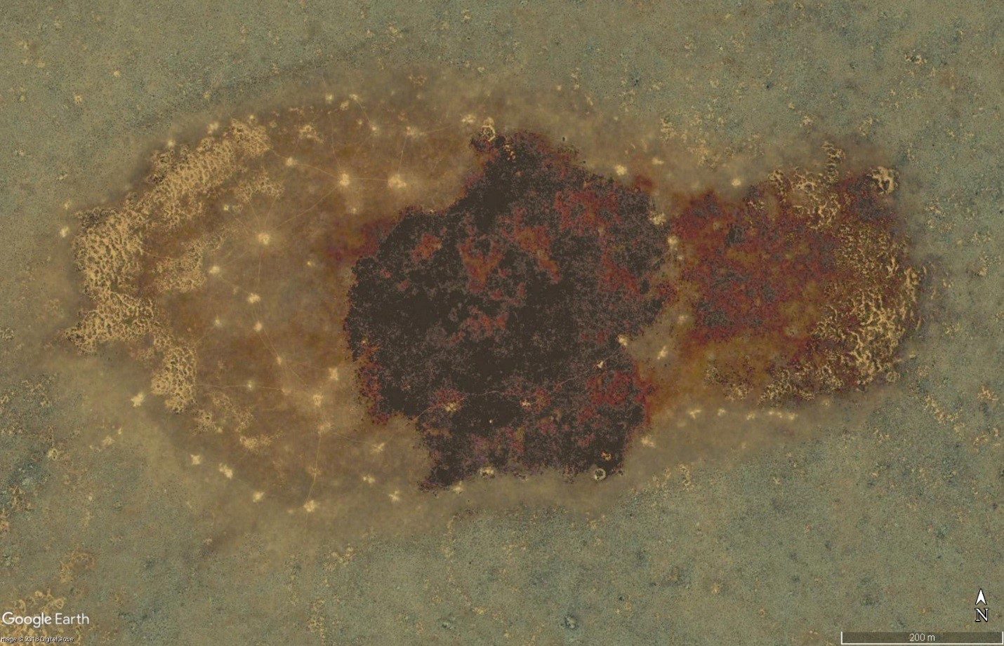
Satellites Reveal Underground Lifestyle of Wombats
A combination of high-resolution satellite imagery and remote motion-activated cameras is helping South Australian researchers compile the first species-wide mapping of distribution and abundance of the Southern Hairy-Nosed Wombat.
First South Korea Government Drone Project Completed with SimActive
Montreal, Canada, September 18th, 2018 – SimActive Inc., a world-leading developer of photogrammetry software, is proud to announce it enabled the first government drone mapping project in South Korea. Asia Aero Survey (AAS), a SimActive regional partner, used...
Nanotron Releases New Production Version of Location Tracking Software for up to 5,000 Objects
Nanotron Technologies GmbH has achieved and deployed a new release of its nanoLES 3 Location Engine and Server software. Through nanoLES 3 5K, nanotron is now able to accurately and reliably track up to 5,000 distinct objects in real time – more than double the...
Quantum Spatial Wins Energy Thought Summit (ETS) Pilot Pitch Competition for Most Innovative Solution for Energy and Utility Companies
Quantum Spatial, Inc. (QSI), the nation’s largest independent geospatial data firm, today announced that QSI won Zpryme’s start@ETS pilot pitch competition for having the most compelling, innovative solution for energy and utility companies. Hosted by Zpryme, a...
