Redlands, Calif., May 15, 2014—Esri’s new Small Government Departmental Platform Agreement allows for unlimited deployments of core ArcGIS software within one governmental department. Departments that have plans to integrate GIS in multiple workflows, such as...
Esri Pledges $1 Billion in Cloud-Based STEM Software to White House ConnectED Initiative
Redlands, Calif., May 27, 2014—Responding to President Barack Obama’s call to help strengthen STEM education through the ConnectED Initiative, Esri president Jack Dangermond announced today that Esri will provide a grant to make its advanced mapping software...
Exelis Wins Multimillion-Dollar Contract for Climate-Monitoring Satellite Payload
ROCHESTER, N.Y., May 20, 2014—Exelis (NYSE:XLS) has been awarded a multimillion-dollar commercial contract to build the primary payload for the Greenhouse Gas Observing Satellite-2 (GOSAT), which Mitsubishi Electric Corporation will build for the Japanese Aerospace...
GeoAir Adds UltraCam Falcon to Aerial Resources in Mexico
Graz, Austria, May 14, 2014—GeoAir has contracted with Microsoft’s UltraCam business unit and subsidiary to purchase an UltraCam Falcon digital aerial camera system and UltraMap workflow software to handle large volumes of data efficiently. GeoAir operates...
Insitu Pacific Demonstrates Fire Management Assistance with ScanEagle Unmanned Aircraft
BRISBANE, Australia, May 13, 2014—Insitu Pacific, the Australia-based subsidiary of Insitu Inc., today announced it recently conducted a successful demonstration for the New South Wales Rural Fire Service (NSW RFS) using the ScanEagle unmanned aircraft system (UAS)....

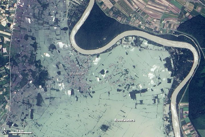
Balkans Flooding Affects 3 Million People
NASA's Earth Observing-1 satellite shows how three months' worth of rain in just three days has caused swollen rivers and devastating flooding across the Balkan region of Europe.

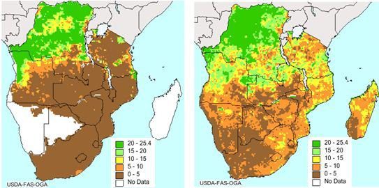
ESA Satellite Helps Boost Food Security
The European Space Agency's Soil Moisture and Ocean Salinity mission has reached beyond its water cycle mission to predict drought and improve crop yield in regions prone to famine.

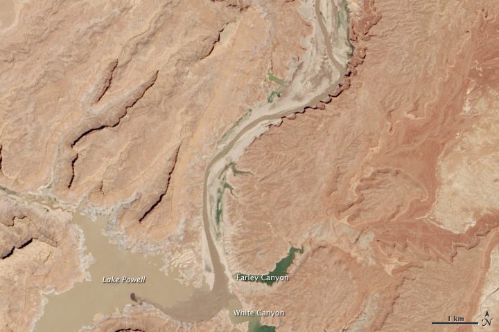
Satellite Shows Half-Empty Lake Powell
Lake Powell's water levels fluctuate depending on how much water flows in from snow and rain and how much flows out to meet needs, but it has been dry in all but three of the last 14 years.

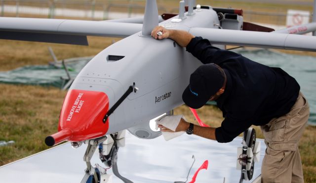
Nigeria’s Neglected Drones Can’t Search for Missing Girls
As U.S. planes try to locate more than 200 girls kidnapped by Islamist group Boko Haram, Nigeria's own unmanned aircraft can't join the search”poor maintenance has them grounded.
Apache-UAV Teaming Combines Best Capabilities of Man, Machine
NASHVILLE, May 8, 2014—Apache helicopters, teamed with Gray Eagle and Shadow unmanned aerial vehicles, are a winning combo, according to Col. Thomas von Eschenbach. Apache AH-64E models, teamed with unmanned aerial vehicles, known as UAVs, are now increasingly...

