August 19, 2015 — Newly released US Topo maps for Wyoming now feature more trails using data provided by the U.S. Forest Service such as the recreational trails in the Bridger-Teton National Forest. “The USGS has expanded an excellent working relationship with the...
Textron Systems Promotes Daryl Madden to Geospatial Solutions' Senior Vice President and General Manager
PROVIDENCE, R.I., AUGUST 19, 2015 — Textron Systems, a business of Textron Inc. (NYSE: TXT), announced today the promotion of Daryl Madden to senior vice president and general manager of its Geospatial Solutions business. He reports directly to Textron Systems...
French Energy Company SPIE Chooses SuperPad To Enhance Survey Efficiency
August 19, 2015 — Supergeo, the total GIS software solution provider, announces that SPIE, France, chooses SuperPad, the mapping application designed for Windows Mobile, to empower its streetlights and other utilities survey works. SPIE, the European leading company...
Blue Marble Exhibits at FutureView 2015 Conference and Technology Summit
Hallowell, Maine, August 19, 2015 —Blue Marble Geographics will be exhibiting at the FutureView 2015 Conference and Technology Summit hosted by Pictometry International Corp. in Nashville, TN from August 19-21. The latest advancements in Pictometry® Imagery, 3D...
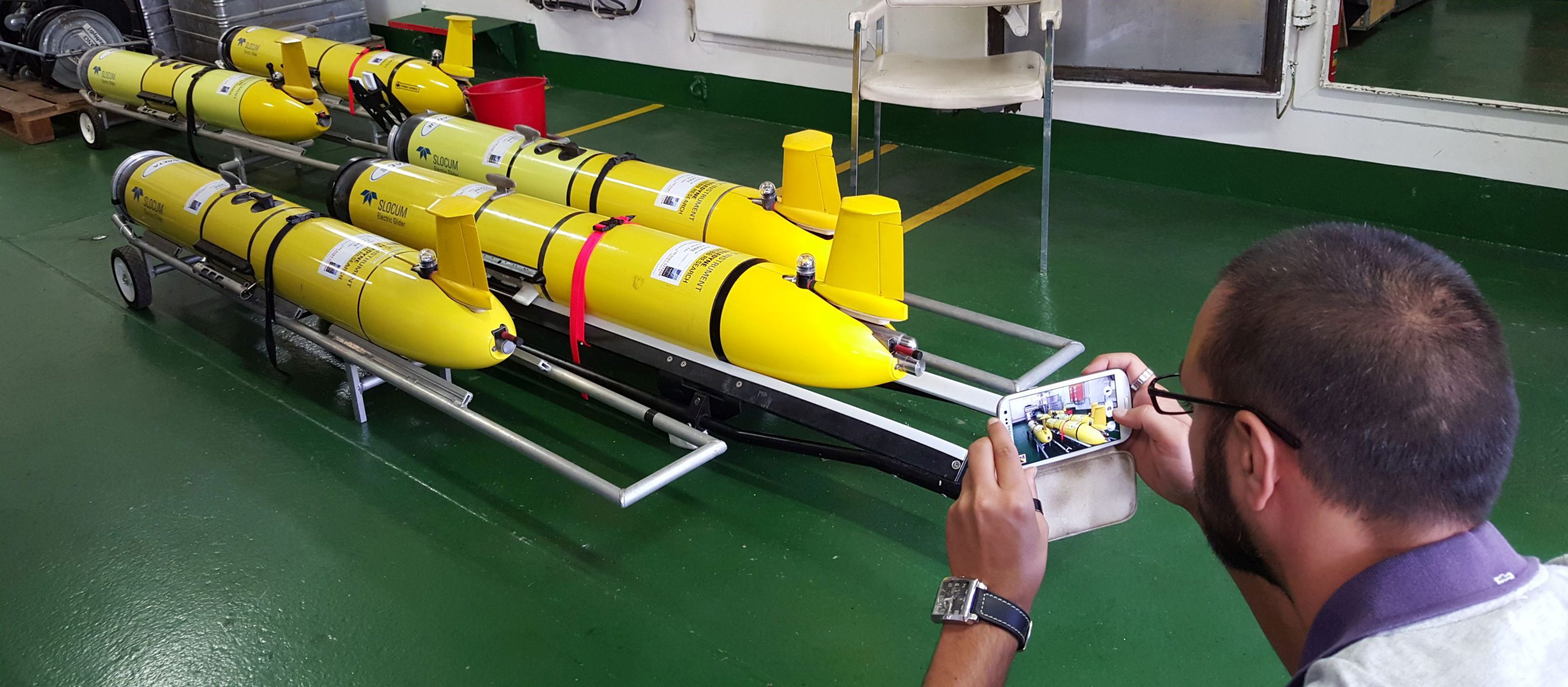
Maritime Research Center ˜Listening to Seas'
Scientists from the NATO STO Centre for Maritime Research and Experimentation (CMRE) and their partners from nine institutions of five NATO nations (Canada, Italy, Norway, United States and United Kingdom) will collect acoustic, oceanographic and geophysical data using traditional and novel observation methods, such as underwater gliders.
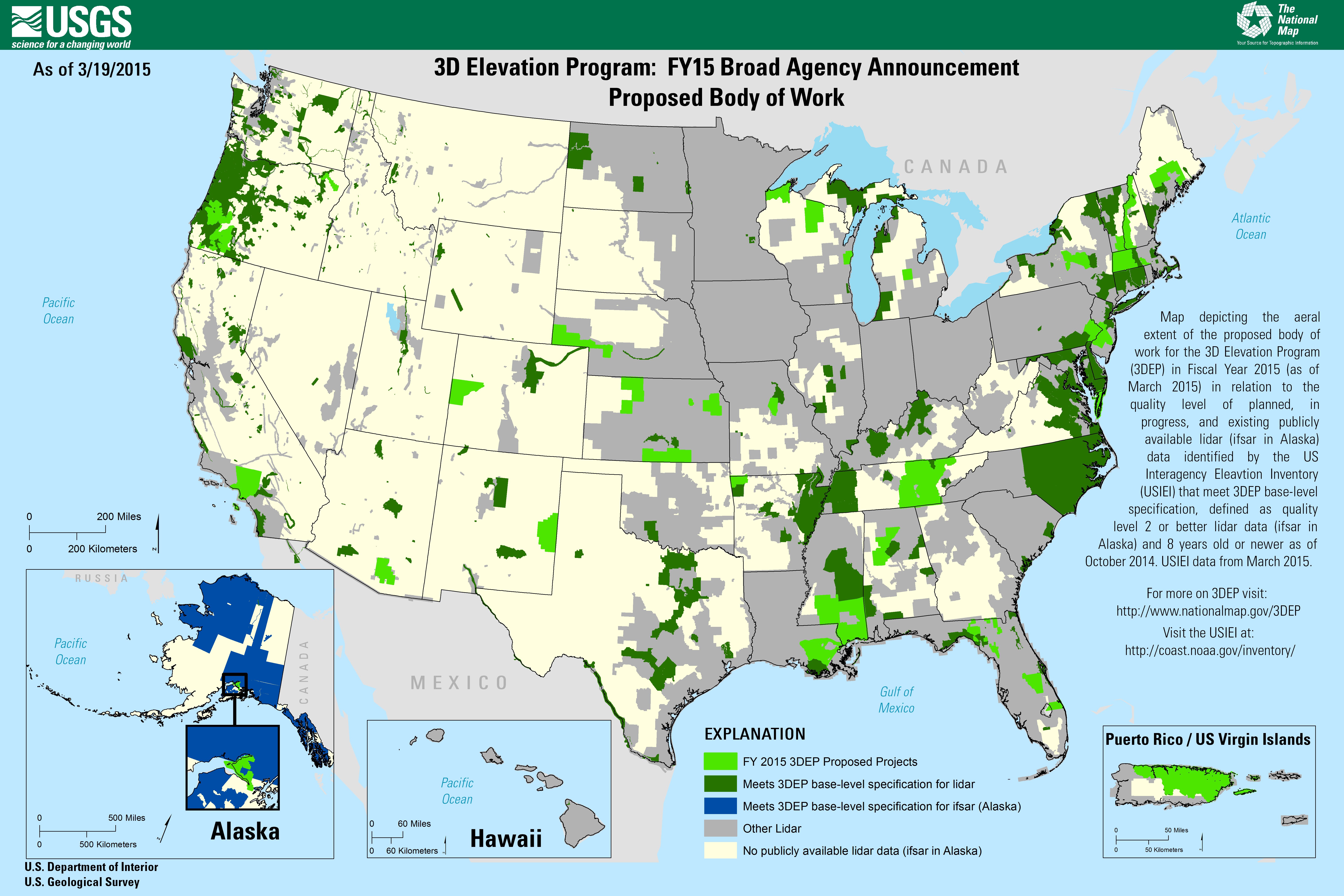
Dewberry to Evaluate New LiDAR Technologies for 3DEP
Under its Geospatial Products and Services Contract with the U.S. Geological Survey (USGS), Dewberry is executing a task order to evaluate two new forms of LiDAR to determine if single-photon LiDAR (SPL) and Geiger-mode LiDAR (GML) can satisfy USGS LiDAR Base Specification version 1.2 for quality level (QL2) LiDAR for use in the USGS 3D Elevation Program (3DEP).
Professor Receives Funding for NASA Soil Research
Aaron Berg, a University of Guelph geography professor using a NASA satellite to study global soil-moisture levels, received a $280,000 boost from the Canadian Space Agency.
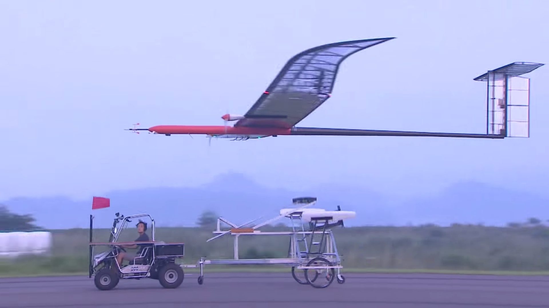
Solar-Powered UAV Flies in Stratosphere
On Aug. 11, 2015, the Korea Aerospace Research Institute (KARI) announced that its EAV-3, a high-altitude UAV powered by solar cells, succeeded in flying into Earth's stratosphere at 14 kilometers above sea level during its nine-hour flight.
OGC Requests Comment on Standard Model and Encoding for Timeseries Data
August 18, 2015 — Members of the Open Geospatial Consortium (OGC®) request comments on proposed OGC standards for the representation of observations as timeseries, that is, a sequence of data values which are ordered in time. The OGC Timeseries Profile of...
Europa Technologies Deploys Unique Ofcom Coverage Map Service
August 18, 2015 — Europa Technologies has deployed a unique coverage map service for Ofcom – the UK telecommunications regulator. The new map is designed to support consumers in choosing a service that best suits their needs, while promoting competition between...
