Australian company geoshepherds created a complete Landsat 8 Mosaic (L8M) of Australia, consisting of more than 7.6 million square kilometers of imagery that has been orthorectified, radiometrically color balanced and pansharpened.
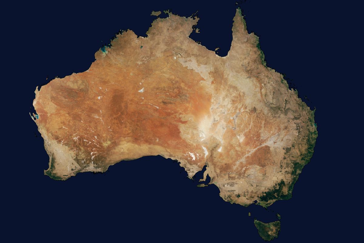
Australian company geoshepherds created a complete Landsat 8 Mosaic (L8M) of Australia, consisting of more than 7.6 million square kilometers of imagery that has been orthorectified, radiometrically color balanced and pansharpened.
BETHESDA, Md., Jan. 11, 2015 — Thanks to ongoing advances in printing technology the ASPRS is pleased to announce that we are able to lower our color plate, color figures/images, fees for the PE&RS journal. All manuscripts submitted after January 1, 2016 will be...
UK, 11 January 2016 — HERE, a leader in navigation, mapping and location experiences and 1Spatial (www.1spatial.com), the global spatial software company, which manages the world’s largest spatial data, today announced that they are teaming up to deliver high...
LONDON — Today, IHS Inc. (NYSE: IHS), the leading global source of critical information and insight, and Airbus Defence and Space announced a three-year partnership agreement that brings together two global leaders in the field of open source intelligence. Under the...
A team of scientists is launching a series of research flights this month over the remote Southern Ocean in an effort to better understand just how much carbon dioxide the icy waters are able to lock away. The ORCAS field campaign—led by the National Center for...
Sydney, Australia, anuary 11, 2016 — Snowflake Software, providers of interoperable data exchange software based on open standards, has announced 1Spatial Australia as its APAC region reseller for its aviation data exchange software products - GO Loader Aviation...
The GEO Business 2016 call for papers deadline closes two weeks today! Submit an abstract online by Friday 22 January 2016. The conference committee is seeking revolutionary and thought provoking abstracts that truly demonstrate the remarkable impact geospatial...
A British consortium led by Surrey Satellite Technology Ltd (SSTL) has been awarded a grant from Innovate UK, the UK’s innovation agency, to co-fund the development of a novel High Test Peroxide (HTP) propulsion system. The new HTP propulsion system is being...
January 8, 2016 — Teledyne Optech is pleased to announce that it will introduce the latest model of its Lynx mobile lidar system, the survey-grade Optech Lynx SG-S at the 95th Annual Meeting of the Transportation Research Board (TRB) on January 10-14 in Washington,...
MARKHAM, Ontario, Canada - January 8, 2016 — PCI Geomatics, a world leading developer of remote sensing and photogrammetric software and systems, will be holding a User Group Meeting in Ottawa, Canada on February 4th, 2016. The free event will bring together the PCI...
