Leicestershire, UK, 27 January 2016 — Aerial mapping company, Bluesky, is partnering with airborne inspection and surveying expert, Cyberhawk, to provide a broader range of aerial survey and mapping services through the use of Unmanned Aerial Vehicles (UAV)...
RIEGL is Attending and Sponsoring the 2016 MAPPS Winter Conference!
RIEGL will be attending and sponsoring the 2016 MAPPS Winter Conference! The 2016 MAPPS Winter Conference will be taking place at the Green Valley Ranch in Henderson, Nevada from January 31, 2016 through February 3, 2016. The 2016 Winter Conference will take on a new...
Design an Interactive Map
The biggest difference between a printed map and a digital map is that the digital map provides interactivity for users. For example, with GIS software, users can click on a feature and identify its attributes to gain more details. The interactive design of the...
The Local Water Corporation of the Philippines Selects SuperGIS Desktop
The leading GIS software and solution provider, Supergeo Technologies Inc., announces that the water corporation of Butuan city, southern Philippines, has selected SuperGIS Desktop Professional as the platform for displaying and editing its geospatial data. Butuan...
OGC Announces Simplified Web Mapping Standard
26 January 2016 — The OGC announces that the OGC membership has adopted the The OGC® WMTS Simple Profile, which defines a simplified profile of the OGC Web Map Tile Service (WMTS) Interface Standard (see below). WMTS Simple limits the flexibility of the original...
Survey Reveals Benefits of Integrating Land Information
Information about land use and ownership restrictions is easier to find and use when combined with national cadastres, a survey by EuroGeographics has shown. The Association, which represents national mapping, cadastral and land registry authorities from the whole of...
New Heartland Maps for the New Year
New US Topo maps for Iowa and Kansas are now available in the USGS Store for free download. The new maps of these Midwestern states feature the inclusion of the U.S. Census Bureau’s Topologically Integrated Geographic Encoding and Referencing (TIGER) road data. "The...
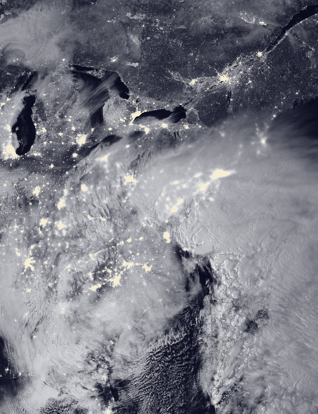
NOAA, NASA Satellites Track Eastern Blizzard
Satellites tracked and helped warn of a major winter storm that hit the eastern United States on Jan. 22-24, 2016, with two low-pressure systems merging to drop heavy snow from Virginia to New England.

Peru Program Puts Trackers on Vultures to Monitor Waste
To raise awareness of Peru's growing waste problem, a multi-agency collaboration is attaching sensors and cameras to vultures, recording their waste-tracking habits.
European Space Imaging Case Study Reveals How Satellite Imagery Helps Protect UNESCO World Heritage Sites
European Space Imaging (EUSI) released a new case study outlining the success of using satellite imagery to help protect UNESCO World Heritage sites this week. Working together with experts at the German Archaeological Institute (DAI) and the German Aerospace Centre...
