Wetlands are land areas that are permanently or seasonally saturated with water. They play an important role in the local environment and associated plant and animal life. On 2 February 1971, the ‘Ramsar Convention on Wetlands’ was adopted in the Iranian city of...
Coordinated Measuring Flights for Climate Research “ Gravity Waves and Airglow
Gravity waves affect the climate and weather. For the first time ever, scientists from the German Aerospace Center (Deutsches Zentrum für Luft- und Raumfahrt; DLR), together with colleagues from the Karlsruhe Institute of Technology (Karlsruher Institut für...
Woolpert Selected for Orthoimagery Collection in Florida
ST. AUGUSTINE, Fla. Feb 2, 2016 — Woolpert has been contracted to collect orthoimagery of St. Johns County, Fla., it was announced today. The six-inch resolution, multispectral digital imagery, collected for the entire 776 square miles, will be used by multiple...
ASI Expands Large-Area LiDAR Capabilities with Investment in Leica Geosystems Sensors
NORCROSS, GA, February 2, 2016 — Leica Geosystems Inc. today announced that Aerial Services, Inc. (ASI), a privately owned small business based in Cedar Falls, IA, has purchased a Leica ALS70-HP LiDAR sensor co-mounted with a four-band, 80 megapixel RCD30 imaging...
Call for Abstracts/Papers/Workshops at the GSDI 2015 World Conference in Taiwan in 2016
We are delighted to announce that the GSDI 15 World Conference (GSDI 15) will be held in Taipei, Taiwan (Rep. of China), from 29 November to 2 December 2016 at the Taipei Nangang Exhibition Center. The theme of GSDI 15 is “Spatial Enablement in the Smart...
Esri Canada to Open GIS Centres of Excellence at the University of New Brunswick & York University
TORONTO – February 2, 2016 — Esri Canada, the leading provider of geographic information system (GIS) solutions, has named the University of New Brunswick (UNB) and York University (York) to its growing network of GIS Centres of Excellence in Higher Education. The...
OGC Seeks Public Comment on Candidate OGC Land and Infrastructure Conceptual Model Standard (LandInfra)
01 February 2016 — The membership of the Open Geospatial Consortium (OGC®) seeks public comment on the candidate OGC® Land and Infrastructure Conceptual Model Standard (LandInfra). LandInfra defines concepts for land and civil engineering infrastructure...
Successful Launch of the First Laser Telecommunication Satellite of the ˜SpaceDataHighway'
EDRS-A, the first relay satellite of the SpaceDataHighway, was successfully launched into geostationary orbit on 30Â January 2016. After a test period, it will become operational for its first end-user customer by mid-2016. The SpaceDataHighway system will provide...
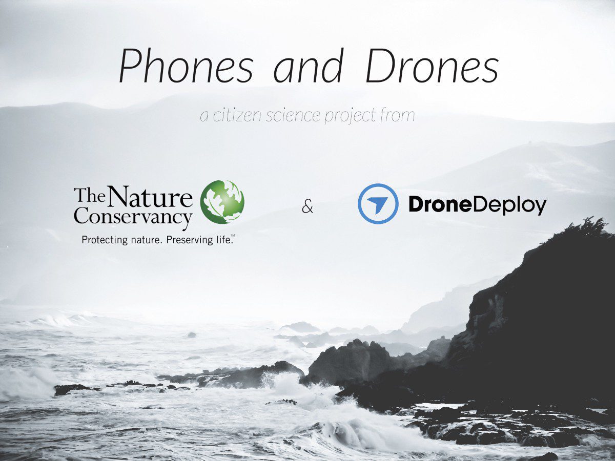
Crowdsourced Project to Monitor California Coast
DroneDeploy and The Nature Conservancy partnered to create California's Phones and Drones project, which allows citizens to help create a crowdsourced map of the California coast.
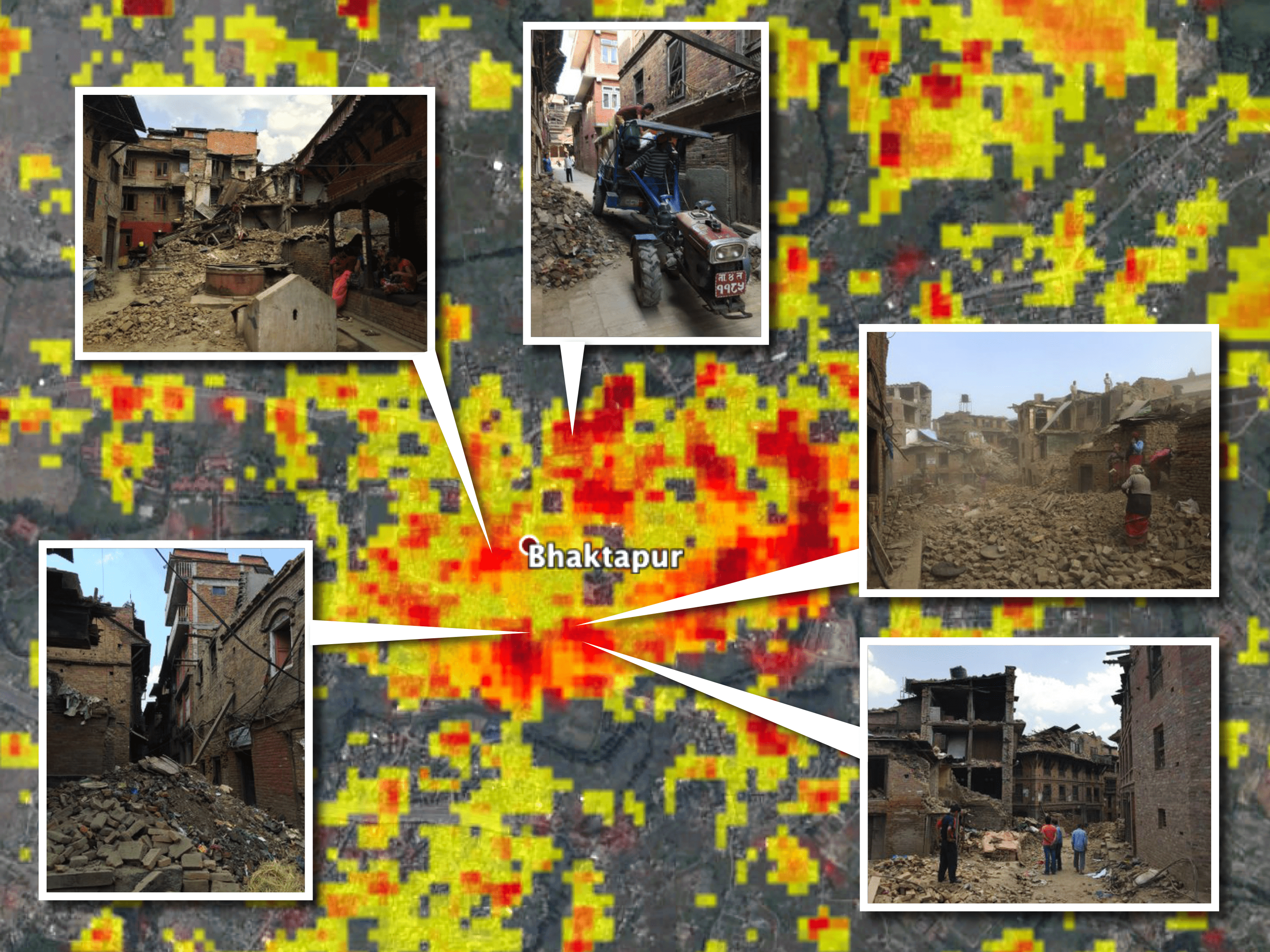
NASA Scientists Develop ˜Damage Maps' from Satellite Images
Researchers led by Sang-Ho Yun at NASA's Jet Propulsion Laboratory developed a way to create damage maps from satellite imagery”even if images are taken at night or when skies are cloudy.
