The president of BOSH Global Services is excited about a new federal law requiring the Federal Aviation Administration to open the national airspace for commercial unmanned aircraft.
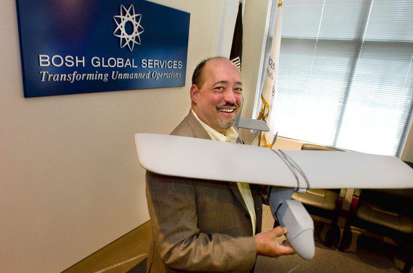
The president of BOSH Global Services is excited about a new federal law requiring the Federal Aviation Administration to open the national airspace for commercial unmanned aircraft.
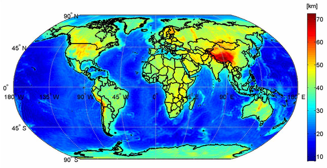
The first global high-resolution map of the boundary between Earth's crust and mantle”the Moho”is based on data from the European Space Agency's GOCE gravity satellite.
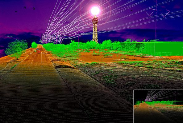
Denver-based Merrick & Company's Sergio Aguayo recently won first place in the International LiDAR Mapping Forum LiDAR as Art contest.
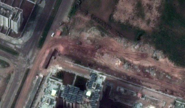
Satellite image provider DigitalGlobe released images from its WorldView-2 satellite that show Syrian army tanks and other armored vehicles in the city of Homs.
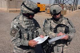
The U.S. Army is using TerraGo geospatial collaboration software to produce, access, update and share geospatial information and applications in support of warfighter efforts around the world.
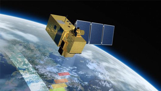
Eurockot Launch Services GmbH, a joint venture between Astrium and the Khrunichev Space Centre, adds two European Space Agency launch contracts to its order book.
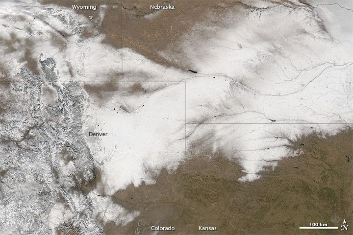
A record-breaking snowstorm struck Colorado in early February 2012, closing an interstate highway, grounding flights and dropping more than a foot of snow on the Denver area.

A drone enthusiast testing out his airborne camera discovered a river of blood behind a Texas meat-packing plant, prompting outrage and investigations by local authorities.
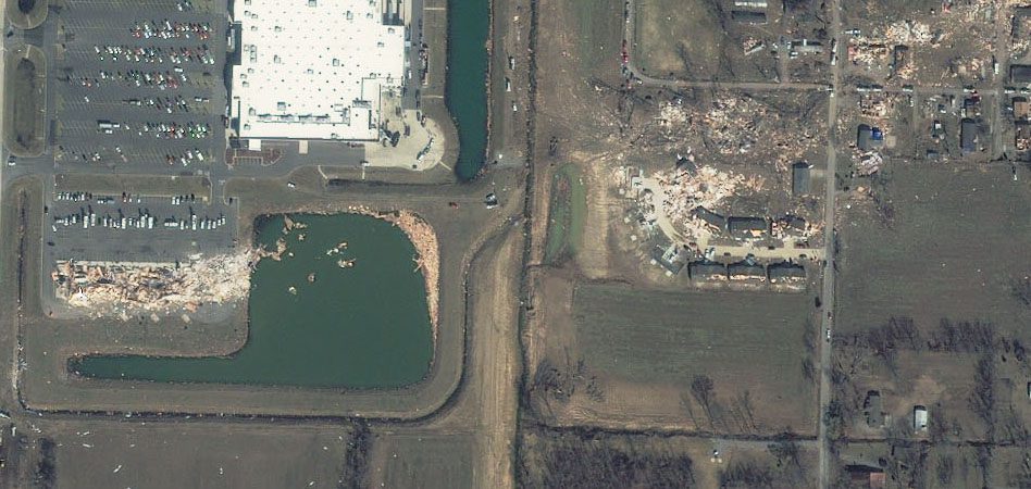
Only days into the month, this already is the deadliest March for tornadoes in the United States since 1994, when 40 people were killed, according to the National Climatic Data Center.
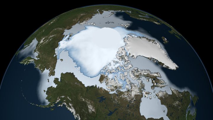
A new NASA study confirms the oldest, thickest Arctic sea ice is disappearing at a faster rate than younger, thinner ice at the edges of the ice cap, making it more vulnerable to further decline.
