The second Sentinel-1 satellite – Sentinel-1B – was launched today to provide more ‘radar vision’ for Europe’s environmental Copernicus programme. Sentinel-1B lifted off on a Soyuz rocket from Europe’s Spaceport in Kourou, French Guiana, at 21:02 GMT...
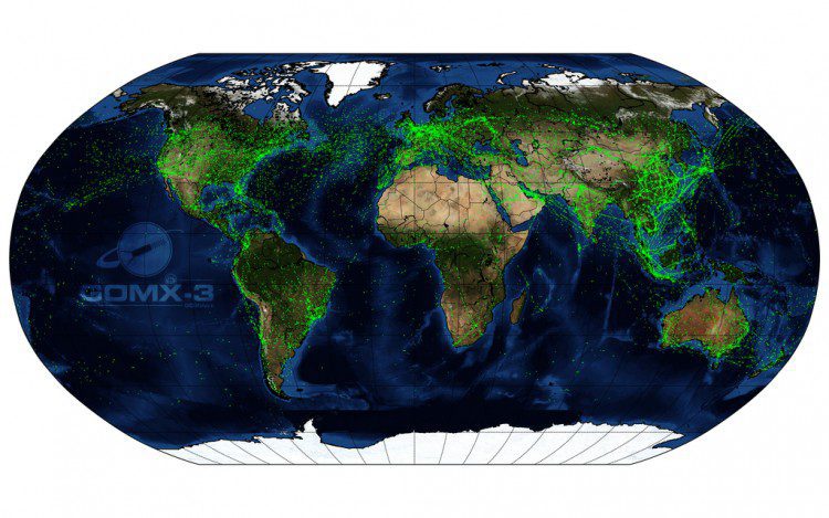
CubeSat Maps Global Air Traffic
The GomX-3 CubeSat, which was ejected from the International Space Station on Oct. 5, 2015, has been tracking aircraft in flight across Earth. Built for the European Space Agency (ESA) by GomSpace in Denmark, the CubeSat's distinctive helical antenna has detected millions of signals from aircraft.
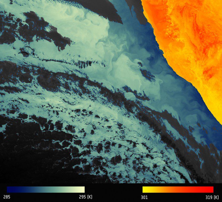
Sentinel-3A Posts First Radiometer Image
The first image from the European Space Agency (ESA) Sentinel-3A Sea and Land Surface Temperature Radiometer (SLSTR) depicts thermal signatures over a part of western Namibia and the South Atlantic Ocean.
European/Australian Partnership to Provide Satellite Data Hub
The European Space Agency (ESA) and Australia's national geological survey, Geoscience Australia (GA), partnered to ensure data from EU's Sentinel satellites are accessible in Southeast Asia and the South Pacific.
Australia Ensured Access to Sentinel Data
ESA and Australia's national geological survey, Geoscience Australia, today agreed to cooperate to ensure data from the EU’s Sentinel satellites are accessible in Southeast Asia and the South Pacific. The agreement supports the Australian government and European...
ESA to Host 2016 Summer School on GNSS at JRC
The European Space Agency (ESA) will host its Summer School on GNSS program for students July 18–29 at the European Commission Joint Research Centre (JRC) in Ispra, Varese, Italy. The 11-day event is open to graduate students that have studied more than three...
Sentinel Data Wanted
ESA has agreed with NASA, the National Oceanic and Atmospheric Administration (NOAA) and the US Geological Survey (USGS) to make data available to them from the European Sentinel satellites. With the third Copernicus satellite, Sentinel-3A, recently launched, ESA has...
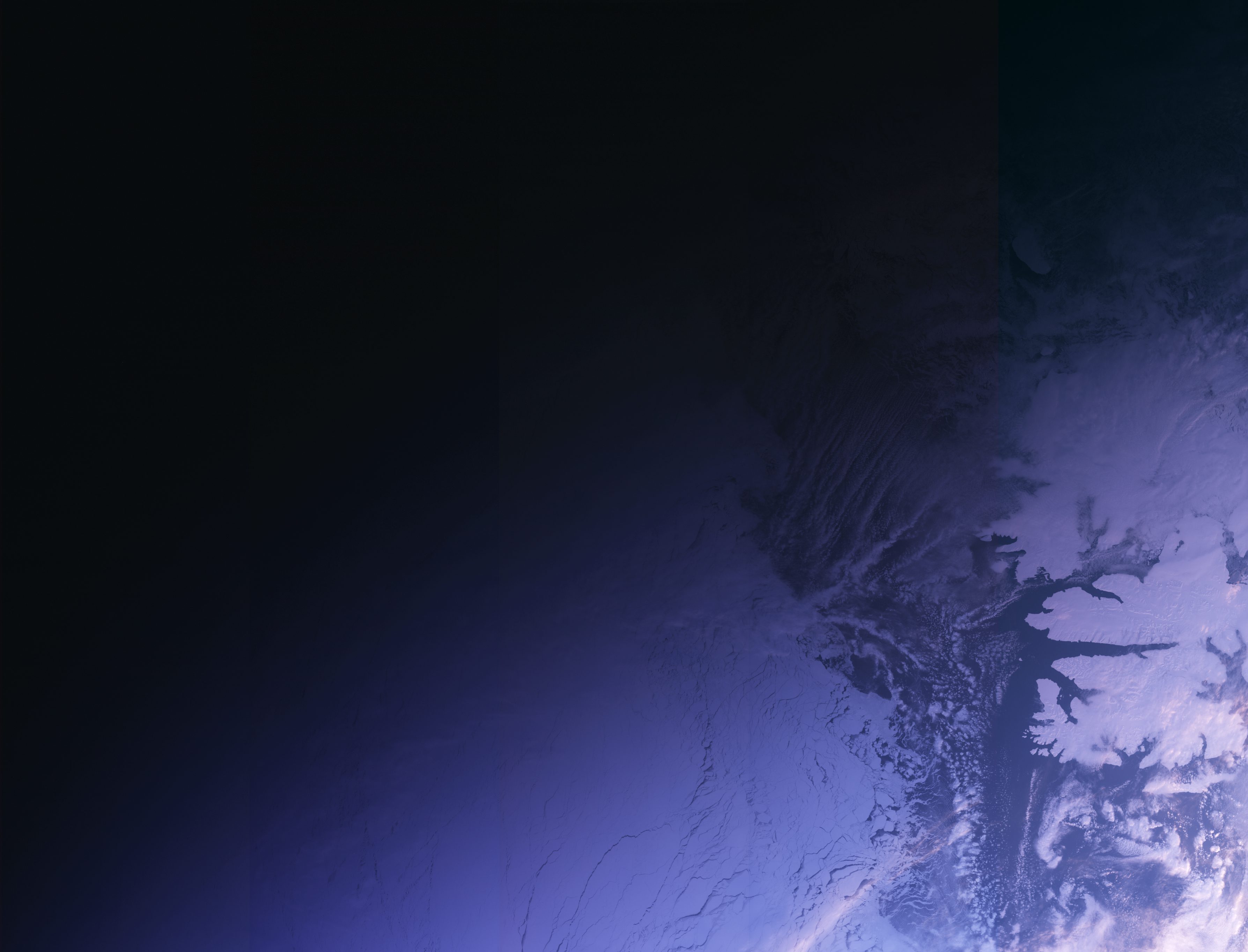
First Image Published from Sentinel Satellite
Two weeks after its successful launch on Feb. 16, 2016, the Copernicus Sentinel-3A satellite captured its first image, the transition from day to night over Svalbard, Norway.
Focus on Gabon Forests for Biomass
With deforestation accounting for 10% of greenhouse gas emissions, satellite observations have an important role to play in mapping this changing ecosystem. ESA is therefore going to great lengths to make sure a new sensor will live up to its promise. Deforestation...
First Views of Earth From Sentinel-3A
Just two weeks after launch, the latest Sentinel satellite has offered a taster of what it will provide for the EU’s Copernicus programme. Sentinel-3A’s very first image, captured at 14:09 GMT on 29 February, shows the transition from day to night over Svalbard,...
