A large semi-autonomous drone capable of monitoring radiation levels after a release of nuclear material in the environment has been developed by Bristol University researchers.
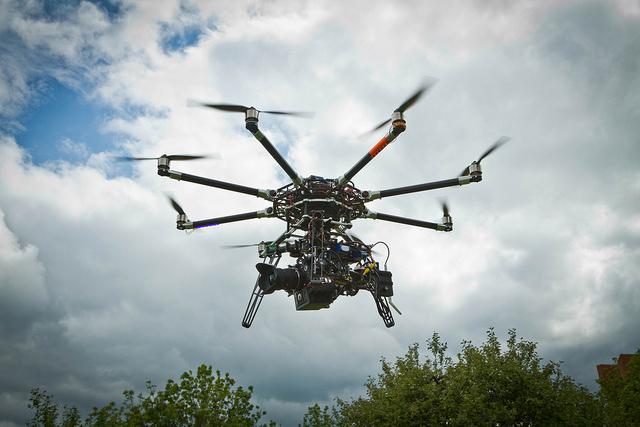
A large semi-autonomous drone capable of monitoring radiation levels after a release of nuclear material in the environment has been developed by Bristol University researchers.
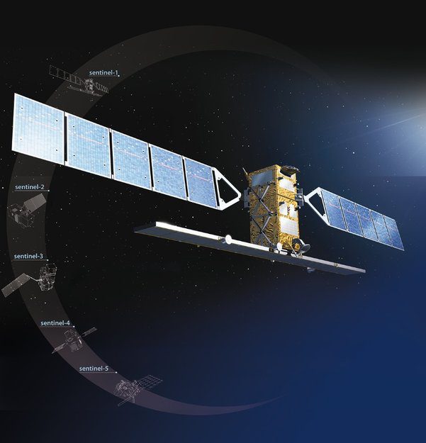
The European Delegated Act on Copernicus provides free, full and open access to users of environmental data from the Copernicus program, including data from the Sentinel satellites.
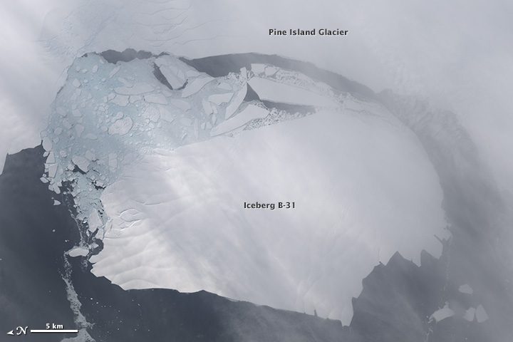
NASA scientists first detected a rift in the Pine Island Glacier in October 2011 during flights for Operation IceBridge. Between Nov. 9“11, 2013, a large iceberg finally separated.
Berlin, Germany, Nov. 18, 2013—BlackBridge has officially launched its newest ortho product, the level 3B Ortho Take. This new product provides image takes that have been bundle adjusted and orthorectified to fully cover an area of interest. This ready-to-use...
Redlands, Calif., Nov. 12, 2013—Esri's new releases of Collector for ArcGIS and Operations Dashboard for ArcGIS include display, configuration, and workflow enhancements that improve field data collection and enterprise oversight. Both apps are available at no cost...
Redlands, Calif., Nov. 13, 2013—Making Spatial Decisions Using GIS and Remote Sensing: A Workbook is the first student workbook to focus on the image processing capabilities inherent in Esri’s ArcGIS software. Designed to complement remote-sensing textbooks in an...
Amsterdam, The Netherlands, Nov. 13, 2013—Today at the 2013 SPAR/European LIDAR Mapping Forum, GeoCue announced the release of LP360 Project Publisher. LP360 Project Publisher is a free application that allows users to create metadata for a collection of point cloud...
Munich, Germany, Nov. 14, 2013—Imagery supplied by European Space Imaging is being used in by Cerberus in their online crowdsourcing game to assist the relief effort in typhoon affected areas in the Philippines. Hans van 't Woud is the developer of this online game...
Denver, Nov. 13, 2013--The Wildlife Conservation Society and geographic information system (GIS) software innovator Esri jointly developed and produced an online Story Map that combines spatial data, excellent cartography, and Web mapping tools to visually tell the...
Des Plaines, Ill., Nov. 13, 2013—URISA is pleased to open up the 2014 Vanguard Cabinet application process. The Vanguard Cabinet (VC) is a URISA initiative which debuted in 2011 to engage young GIS practitioners (35 and under), increase their numbers in the...
