MISSOULA, MONT., Dec. 3, 2013–GCS, a geospatial solutions firm, has hired CDR David Edgarton (USN, Ret.) as its new Director of Business Development. Edgarton, a former Commanding Officer of a U.S. Navy Electronic Attack Squadron, will focus on expanding GCS’...
Hexagon Announces Changes within Technology Division and New Appointments to Group Management
STOCKHOLM, Dec. 2, 2013—In line with Hexagon’s multi-industry focus and continued effort to truly leverage its entire portfolio, existing platforms, and global footprint to create the next generation of value for Hexagon customers, the following changes are...
SPAR Point Group Announces 2014 ILMF Conference Program
Portland, Maine, Nov. 21, 2013—Details on the 2014 International LiDAR Mapping Forum (ILMF) event are online—a three-day technical conference and exhibition focused on airborne, terrestrial and bathymetric LIDAR, with a particular emphasis on mobile mapping...
Sanborn Purchases Visual Intelligence iOne n-Oblique Sensor System Solution
Houston, Dec. 3, 2013—Houston-based Visual Intelligence announced today that Sanborn Map Company’s extensive evaluation of Visual Intelligence’s iOne n-Oblique Sensor System Solution for oblique and 3D imaging has resulted in a purchase. Sanborn is the first...
Special Offer Helps Small Firms Implement Esri Software
Redlands, Calif., Dec. 2, 2013—In response to industry demand, Esri, the leader in geographic information system (GIS) software development, has announced a special opportunity for small companies engaged in landscape architecture and urban design to take advantage...
Valtus Imagery Services Announces Availability of DigitalGlobe Precision Aerial Product through Online Store
Calgary, Alberta, Canada, Nov. 19, 2013—Valtus Imagery Services, pioneers of industry leading spatial data access solutions, today announced the availability of DigitalGlobe’s Precision Aerial product through its online spatial data store. The fully automated...
Proba-V Data Ready to Use
Less than seven months after launch, the European Space Agency's Proba-V Earth-watcher satellite is ready to provide global vegetation data for operational and scientific use.

28 Doves Heading into Space
Planet Labs is preparing to launch a fleet of 28 miniature satellites dubbed Flock 1, the world's largest constellation of Earth observation satellites.
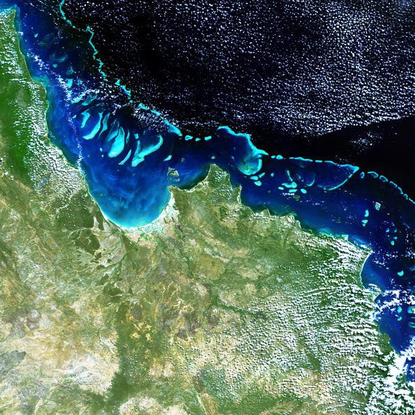
Satellites Help Map the World's Largest Coral Reef
Scientists used satellite imagery to create a set of high-resolution 3-D maps of the entire Great Barrier Reef, a critical step toward identifying, managing and protecting the giant ecosystem.
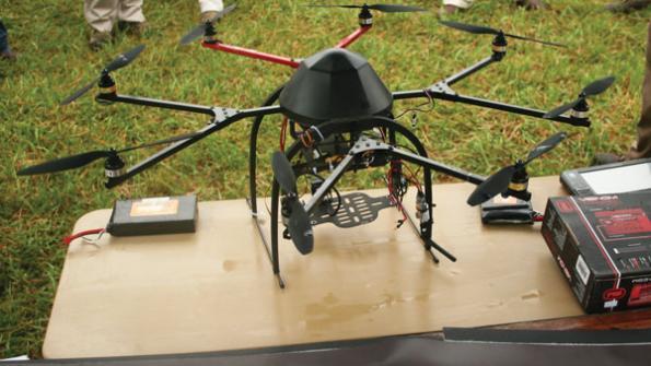
Unmanned Aircraft Face a Bright Future in Agriculture
Interest is growing rapidly in the use of unmanned aircraft systems for precision agriculture, which potentially could become the largest application for this developing technology.
