The National Reconnaissance Office is looking at technology developed by the video game industry to help it improve how it gathers and analyzes intelligence data.

The National Reconnaissance Office is looking at technology developed by the video game industry to help it improve how it gathers and analyzes intelligence data.
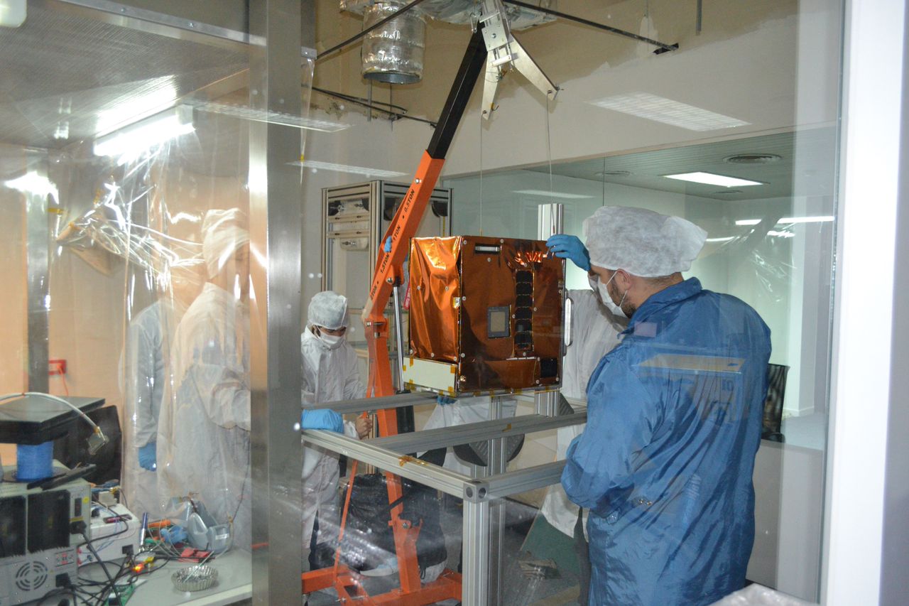
Among the 30-plus small satellites carried into orbit by the most recent Kosmotras Dnepr launch was BugSat 1, the third prototype for Argentinian startup company Satellogic.
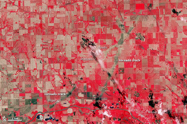
On June 16, 2014, a tornadic thunderstorm system moved across portions of northeast Nebraska, producing five tornadoes, including rare twins on the ground at the same time.
Colorado Springs, Colo., June 25, 2014—The Sanborn Map Company announces a key upgrade to its world-class 3-D geospatial product line with updated coverage of the Dallas, New York, Phoenix and San Francisco metropolitan areas. Sanborn’s massive collection of...
Hallowell, Maine, June 18, 2014—Blue Marble Geographics (bluemarblegeo.com) is pleased to announce the release of the Global Mapper Software Development Kit (SDK) version 15.2. This interim release features a significant improvement in the organization and quantity...
IRVINE, Calif., June 18, 2014—CoreLogic® (NYSE: CLGX), a leading global property information, analytics and data-enabled services provider, today introduced a new land records management solution that is the first single source of location information and property...
GATINEAU, Quebec, Canada, June 19, 2014—PCI Geomatics, a world-leading developer of remote sensing and photogrammetric software and systems, the release of Geomatica 2014; the latest version of the company’s complete and integrated desktop image processing...
PARIS, June 16, 2014—Sagem (Safran) just tested and integrated successfully a new generation optronics multi-sensors suite on its Patroller™ endurance UAS. Tested in France between April and June 2014, during a campaign of 30 flights, this new optronics suite is...
Ramat Gan, Israel, June 11, 2014—VisionMap Ltd, leading provider of aerial survey and mapping systems, released a new version of its A3 LightSpeed image processing suite. The new version includes several upgrades and new features. The software’s orthophoto...
London and Glencoe, Ill., June 23, 2014—Directions Magazine and Corinium Intelligence have joined to present the Location Intelligence World 2014 Conference that will be held October 7-8, 2014, at the Radisson Blue Portman Hotel in London, UK. The Location...
