COPENHAGEN, December 2, 2015 — Phase One, A/S, the leading provider of open-platform, high-end camera systems and solutions, today announced that it has acquired the assets of Mamiya Digital Imaging Company, Ltd (MDI) and has appointed Makoto Honda as the new...
Farmers Benefit from Satellite Coverage
December 2, 2015 — Farmers can now call on the latest satellite information using the unique TalkingFields service to get the best from their land while cutting the environmental cost. Globally available satellite data are fine-tuned to the needs of individual...
International LiDAR Mapping Forum 2016 Program Announced
December 2, 2015 (Portland, Maine, USA) — Event organizers announced The International LiDAR Mapping Forum (ILMF) 2016 Conference Program today, which can be viewed online here. The 16th edition of the technical conference and expo, taking place February 22-24, 2016...
Ready to Code?
December 2, 2015 — Listen up, coders! There will be a new series of lessons showing you how to use our SuperGIS Server JavaScript API. Since the first release of SuperGIS Server 3.2, we have been continuously developing lots of useful APIs to help you build...
SuperGIS Cup 2015 Awarded to Chien Hsin University
December 2, 2015 — SuperGIS Cup is an annual competition held by Supergeo and Lunghwa University of Science and Technology, with the main purpose of promoting the application of GIS and to provoke geospatial awareness among college students in Taiwan. The...
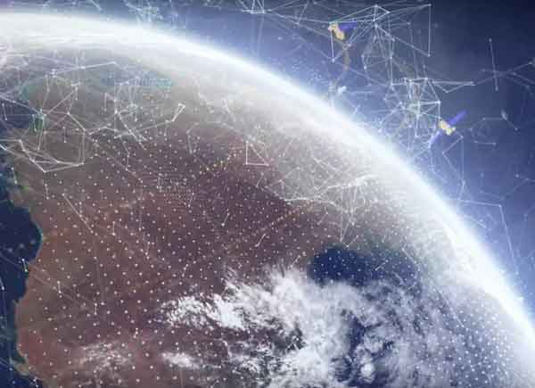
Data Cube Approach Introduces Architectures for EO Data
There are many barriers to accessing and applying satellite data, such as the cost and complexity of transmission, handling and storage as well as the need to calibrate and process large volumes of imagery from multiple satellites.

Story Map Navigates Cause and Effects of Climate Change
With the Atlas for a Changing Planet Story Map, scientists, policy makers, planners and activists can examine detailed spatial information critical for adapting to a warmer future.
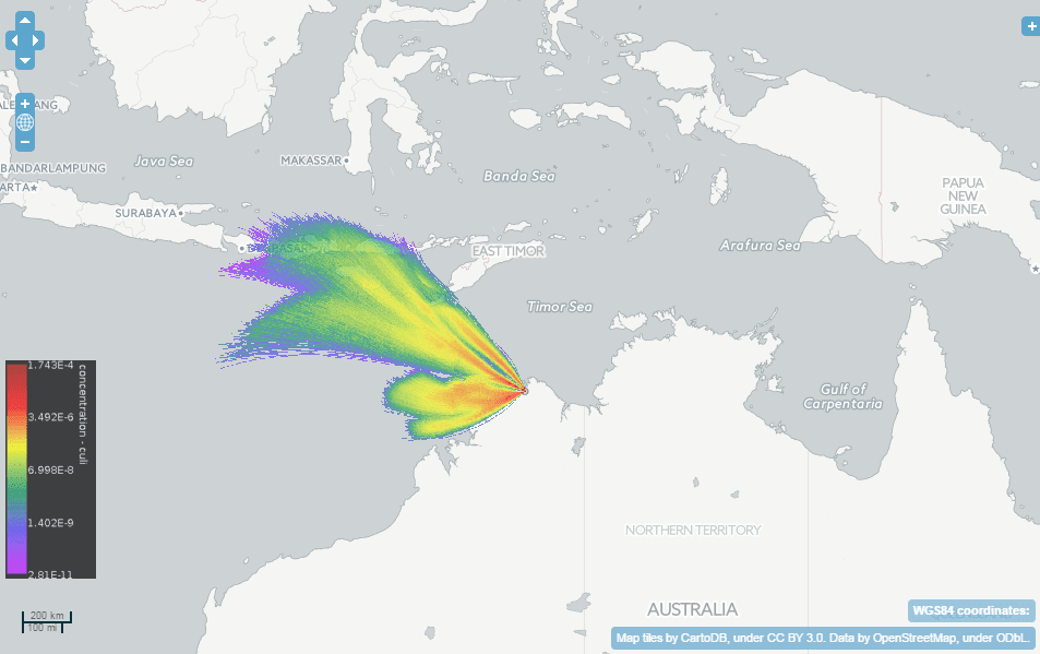
Australian Scientists Create Wind-Dispersion Models to Assess Threats
A collaboration among Australia's national science agency (CSIRO), Bureau of Meteorology and Intersect created TAPPAS (Tool for Assessing Pest and Pathogen Aerial Spread), an online software tool for modeling the wind dispersal of living organisms.
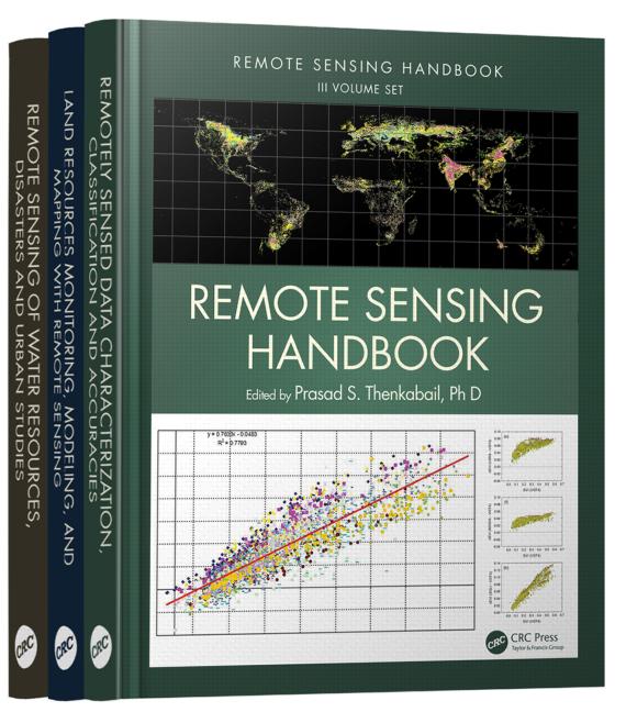
USGS Publishes Remote-Sensing Handbook
The newly published, three-volume Remote Sensing Handbook includes remote-sensing topics written by more than 300 leading global experts.
Measuring Coastal Slope Movements From The Air
December 1, 2015 — Carlos Gonzales from 3D Laser Mapping will explore the capabilities of combining airborne laser scanning and photography as an approach to measure coastal slope movements, during his talk at MMT in Sydney, Australia. (9-11th December, 2015)...
