Information about land use and ownership restrictions is easier to find and use when combined with national cadastres, a survey by EuroGeographics has shown. The Association, which represents national mapping, cadastral and land registry authorities from the whole of...
New Heartland Maps for the New Year
New US Topo maps for Iowa and Kansas are now available in the USGS Store for free download. The new maps of these Midwestern states feature the inclusion of the U.S. Census Bureau’s Topologically Integrated Geographic Encoding and Referencing (TIGER) road data. "The...
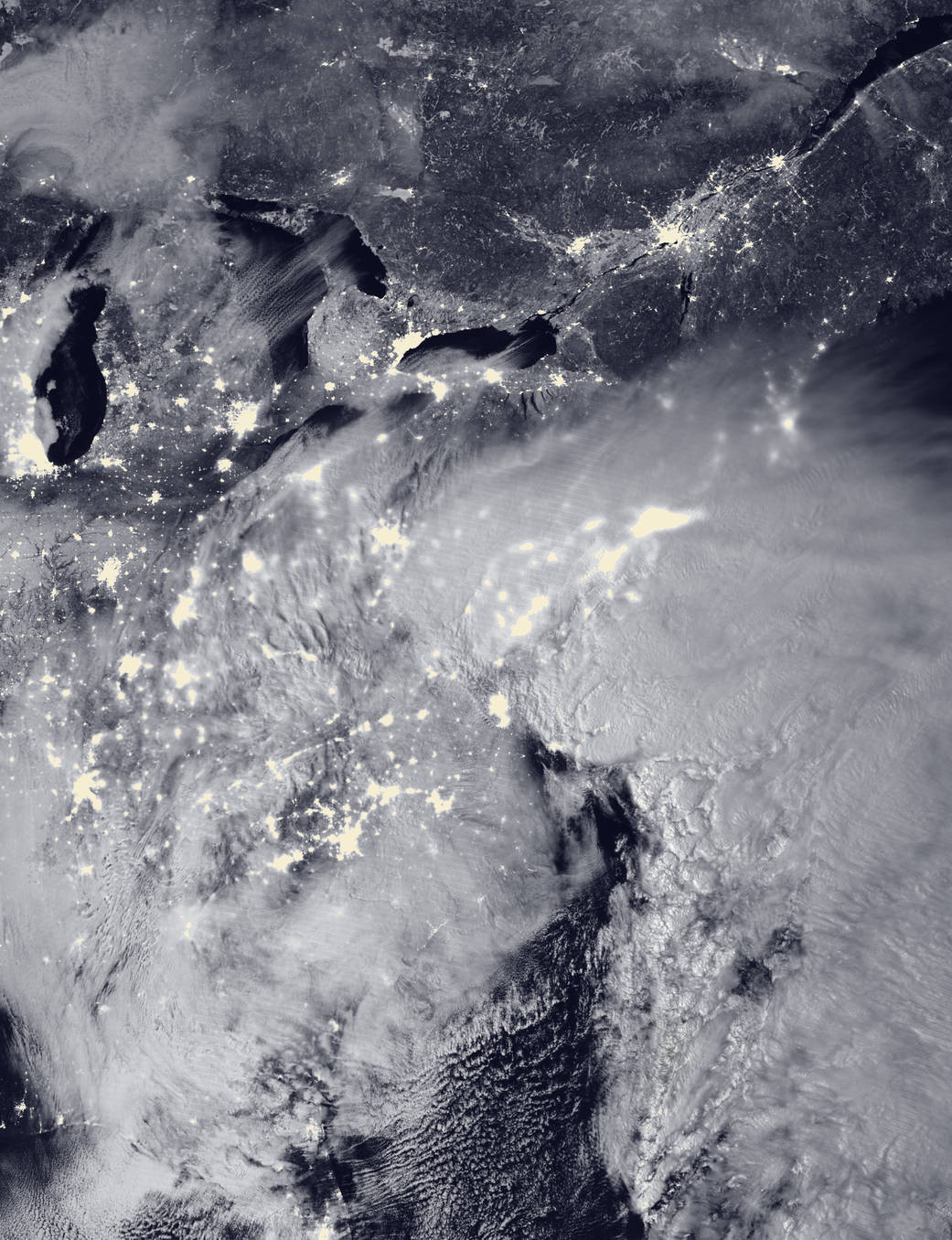
NOAA, NASA Satellites Track Eastern Blizzard
Satellites tracked and helped warn of a major winter storm that hit the eastern United States on Jan. 22-24, 2016, with two low-pressure systems merging to drop heavy snow from Virginia to New England.

Peru Program Puts Trackers on Vultures to Monitor Waste
To raise awareness of Peru's growing waste problem, a multi-agency collaboration is attaching sensors and cameras to vultures, recording their waste-tracking habits.
European Space Imaging Case Study Reveals How Satellite Imagery Helps Protect UNESCO World Heritage Sites
European Space Imaging (EUSI) released a new case study outlining the success of using satellite imagery to help protect UNESCO World Heritage sites this week. Working together with experts at the German Archaeological Institute (DAI) and the German Aerospace Centre...
Navmii Appoints Steve Coast, OSM Founder, as Board Advisor
LONDON — Navmii, the free, smart navigation and traffic app, today announces that Steve Coast, the founder of the OpenStreetMap Foundation (OSM), will join Navmii as a board advisor to further enhance its B2B mapping products and services. Navmii has created...
Geospatial World Forum to Bring Business into Focus
Since the past few years, geospatial industry has seen major shift in its business models largely due to global demand of cloud-based and open-interoperable solutions. The advent of information technology and connectivity not only makes the world smaller, but creates...
TerraGo and Eos Positioning Partnership Delivering Next-Generation GPS / GNSS Solutions for Customers Today
TerraGo, a pioneer of geospatial collaboration and enterprise mobility software, announces a technology partnership with Eos Positioning Systems that is driving collaboration across company product lines and already producing field-tested, customer-proven results. The...
OGC, InLocation Alliance and i-locate Project Seek Input on Use Cases and Benefits of Indoor Positioning
22 January 2016 — The Open Geospatial Consortium (OGC®), the Inlocation Alliance (ILA) and the i-locate Project invite you to contribute to a survey on use cases and benefits of indoor positioning. Kirk Burroughs, Board Chair of InLocation Alliance stated that...
URISA’s GIS Hall of Fame Nominations Process Opens
Des Plaines, IL, January 22, 2016 — URISA is pleased to announce that it is now accepting applications for its GIS Hall of Fame. Nominations are due May 1, 2016. URISA's GIS Hall of Fame honors persons and organizations that have made significant and original...
