RIEGL will be attending, exhibiting and presenting at ILMF! International LiDAR Mapping Forum (ILMF) is a technical conference and exhibition showcasing the latest airborne, terrestrial, and underwater LiDAR, as well as emerging remote-sensing and data collection...
Elbit Systems Introduces Skylark 3: The Latest Addition To Its Family Of Mini-UAS
Elbit Systems has developed the Skylark3, a new autonomous mini Unmanned Aircraft System (UAS), best suited for brigades and divisions in "beyond the next hill" reconnaissance, counterinsurgency and force protection missions, as well as for use in a range of civil...
Growing Adoption of Open-Source GIS Software Driving the Global GIS Market Through 2020, Says Technavio
LONDON — According to the latest market study released by Technavio, the global geographic information system (GIS) market is set to reach close to USD 16 billion by 2020, growing at a CAGR of more than 10%. This research report titled ‘Global GIS Market...
Sentinel-3: A New Window on the Changing State of Our Oceans
Climate change is much discussed, says Dr Simon Keogh of the Met Office, and to inform the conversation the Met Office uses historical scientific data including sea-surface temperature records, based on data from the Along Track Scanning Radiometer (ATSR) series of...
Bluesky Sponsors UNESCO Biosphere Reserve Expansion in Kenya
Leicestershire, UK, 16 February 2016 – Aerial mapping company Bluesky is aiding the expansion of a UNESCO Biosphere Reserve in Kenya. Working with Cranfield University, the UK based aerial survey specialist will provide financial and technical support for the...
AZO Brings “Big Data from Space” to this Year Mobile World Congress 2016
Five startup companies will present their game changing Earth observation services delivered by the European Copernicus programme on the SAP HANA Cloud Platform at the SAP booth at Mobile Word Congress (MWC 2016). Earth observation data provides crucial economic and...
Success of Nottingham City Council's Open Data Initiative Supported by FME & 1Spatial
Cambridge, UK, 16th February 2016 — 1Spatial’s Certified FME consultants supported Nottingham City Council’s use of FME technology to reduce the response time of Freedom of Information Act 2000 (FOI) requests. Production of validated and redacted FOI responses...
Loxley Chooses SimActive for Royal Thai Government Project
Montreal, Canada, Feb. 16, 2016 – SimActive Inc., a world-leading developer of photogrammetry software, is pleased to announce that Loxley PCL has purchased its Correlator3D™ for a major mapping project in Thailand. The software is used by its subsidiary, Data...
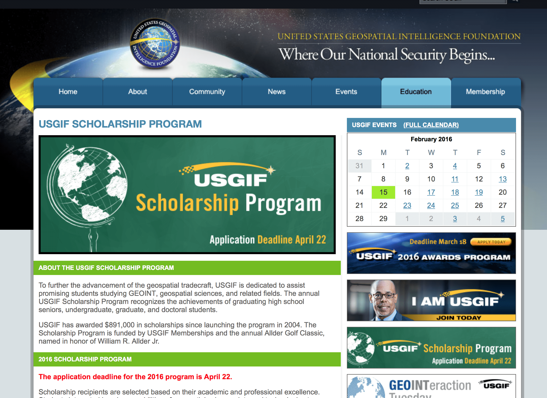
USGIF Accepting Applications for Awards, Scholarships
The U.S. Geospatial Intelligence Foundation (USGIF) is accepting nominations for its 2016 Awards and Scholarship programs.
OS Maps Out of this World
607 paper maps, the most detailed digital data picture of Great Britain, and now one red planet Using NASA open data, Ordnance Survey has created a one-off paper and digital map of the Martian landscape. OS, whose database of Great Britain has up to 500 million...
