The DXD demonstration took place at Arizona's Yuma Proving Grounds, where a series of eight balloon drops at altitudes up to nearly 11 miles successfully launched tiny remote sensing gliders.
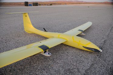
The DXD demonstration took place at Arizona's Yuma Proving Grounds, where a series of eight balloon drops at altitudes up to nearly 11 miles successfully launched tiny remote sensing gliders.
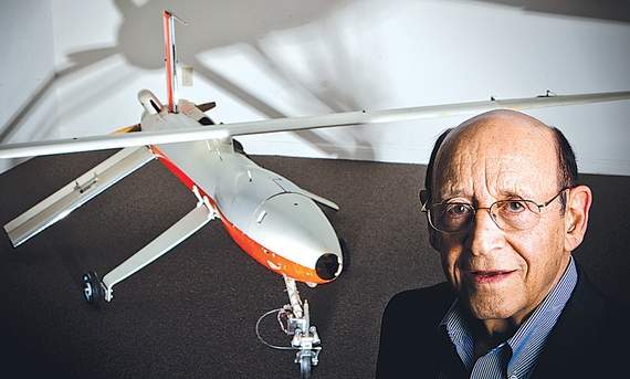
In 1980, an immigrant engineer from Israel named Abraham Karem retreated to his garage near Los Angeles and began building an unmanned aircraft that has evolved into a modern aviation icon.
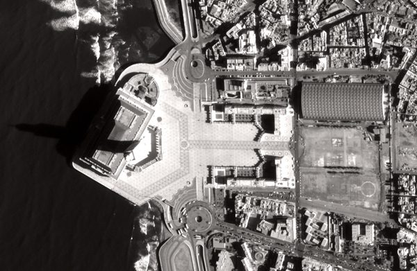
After the Pléiades 1A satellite returned impressive first images three days into orbit, Astrium says its agility and reactivity are among innovations to expect during the next several months.
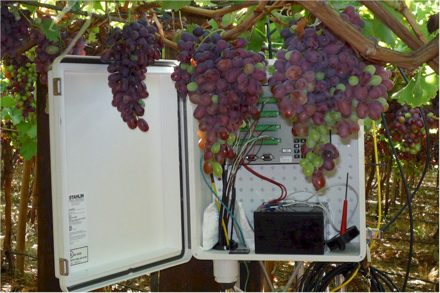
The European Space Agency's GrapeLook service lets growers determine exactly when to water their vineyards, precisely how much water to use and more to ensure an optimal grape harvest.

Competition among states is likely to heat up in response to provisions in the 2012 National Defense Authorization Act that call for six new unmanned aircraft system test sites.
The European Space Agency’s CryoSat team has cleverly altered the satellite's original ice-monitoring mission to include delivery of valuable near-real-time marine information.
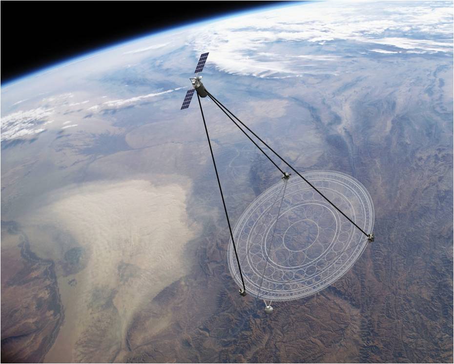
To meet national security requirements around the world, it would be optimal to have the instant high-tech, zoom-in views often seen in spy movies, capabilities that currently don't exist”yet.
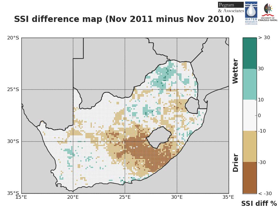
With many African countries suffering from a lack of water, new knowledge acquired from satellites is paving the way to sustainable water management practices.
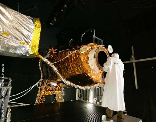
Astrium Geo-Information Services will compete with U.S. satellite companies DigitalGlobe and GeoEye when its newly launched Pleiades 1A high-resolution Earth observation satellite becomes operational in early 2012.
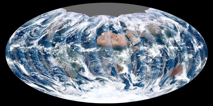
This image collected Nov. 24, 2011, is the first complete global image from the NPP satellite's Visible Infrared Imager Radiometer Suite, which can image the entire Earth every day with no gaps.