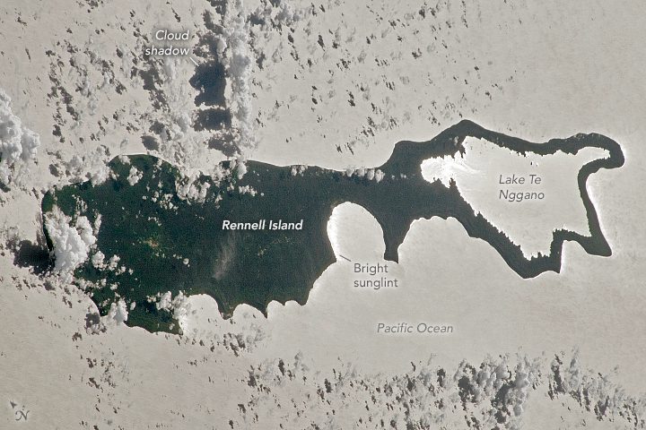
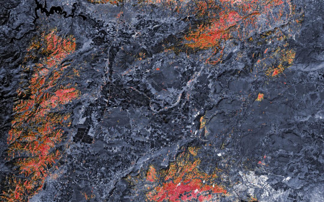
Rennell Island is part of the Solomon Islands, a nation in the western Pacific Ocean located northeast of Australia and east of Papua New Guinea. Rennell, also known as Mu Nggava Island, lies 210 kilometers (130 miles) south of Guadalcanal—the nation’s main island.
Belize Coral Reef Risk
Using two decades of NASA satellite measurements stored in the cloud, scientists recently assessed the vulnerability of Belize’s renowned coral reefs to bleaching and collapse.
Joint NASA, CNES Water-Tracking Satellite Reveals First Stunning Views
The international Surface Water and Ocean Topography (SWOT) mission–led by NASA and the French space agency Centre National d’Études Spatiales (CNES)–sent back some of its first glimpses of water on the planet’s surface, showing ocean currents like the Gulf Stream in unprecedented detail.
Lava and Snow in Hawai’i
An astronaut aboard the International Space Station (ISS) photographed the island of Hawai’i and its snowcapped volcanoes Mauna Loa and Mauna Kea.
Ozone-Measuring Instrument on NOAA-21 Satellite Captures its First Images
On Feb. 9, 2023, an ozone-measuring instrument on the recently launched NOAA-21 satellite opened its doors and, over the course of a week, gathered data for its first global image.
Tropical Cyclone Freddy Lingers
For more than a month, Tropical Cyclone Freddy has cast about in the Indian Ocean, bringing powerful winds and downpours to anything in its long and wandering path.
Snow in Southern California
A powerful late-February 2023 storm brought blizzard warnings, cold rains, howling winds, and rare low-elevation snow to parts of southern California more accustomed to warmth and sun.
NASA’s Advanced Air Mobility Studies
Across NASA, researchers are conducting Advanced Air Mobility (AAM) studies that will transform U.S. communities, creating new ways to move people and goods in the sky. The data and AI-based decision-support tools enabled by the Data & Reasoning Fabric concept will help further the AAM community’s goals by providing information needed for future flight operations.
Chile Battles Raging Wildfires
Deadly wildfires continue to rage in south-central Chile, destroying hundreds of thousands of hectares of land across the country. Satellite images captured by the Copernicus Sentinel-3 mission on Feb. 4, 2023, show the ongoing fires and heatwave in South America.
NASA’s Satellites Help with Turkey, Syria Earthquake Response
Following the magnitude 7.8 and 7.5 earthquakes that struck southern Turkey and western Syria Feb. 6, 2023, NASA is working to share its aerial views and data from space in ways that can aid relief and recovery workers in the region as well as improve its ability to model and predict such events.