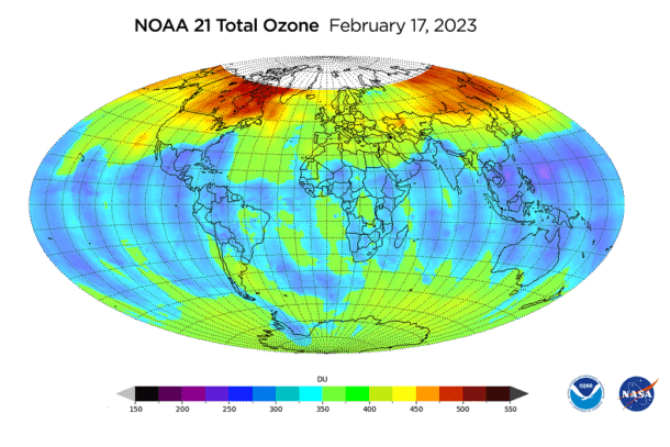
 On Feb. 9, 2023, an ozone-measuring instrument on the recently launched NOAA-21 satellite opened its doors and, over the course of a week, gathered data for its first global image. The Ozone Mapping and Profiler Suite (OMPS) consists of three sensors that monitor Earth’s ozone layer and track its recovery.
The map above, created using OMPS data, shows total ozone concentrations in the atmosphere around the globe. Higher ozone levels are concentrated in far northern latitudes, which is typical for this time of year.
OMPS was originally designed to measure ozone high in the atmosphere; this ozone layer protects humans and other life on Earth from the harmful effects of ultraviolet radiation. This is not to be confused with ground-level ozone, a harmful air pollutant and the main ingredient in smog.
Image Credit: NASA/NOAA/JPSS

