Today, Airlango launched Mystic, an advanced AI-powered drone with the ability to recognize and autonomously follow its owner, obey gesture commands from the ground, and take high precision photos without user interaction. It is available now on Kickstarter starting...
ViON and Nutanix Showcase Hyperconverged Infrastructure-Based Solution Designed for GIS Operations at 2018 ESRI User Conference
HERNDON, Va.- ViON Corporation, a cloud service provider and market leader in the design, delivery and maintenance of mission-critical IT infrastructure solutions, announced today that it has partnered with Nutanix to showcase a new hyperconverged infrastructure-based...
Teledyne Optech's Vinod Ramnath awarded JALBTCX Technical Achievement Award
Teledyne Optech is pleased to announce that Research Scientist and Development Manager Vinod Ramnath was awarded the Sebastian Sizgoric Technical Achievement Award by the Joint Airborne Lidar Bathymetry Technical Center of Expertise (JALBTCX) at their 19th Annual...
Esri and Waze Deliver Near Real-Time Data for Smarter Cities
Redlands, California—Esri, the global leader in location intelligence, today announced Waze live alert data will now be available in Esri's ArcGIS Marketplace for free to members of the Waze Connected Citizens Program. The Connected Citizens Program, a two-way...
Introducing Concept3D’s Tour Builder: A New Platform for User-Created VR Tour Experiences
DENVER - Concept3D, a leader in creating software to power immersive online experiences, today announced the launch of its new Tour Builder platform which allows anyone to create, manage and share their own VR-enabled virtual tours. Using Tour Builder is dead...
Epson Debuts New T-Series Wireless Technical Printers Featuring All-New Space-Saving Design
SAN DIEGO, Calif. (ESRI, Epson Booth #127) – July 10, 2018 – Epson today announced two new high-speed, easy-to-use wide-format SureColor® T-Series plotters – the Epson SureColor T3170 24-inch desktop printer and the SureColor T5170 36-inch floor-standing...
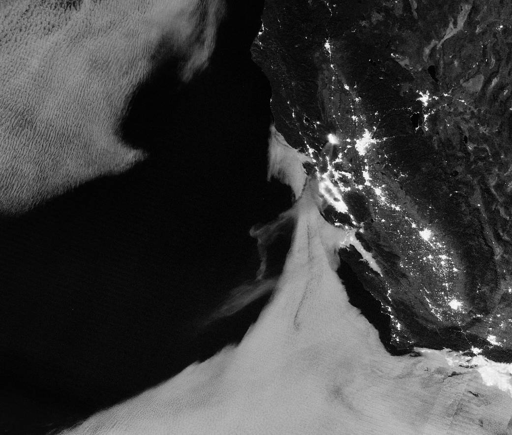
County Fire Lights Up the Night
Light from the County Fire illuminated the night skies of Northern California when the Suomi NPP satellite acquired this image overnight on July 1, 2018.
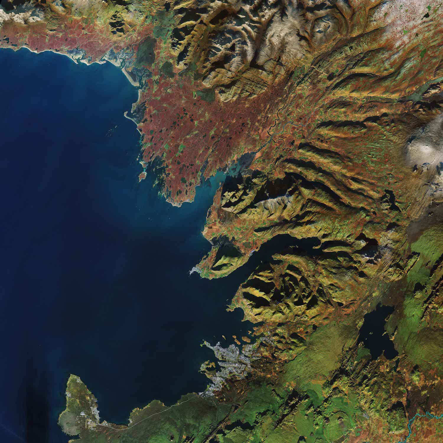
Reykjavik, Iceland
The Copernicus Sentinel-2A satellite takes us over Reykjavik, the capital of Iceland.
Maxar Technologies' DigitalGlobe Introduces EarthWatchâ„¢, the Most Powerful Cloud-Based Commercial Product for Geospatial Information
WESTMINSTER, Colo.- DigitalGlobe, a Maxar Technologies company (formerly MacDonald, Dettwiler and Associates Ltd.) (NYSE: MAXR; TSX: MAXR), announced today the launch of its newest product, EarthWatch, a cloud-based subscription for viewing, streaming and downloading...
Perspecta to Provide Geography Data Management Services to National Geospatial-Intelligence Agency
CHANTILLY, Va. -Â Perspecta Inc. (NYSE: PRSP), a leading U.S. government services provider, announced today that it has been selected to support the creation, validation, enrichment, and integration of foundational geospatial intelligence data for the National...
