International LiDAR Mapping Forum (ILMF) and Lidar Magazine are excited to host second annual Lidar Leader Awards, which will be presented at ILMF, taking place January 28-30, 2019 in Denver. This is a unique opportunity for the geospatial community to recognize the...
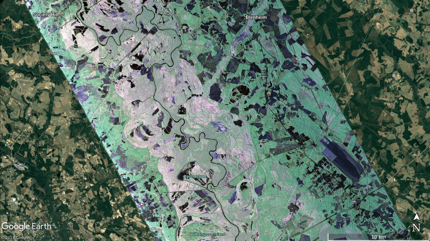
NASA Airborne Team Surveys Flooding from Hurricane Florence
In the aftermath of Hurricane Florence, which struck the Carolinas on Sept. 14, 2018, NASA quickly deployed a sophisticated airborne radar to give disaster response agencies a much-needed view of floodwaters that continued to threaten the region.
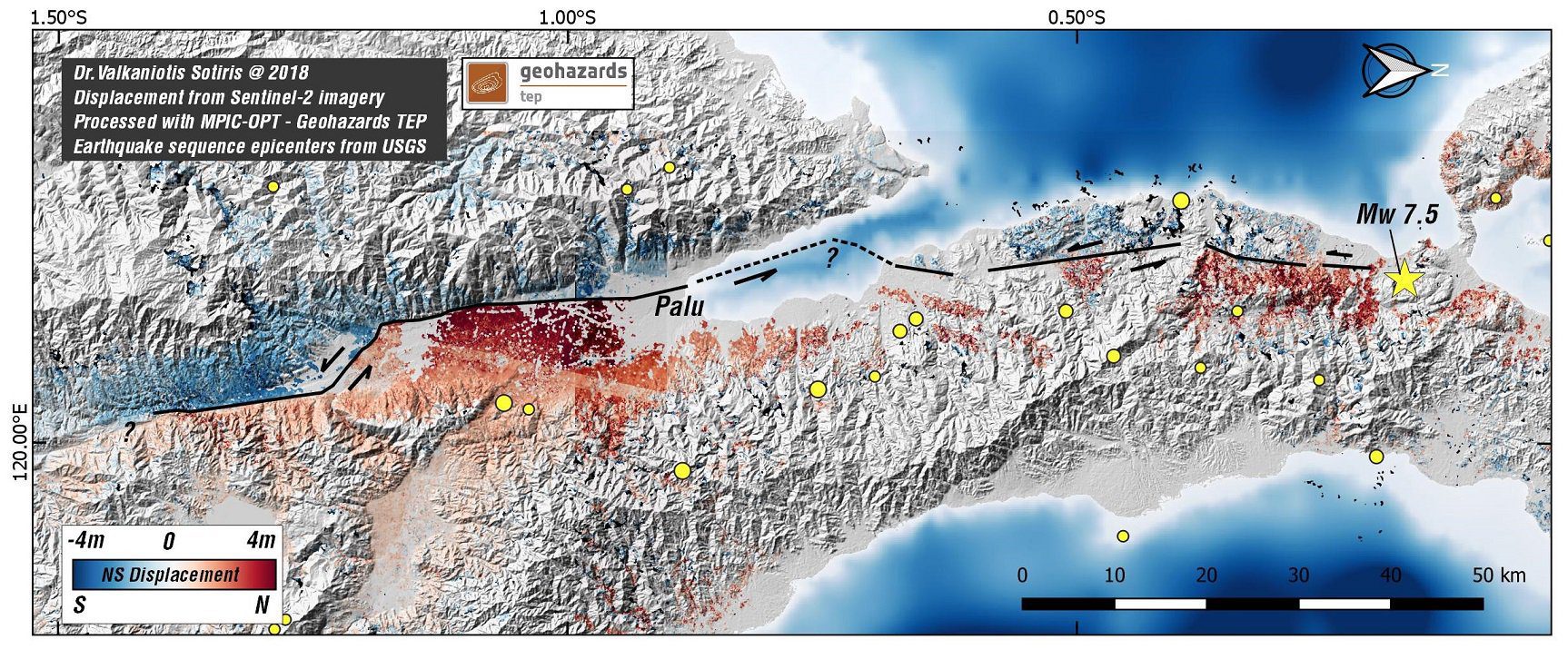
Indonesia Earthquake Displacement Map
Thematic experts from the Corinth Rift Laboratory in Greece generated a displacement map using Copernicus Sentinel-2 acquisitions from Sept. 17 and Oct. 2, showing the impact of the 7.5-magnitude earthquake that hit Indonesia on Sept. 28, 2018.
NavVis IndoorViewer Now Converts Static Scans into Immersive 360° Imagery
MUNICH, Germany – NavVis, a leading provider of indoor spatial intelligence technology, can now automatically convert E57 point cloud files into interactive, realistic 360° walkthroughs, following the latest software upgrade to IndoorViewer. NavVis IndoorViewer is...
Esri Business Partner, GEO Jobe GIS, at the 6th Annual Mississippi Geospatial Conference
OLD HICKORY, Tenn.- GEO Jobe is pleased to be involved as a supporter and sponsor of the 6th annual Mississippi Geospatial Conference, taking place October 11-12, 2018 at the University of Southern Mississippi Gulf Park Campus in Long Beach, MS. Representing GEO Jobe...
URISA Releases White Paper Defining the Boundaries of Practice Between Surveyors and GIS Professionals
In recent years, URISA's Policy Advisory Committee has facilitated several panel discussions at GIS-Pro conferences during which surveyors and GIS professionals have discussed the distinctive, yet complementary, services that each profession provides. Surveyors and...
Epson to Announce and Demonstrate New Robot Solutions at Pack Expo
CARSON, Calif.- Who: At Pack Expo, Epson Robots will be launching the SynthisTM T6 All-in-One SCARA robot as well as  Force Guide, a high performance integrated force guidance solution. The company will also showcase  various leading robots for factory automation in...
Maxar’s SSL Continues Positive Momentum in Growing U.S. Government Pipeline
PALO ALTO, CA -Â SSL, a Maxar Technologies company (formerly MacDonald, Dettwiler and Associates Ltd.) (NYSE: MAXR) (TSX: MAXR), and a leading provider of innovative satellites and spacecraft systems, has been selected as one of three companies qualified to compete...
L3 to Deliver Modernized ISR Sensors With Next-Generation Accuracy
NEW YORK - L3 Technologies (NYSE:LLL) announced today that it has been awarded an indefinite-delivery/indefinite-quantity (ID/IQ) contract valued at up to $454 million from the U.S. Army for the next-generation WESCAM MXâ„¢-10D electro-optical/infrared and laser...
FLIR Launches Black Hornet Vehicle Reconnaissance System
WILSONVILLE, Ore.- FLIR Systems, Inc. (NASDAQ: FLIR) today announced the FLIR Black Hornet® Vehicle Reconnaissance System (VRS), featuring the Black Hornet 3 nano-unmanned aerial vehicle (UAV) designed for global military, government agency, and first responder...
