The Copernicus Sentinel-2 mission collected this false-color image of Lake Valencia in northern Venezuela.
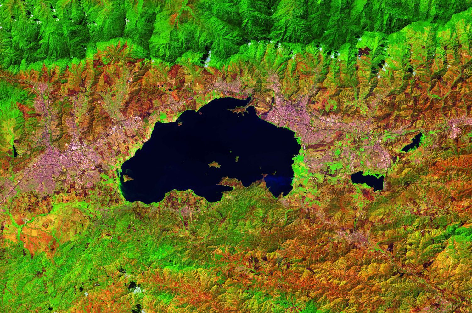
The Copernicus Sentinel-2 mission collected this false-color image of Lake Valencia in northern Venezuela.
Monaco – The GEBCO-Nippon Foundation Alumni Team has won the Shell Ocean Discovery XPRIZE, prevailing against talented teams from around the world to claim the top prize of $4 million for their entry concept.  The award was presented to the team at a ceremony at...
The U.S. Army Corps of Engineers (USACE) Wilmington District has awarded Dewberry, a privately held professional services firm, an architecture/engineering services task order for the South Atlantic Coastal Study (SACS). Under this contract, the firm will serve as...
REDLANDS, Calif.— Esri, the global leader in location intelligence, today announced that Microsoft’s Tactical Edge Platform will use Esri’s ArcGIS Enterprise to give its Microsoft Azure and Azure Cognitive Services a geographic context through Esri’s advanced...
DENVER - Intermap Technologies announced today the release of NEXTMap Orthorectification, an accurate, cost-effective, worldwide, and fast satellite imagery enhancement service. Available as a cloud-based, secure application or professional service, depending upon...
ProgeSOFT is delighted to present progeCAD 2020 Professional, the new version of its DWG/ DXF-native CAD for professional drawing with perpetual licensing solutions. The released version sports the new IntelliCAD 9 engine, digital signing of drawing files and is...
SOUTH JORDAN, Utah - Aerial imagery business, Nearmap, today launched its new 3-D product in a move that will revolutionize the way industries such as urban planning, architecture, construction, government and councils view and shape cities across Australia and the...
TEL AVIV, Israel and GRAND FORKS, North Dakota - Drone safety company ParaZero Technologies Ltd (ASX: PRZ), together with the Northern Plains UAS Test Site (NPUASTS), has completed the testing and compliance process for ParaZero's SafeAir Mavic in accordance with...
REDLANDS, Calif.— Esri, the global leader in geographic information system (GIS) technology, today announced its partnership with the E.O. Wilson Biodiversity Foundation and will be providing the mapping and analytics capabilities of the ArcGIS platform to...
GSSI, the world’s leading manufacturer of ground penetrating radar (GPR) equipment, is pleased to announce a distribution partnership with Blinken Tools AB, headquartered in Karlstad, Sweden. This alliance focuses on expanding GSSI’s presence in the Scandinavia...
