San Diego, Calif. - At the 2019 Esri User Conference, the Geospatial Intelligence Center (GIC), an insurance industry consortium spearheaded by the National Insurance Crime Bureau (NICB), and Esri today introduce Virtual Inspection Studio (VIS). A new tool available...
New Usage-Based Service Plans for Trimble Catalyst Enable Geospatial Organizations to Access Precise Positioning On Demand
SUNNYVALE, Calif.— Trimble (NASDAQ: TRMB) announced today its Trimble® Catalyst™ software-defined Global Navigation Satellite System (GNSS) receiver for Android™ phones and tablets is now available with a usage-based service plan—Trimble Catalyst On...
Woolpert First Provider Approved by PennDOT to Operate Drones for State Projects
The Pennsylvania Department of Transportation requires UAS operators to undergo extensive PennDOT training in addition to attaining the FAA’s Part 107 Remote Pilot Certificate. HARRISBURG, Pa. — Woolpert had numerous surveying, mapping and geospatial professionals...
On-Demand Drone Insurance SkyWatch.AI Launches in UK: The Safer you Fly, the Lower the Premium
Tel Aviv – SkyWatch.AI, the world’s first on-demand, telematics-based insurance platform for commercial drones, today launched in the United Kingdom. Building on its success in the US, SkyWatch.AI’s UK policies will be underwritten by international specialty...
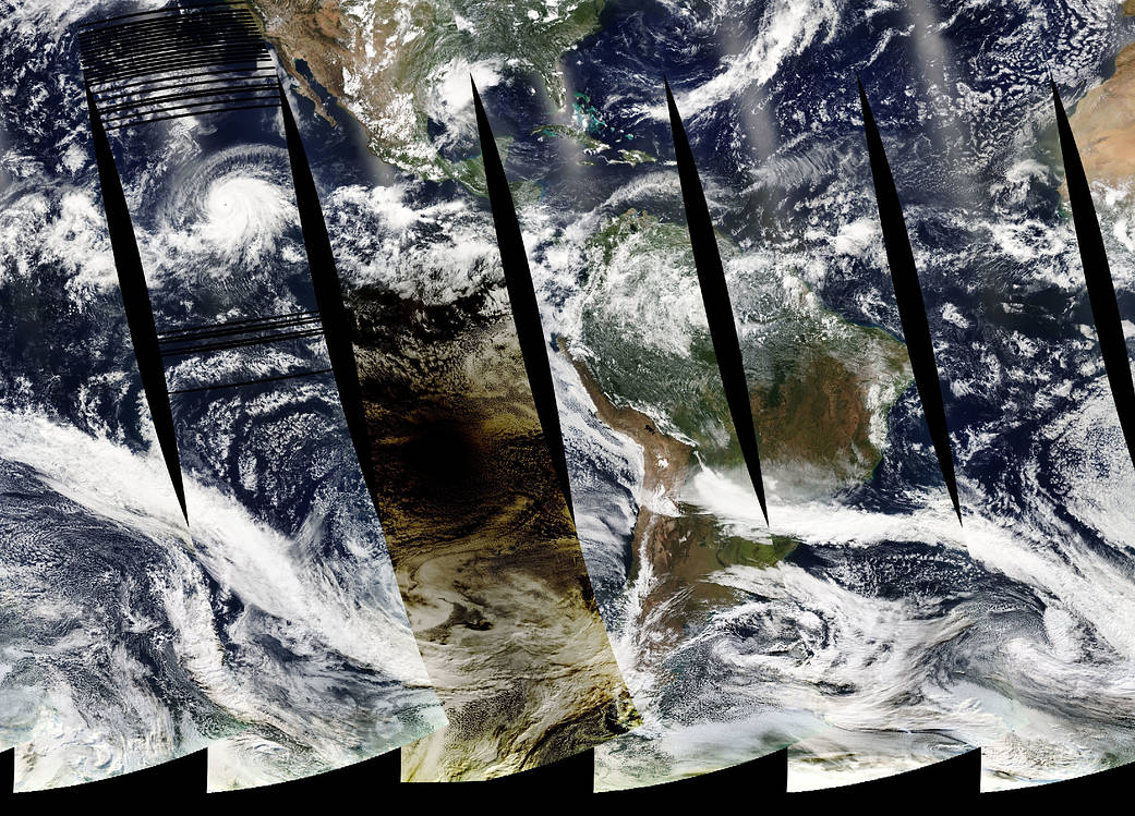
Total Solar Eclipse Darkens the South Pacific
On July 2, 2019, skywatchers in the beach city of La Serena, Chile, looked up at 4:38 p.m. local time to see a black circle in the sky.
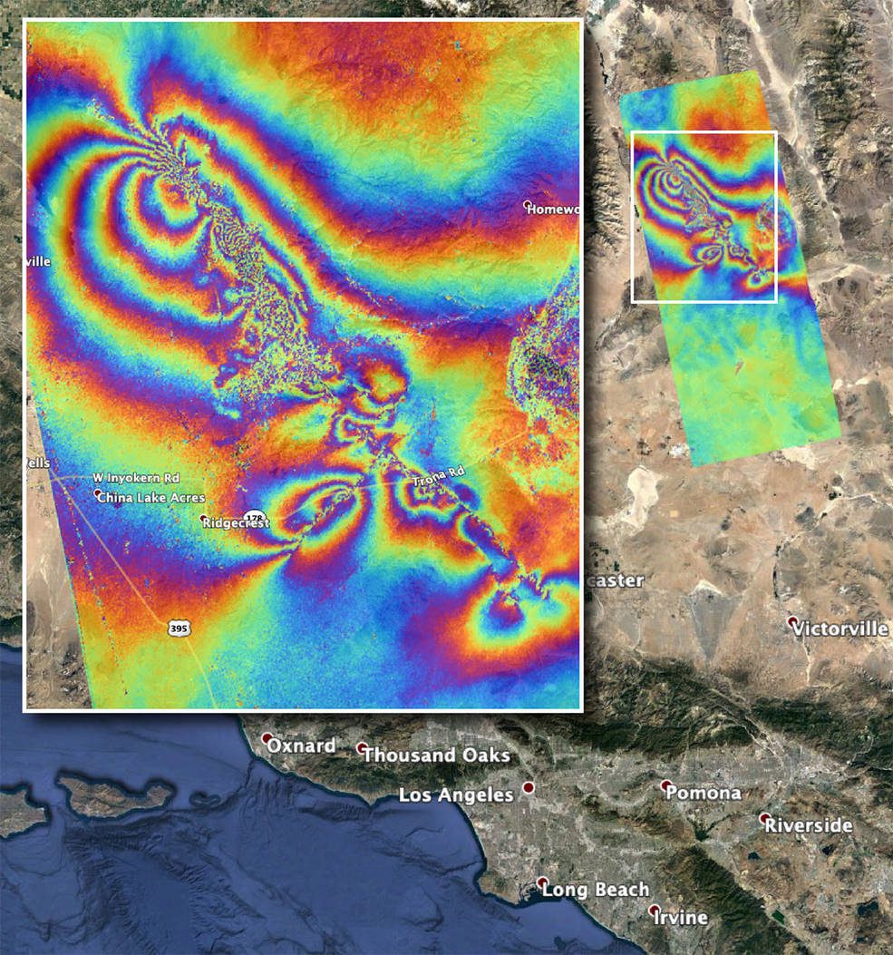
NASA Maps Surface Changes From California Quakes
Damage from two strong earthquakes that rattled Southern California on July 4 and July 5”magnitude 6.4 and 7.1, respectively”can be seen from space.
EuroGeographics adds new administrative boundaries to its geospatial open data
EuroGeographics today (8 July 2019) announced the addition of NUTS 3 official boundary information in its European geospatial open data from official national sources. As well as enabling socio-economic analysis of more than 1,300 administrative regions across Europe,...
Barry Wellar, C.M., GISP Announced as Closing Speaker for URISA’s GIS Leadership Academy in Toronto
URISA is pleased to announce that Barry Wellar, C.M., GISP will provide the closing remarks at the GIS Leadership Academy (GLA) in Toronto (August 19-23, 2019). On March 14, 2019, former URISA President (1978) and Professor Emeritus at the University of Ottawa, Barry...
DTN and Esri Strengthen Partnership With Expanded Services
MINNEAPOLIS - DTN, the leading provider for actionable weather insights, today announces its expanded partnership with Esri, the world leader in location intelligence. This growing partnership builds on the success of a three-year relationship and now offers even more...
CentralSquare to Showcase Cloud-Based and Fully Mobile Public Administration Software at Esri User Conference
Lake Mary, Fla.- CentralSquare, a leader in public sector software, announced today that it will participate at the Esri User Conference 2019 being held July 8-12, 2019, in San Diego, CA. Presenting from conference booths 1819 and 1919, CentralSquare will showcase its...
