RALEIGH, N.C. -- PrecisionHawk, a leading commercial drone and data company, has opened access to its professional mapping and analytics software, PrecisionMapper, for free. By eliminating the cost barrier, operators have the flexibility to 'bring their own drone'...
New Content and Videos are Featured in the King Schools Version 2.0 Drone Pilot License Test Prep Course
SAN DIEGO and DALLAS - AUVSI XPONENTIAL Conference -- Drone pilots who want to fly their drones in furtherance of a business have a fun and quick way to prepare to pass the required Part 107 Remote Pilot Certificate written test with Version 2.0 of the King Schools...
Tata Consultancy Services Launches First Drones Research Lab in Cincinnati, Ohio
CINCINNATI and MUMBAI, India - Tata Consultancy Services (TCS) (BSE: 532540, NSE: TCS), a leading global IT services, consulting and business solutions organization, has opened its first Drones Research Lab  in the US at its Seven Hills Park Innovation Center...
senseFly Corridor Solution Boosts Efficiency of Linear Mapping Projects
Cheseaux, Switzerland – senseFly, the world’s leading producer of mapping drones, today announces senseFly Corridor, a new platform enhancement that vastly simplifies the drone (UAS) mapping of linear infrastructure and sites. senseFly Corridor will debut on May...
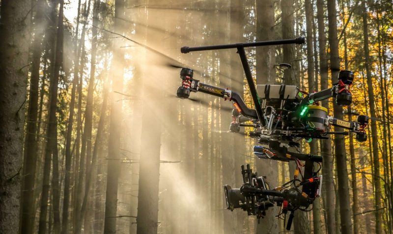
Vertical Images: From Film Making to Inspection, and Why the Future of Drones Doesn't Lie in Flying
Successful drone entrepreneur Petr LnÄ›niÄka went from award-winning filmmaker to drone inspection leader in his native Czech Republic. Here he lays out 3 pieces of advice and explains why for him, the transition seemed logical, and why he believes the future of drone mapping services will place less and less emphasis on drones and more and more weight on mapping data.
Martin Instrument Adds Microdrones UAVs to their Extensive Offering
AUSTIN, Texas — Microdrones is excited to announce that Martin Instrument, a leading equipment provider for surveying and construction companies throughout Texas, has added a new product line to their extensive offering: Microdrones mdMapper unmanned aerial...
Robotics and Drones Take Center Stage During RoboBusiness Europe and TUS Expo, 19-21 April 2017
Delft, the Netherlands, 29 March 2017: World renowned keynotes speakers, entrepreneurs and distinguished VIP guests will be present at the Grand Opening of the third edition of The Unmanned Systems (TUS) Expo and RoboBusiness Europe on 19 April 2017 at World Forum The...
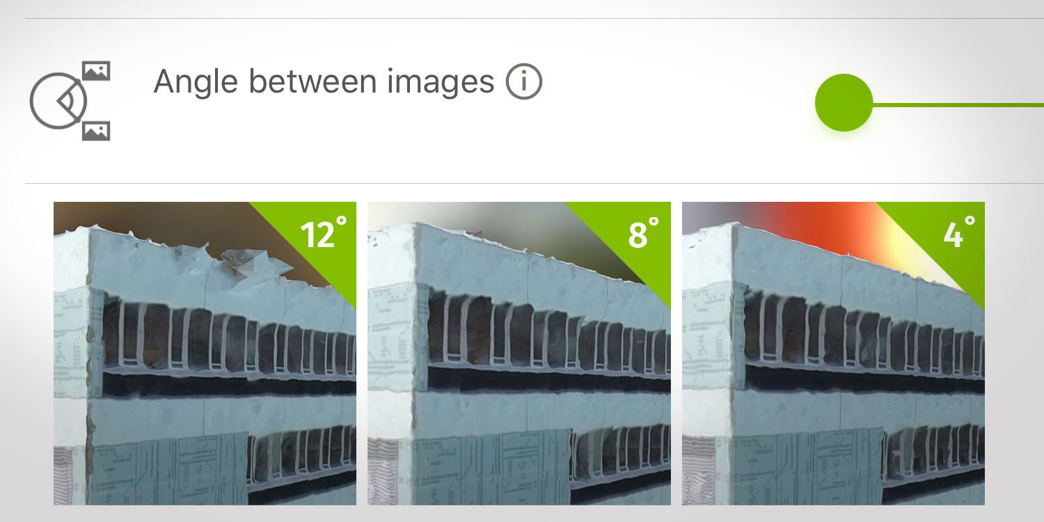
How Do I Choose the Correct Image-Capture Settings for 3D Models?
What are the effects of the angle between images setting in circular missions when it comes to 3D reconstruction?
Drone Heroes Take Europe by Storm!
Brussels, Belgium – From June 20th until June 22nd the pinnacle of the drone industry in Europe will gather at Commercial UAV Expo in Brussels. During this highly-anticipated conference and exhibition, an international jury of drone professionals will present...
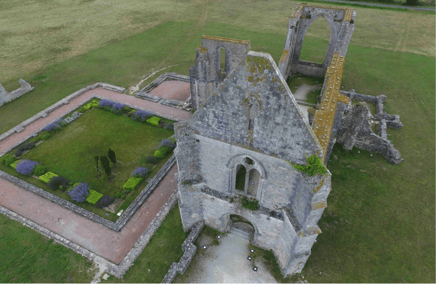
Drones, 3D Modeling and Printing Technologies Combine to Map France's Abbey of Chateliers and Church of Ars-en-Ré
Exploring ways to expand and better their services, participants in a multi-technology project showcased what can be achieved by combining aerial photography, photogrammetry-based 3D modeling and 3D printing.
