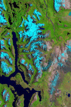
This image taken Jan. 14, 2015, by the Operational Land Imager on Landsat 8 shows the glaciers of Sierra de Sangra, an icy stratovolcano spanning the border of Chile and Argentina. Snow and ice are blue in the false-color image, which uses different wavelengths to better differentiate areas of ice, rock and vegetation. (Credit: NASA/Landsat 8)
Reports and studies of shrinking glaciers and ice sheets in Greenland and Antarctica come in regularly, but an additional ice field can be added to the list: Patagonia, the mountainous area at the southern end of South America shared by Argentina and Chile.
Mauri Pelto, a glaciologist at Nichols College, has been comparing imagery from Landsat satellites to determine that a wide variety of ice fields and glaciers throughout Patagonia have lost as much as 25 percent of their length in the last 30 years. In addition to global issues of rising seas and temperatures, the melting ice can more-locally affect the communities downstream that rely on the glaciers for a steady water supply.

