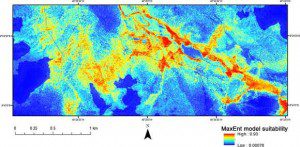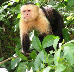
In this Capuchin monkey habitat model, warmer colors represent areas of higher habitat suitability, and cooler colors represent lower suitability. (Credit: Journal of Applied Remote Sensing doi:10.1117/1.JRS.9.096020 (© the authors))
Scientists eager to study the bearded capuchin monkeys (Sapajus libidinosus) of northeastern Brazil”especially interesting because they use stone tools to crack open the hard casings of palm nuts to eat the meat inside”are concerned the monkeys will lose critical habitat as industrial agriculture is rapidly expanding and intensifying in the region.
A new study in the Journal of Applied Remote Sensing explains how researchers applied remote sensing and GIS to characterize capuchin habitat to identify and protect their range.
A multispectral satellite image of the study area was used to identify land-use/land-cover elements relevant to the movement of capuchin monkeys, such as vertical scarps and areas of human influence. By developing a normalized difference vegetation index, researchers were able to map the density of vegetation in the study area. Other factors incorporated in the habitat model included elevation and percentages of green vegetation, bare soil, and shadow from spectral mixture analyses.
For more information and study conclusions, click here.

