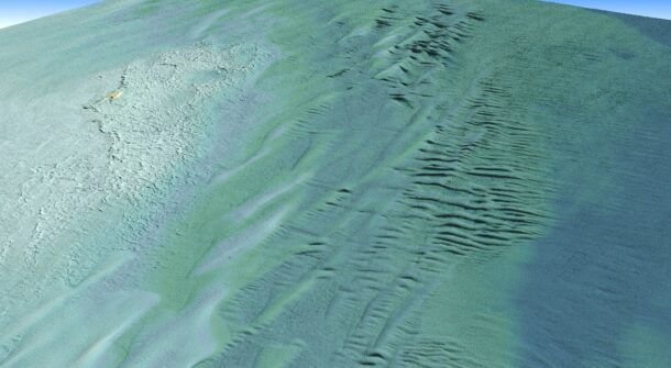
An oblique view of a Digital Elevation Model (DEM) derived from topobathymetric lidar collected by Tetra Tech’s CZMIL SuperNova. This view is looking northwest across Lake Superior toward Tahquamenon Island in Whitefish Bay. (Credit: Tetra Tech Inc.)
Tetra Tech Inc. used a Teledyne Optech CZMIL SuperNova Topobathymetric lidar system to successfully complete a project for the National Oceanic and Atmospheric Administration (NOAA) to update all its bathymetric maps in the Great Lakes region, which includes refined maps of the marine ecology. This necessitates obtaining accurate digital elevation models and reflectance products. The updated information will aid in enhancing the understanding of the Great Lakes hydrography and ecosystem.
The CZMIL SuperNova enabled mapping of the lakebed to a maximum depth of 31 meters. The intensity raster product, crafted with input from NOAA, served as a valuable tool for benthic habitat modeling, and the full waveform data will contribute to further research questions. At the end of the project, Tetra Tech delivered classified point clouds and gridded products.

