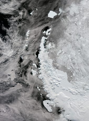
 The Antarctic Peninsula is the northernmost and warmest region of the Antarctic continent. It resembles a 1,000-kilometer-long arm covered with ice, stretching toward the southern tip of South America.
The peninsula’s west coast features more than 100 large glaciers and numerous islands, including the big Adelaide Island, visible at the bottom of this image collected by the Copernicus Sentinel-3 satellite. Moving north, we see the Biscoe Islands, Anvers and Brabant islands, and the South Shetland Islands, separated from the northwestern tip of the peninsula by the Bransfield Strait.
Visible further north, Elephant and Clarence Islands are the outermost of the South Shetland archipelago. To the east is the A23a iceberg, currently the largest iceberg in the world. It calved from the Filchner-Ronne ice shelf in West Antarctica in 1986, but only recently, driven by winds and currents, started drifting quickly away from Antarctic waters. Like most icebergs from the Weddell Sea, A23a is likely to end up in the South Atlantic on a path called iceberg alley.
Thick ice shelves lie along the eastern side of the Peninsula, including the renowned Larsen Ice Shelf, a series of three shelves – A (the smallest), B, and C (the largest) – extending into the Weddel Sea.
Image Credit: Contains modified Copernicus Sentinel data (2023), processed by ESA

