I n his book “Winning Modern Wars,†retired U.S. Army General Wesley Clark writes, “Defeating terrorism is more difficult and far-reaching than we have assumed. ... We may be advancing the ball down the field at will, running over our opponent’s defenses, but...
Can Increasing Orbital Debris Hazards Ground LEO Satellites?
By Philip Hattis, Ph.D., laboratory technical staff, Draper Laboratory (www.draper.com), Cambridge, Mass. Imagine a world where low Earth orbit (LEO) satellite functions such as hurricane tracking, climate change and natural disaster monitoring or arms...
U.S. Budget Battle Has Far-Reaching Consequences for Geospatial Industry
By Kevin D. Pomfret, executive director, Centre for Spatial Law and Policy (www.spatiallaw.com), Richmond, Va. The defense industry has known since last year that the Department of Defense would need to make cutbacks. With deficits and debt becoming increasing...
What to Watch in 2012
We’re pleased to present our annual State of the Industry report. Once again, our Editorial Advisory Board members have done a great job of identifying the most significant forces impacting the remote sensing industry, as well as key challenges and potential...
Ground Truth: Empowering the Warfighter with GEOINT
By Army Capt. Edward Major, formerly executive officer to the director of military support staff, National Geospatial-Intelligence Agency (www.nga.mil), Bethesda, Md. Simply put, the “where†is what ties everything together. Geospatial intelligence (GEOINT) helps...
GEOINT: A System-of-Systems Approach
By Michael Hales, technical executive, International Group, Office of International Affairs and Policy, National Geospatial-Intelligence Agency (NGA), Bethesda, Md. Imagine an architecture where 87 countries and 61 organizations pulled their Earth-observing...
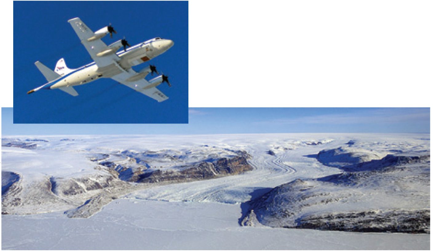
IceBridge: Building a Record of¨ Earth's Changing Ice, One Flight at a Time
By Holli Riebeek, NASA Earth Observatory (http://earthobservatory.nasa.gov), Greenbelt, Md. “Because understanding of some important effects driving sea level rise is too limited, this report does not assess the likelihood, nor provide a best estimate or an...
Intriguing Images Spawned By an Intriguing Industry
We wind down 2011 with our annual look at notable events as seen through the eyes of Earth observation sensors, beginning on page 12. With new sensors and systems being introduced all over the globe, observing the planet is becoming more thorough each year. In...
Defining a Military Strategy for the New Space Environment
By William J. Lynn, III, U.S. deputy secretary of Defense, Washington, D.C. As disaster struck Japan and revolution swept the Middle East, Americans again watched global events unfold in real time through a network of satellites in space that has revolutionized both...
Modern Warfare's Battle Cry: I, Robot
The quest for geospatial intelligence (GEOINT) began with the first skirmishes between rival tribes centuries ago. Today’s warfighter seeks the same edge by having better GEOINT about the enemy than the enemy has about him or her—that hasn’t changed. But the way...
