TORONTO, May 5, 2014—Optech is pleased to announce that it will be exhibiting at the 2014 Association for Unmanned Vehicle Systems International (AUVSI) Conference and Tradeshow in Orlando, FL, May 13-15. From the depths of marine environments to the barren plains...
PCI Geomatics Continues Tradition of Supporting Higher Education with the Centre of Geographic Sciences
RICHMOND HILL, Ontario, Canada, April 30, 2014—PCI Geomatics, a world-leading developer of remote sensing and photogrammetric software and systems, as part of its education initiative, recently visited with students and faculty at the Annapolis Valley Campus of the...
RIEGL USA to Exhibit and Present at AUVSI’s Unmanned Systems 2014
ORLANDO, Fla., May 1, 2014—RIEGL USA will be exhibiting and presenting at AUVSI's Unmanned Systems 2014! AUVSI's Unmanned Systems 2014 will be held at the Orange County Convention Center in Orlando, Florida from May 13 through May 15, 2014. RIEGL USA will be...
URISA and IAAO Issue Call for Presentations for GIS/CAMA 2015
Des Plaines, Ill., May 1, 2014—The International Association of Assessing Officers (IAAO) and the Urban and Regional Information Systems Association (URISA) are pleased to announce the 19th GIS/CAMA Technologies Conference taking place March 2-5, 2015 in Oklahoma...
Esri and the United Nations Partner to Improve Global Climate Resilience
Redlands, Calif., May 5, 2014—Esri and the United Nations Office for Disaster Risk Reduction (UNISDR) have formed a partnership to build more resilient communities with geospatial technology. The announcement was made at the Abu Dhabi Ascent conference on Sunday,...
Lockheed Martin Marks Significant Milestone in Research and Development for Unmanned Technologies
VINEYARD, Utah, April 29, 2014—Three systems acquired by Lockheed Martin [NYSE: LMT] have progressed from their research and development phase to operational readiness. The Indago vertical take-off and landing (VTOL) quad-rotor, accompanied by its handheld ground...
NASA-CNES Move Forward with Global Water and Ocean Surface Mission
Washington, D.C., May 2, 2014—NASA and the French space agency Centre National d'Études Spatiales (CNES) have agreed to jointly build, launch, and operate a spacecraft to conduct the first-ever global survey of Earth's surface water and to map ocean surface height...
Stennis Space Center Ranks First in Innovation
Stennis Space Center, Miss., April 30, 2014—The Enterprise for Innovative Geospatial Solutions (EIGS) is pleased to announce a recent survey named NASA's John C. Stennis Space Center (SSC) as number one for innovation among federal agencies by the Partnership for...
URISA Invites Participation in GIS Education Needs Assessment
Des Plaines, Ill., April 30, 2014—URISA is conducting a brief survey in order to better serve the educational needs of the GIS community. Please take a few moments to respond to the questionnaire which addresses educational topics of interest, education delivery...
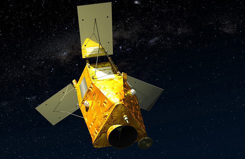
After Launch Delay, Kazakhstan EO Satellite in Orbit
Following a one-day reset due to launch pad difficulties on April 28, 2014, the Republic of Kazakhstan's first Earth observation (EO) satellite was placed in orbit on April 29.
