Cambridge, 20 January 2016 — (www.1spatial.com) 1Spatial plc, the spatial big data company, is hosting a series of free events in the UK and Australia, to help users to automate their processes, innovate and connect with FME users. 1Spatial is a Value-Added Reseller...
20th Anniversary of GIS/CAMA Technologies Conference to be Celebrated in Savannah
Des Plaines, IL , January 20, 2016 — URISA and the IAAO are excited to celebrate the 20th Anniversary GIS/CAMA Technologies Conference in Savannah, Georgia next month. To commemorate the occasion and the educational partnership, the conference is returning to the...
Esri Debuts Solutions to Help Organizations Compete in FCC Auction
Redlands, California—January 19, 2016 — Enterprises of all sizes can now gain a competitive edge in the 2016 Federal Communications Commission (FCC) 600-MHz spectrum auction using Esri Solutions for Smart Spectrum Analysis. With three offerings available, Esri's...
W3C and OGC Spatial Data on the Web Working Group publishes First Public Working Draft of its Best Practices
19 January 2016 — The W3C and OGC Spatial Data on the Web Working Group has published the First Public Working Draft of its Best Practices document for Spatial Data on the Web. This is a concerted attempt to bring together techniques used by the geospatial industry...
Indonesian City Gears up Smart City Roadmap with Smart Mapping Tech
The City of Depok, located in the West Java Province, Indonesia, has cemented its commitment to achieve smart city status by 2025 by leveraging state-of-the-art mapping technology to boost government efficiency and productivity. The 2015 winner of the Indonesian Smart...
SuperSurv 3.3 Delivers the Best Mobile GIS Experience
SuperSurv 3.3 for Android, the best smart mobile GIS Application developed by Supergeo has just released an updated edition with new features and improvements! In this version, SuperSurv 3.3 not only enables users to flexibly apply the OGC Standard WMS Layers (support...
GEO Business Call for Papers closes on FRIDAY- 22 Jan 2016
The GEO Business 2016 call for papers deadline closes on FRIDAY! Submit an abstract online. The conference committee is seeking revolutionary and thought provoking abstracts that truly demonstrate the remarkable impact geospatial technologies and solutions are having...
Ordnance Survey to Map Oman's World Class Geospatial Path
Ordnance Survey (OS) has signed a deal with the Sultanate of Oman Ministry of Defence to help the National Survey Authority (NSA) advance its position as Oman’s national mapping authority. This contribution to the development of NSA as a world-class national...
OGC Seeks Public Comment on Candidate Geospatial User Feedback Conceptual Model and XML Encoding Standard
19 January 2016 — The membership of the Open Geospatial Consortium (OGC®) seeks public comment on the following two candidate standards: OGC Geospatial User Feedback Conceptual Model (“GUF Modelâ€) and the OGC Geospatial User Feedback XML encoding Standard. The...
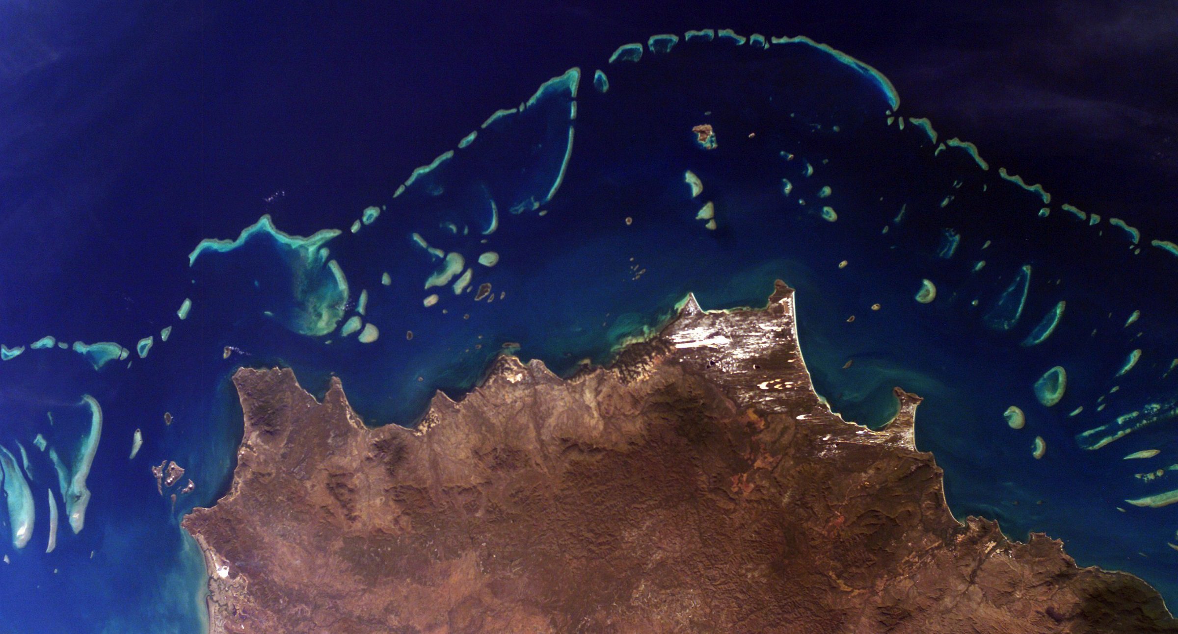
NASA Introduces CORAL Campaign
A new three-year NASA field expedition will use advanced instruments on airplanes and in the water to survey more of the world's coral reefs in greater detail. The COral Reef Airborne Laboratory (CORAL) will measure the condition of these threatened ecosystems and create a unique database of uniform scale and quality.
