Sophia Antipolis, France – February 17, 2016 – LuxCarta, parent of leading geodata production companies ComputaMaps and GEOIMAGE, announced today it is moving to a single global brand. The company’s digital maps and SpacEyes3D visualization software will be...
Maptitude 2016 is Available Now
NEWTON, MA (USA) - Caliper Corporation is pleased to announce that Maptitude 2016, a major release of Caliper Corporation's popular GIS (Geographic Information System) and mapping software, is available now. The 2016 version provides the most up-to-date and accurate...
Global Mapper LiDAR Module 17.1 Released with New Custom Feature Extraction Tool
Hallowell, Maine – February 16, 2016 - Blue Marble Geographics (bluemarblegeo.com) is pleased to announce the immediate availability of an update to the Global Mapper LiDAR Module. Offered in conjunction with the recent release of Global Mapper version 17.1, Blue...
Esri Announces Big Changes to Small Government Enterprise License Agreement Program
Redlands, California—February 17, 2016 — Esri has announced a significant change to its Small Municipal and County Government Enterprise License Agreement (ELA) program. Municipal and county governments serving populations between 100,000 and 250,000 that have...
Geospatial Analytics Market Worth 72.21 Billion USD by 2020
According to a new market research report "Geospatial Analytics Market by Type (Surface Analysis, Network Analysis, Geovisualization), Technology, Application, Vertical, Region (Europe, North America, Asia-Pacific, Middle East & Africa, Latin America) - Global...
MQ-4C Triton UAS Completes Operational Assessment
NAVAL AIR STATION PATUXENT RIVER, Md., Feb. 17, 2016 — The MQ-4C Triton unmanned aircraft system (UAS) built for the U.S. Navy by Northrop Grumman Corporation (NYSE:NOC) has successfully completed Operational Assessment (OA). Pending final data analysis, the...
Ball Aerospace Completes Instrument Integration on Nation’s Next Polar-orbiting Weather Satellite
BOULDER, Colo., Feb. 17, 2016 — All five of the complex and critical instruments that will deliver data for NOAA's next polar-orbiting weather satellite mission have been integrated by Ball Aerospace & Technologies Corp. on the Joint Polar Satellite System-1...
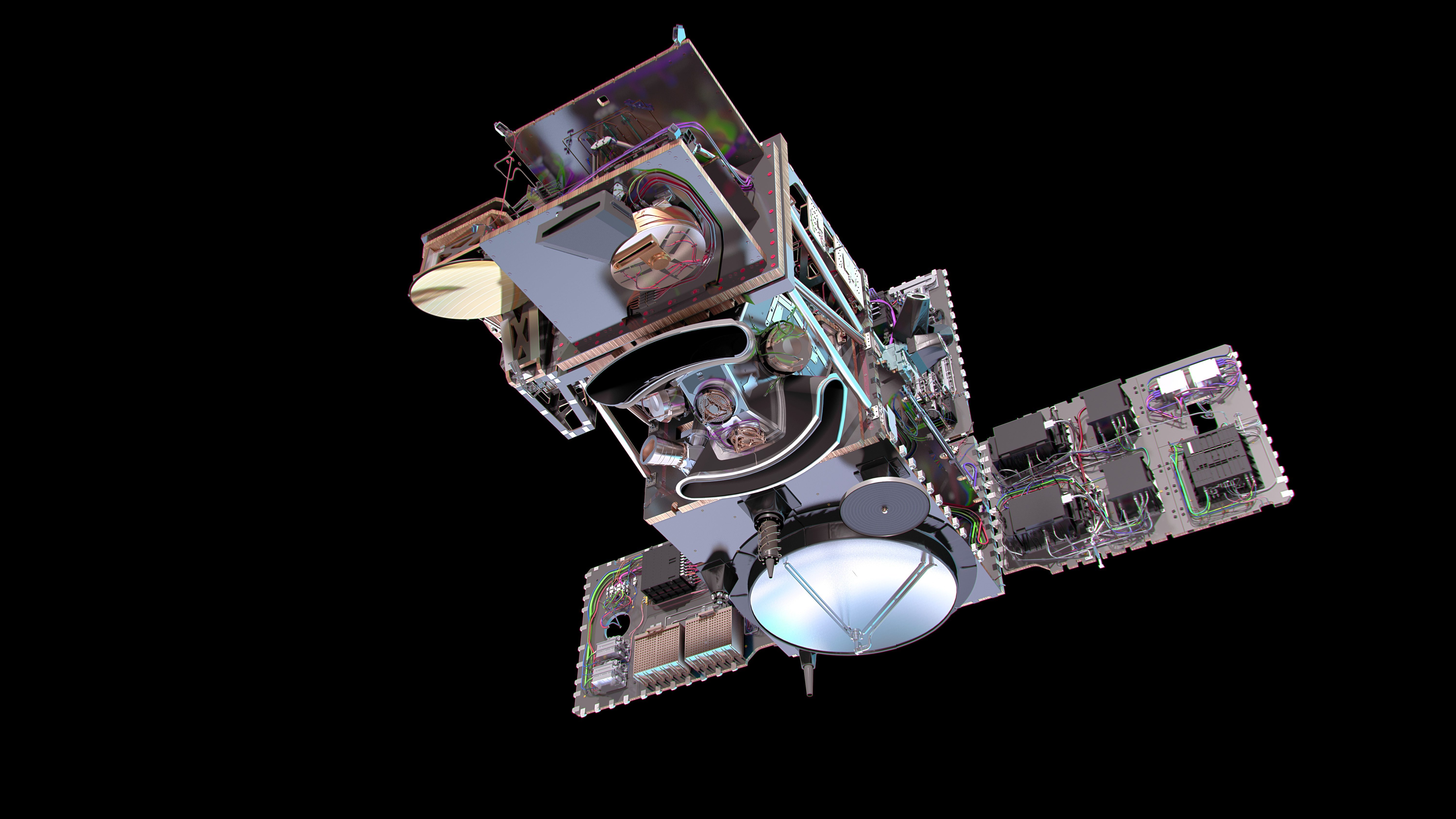
Sentinel-3A Satellite Successfully Launched
On Feb. 16, 2016, the European Space Agency's much-anticipated Sentinel-3A satellite was successfully launched from the Plesetsk cosmodrome in northern Russia.
RIEGL is Attending, Exhibiting, and Presenting at ILMF!
RIEGL will be attending, exhibiting and presenting at ILMF! International LiDAR Mapping Forum (ILMF) is a technical conference and exhibition showcasing the latest airborne, terrestrial, and underwater LiDAR, as well as emerging remote-sensing and data collection...
Elbit Systems Introduces Skylark 3: The Latest Addition To Its Family Of Mini-UAS
Elbit Systems has developed the Skylark3, a new autonomous mini Unmanned Aircraft System (UAS), best suited for brigades and divisions in "beyond the next hill" reconnaissance, counterinsurgency and force protection missions, as well as for use in a range of civil...
