WEST VIRGINIA — Woolpert has tasked its unmanned aerial systems (UAS), or drones, with monitoring landslide areas and potential landslide areas in northern West Virginia. “This is an active weather time, with West Virginia experiencing historic rains,†said...
Esri Helps Youth Locate First Job
Redlands, California —Advocates of the Opportunity Youth Network (OYN) have called for employers nationwide to embrace young people entering the workforce through the organization's First Job Compact. The compact urges companies to earmark entry-level positions for...
Latest Version of TerraGo Edge Improves Efficiency, Accuracy and Quality of Field Data Collection
TerraGo, a pioneer of geospatial collaboration, field data collection and enterprise mobility software, announces the availability of TerraGo Edge 3.9.5 with a number of new, powerful features for iOS®, Android® and web users. TerraGo Edge is the only mobile...
SeaRobotics Delivers Unmanned Surface Vehicle for Marine and Aquatic Research
STUART, Florida. – SeaRobotics Corporation (SeaRobotics) has delivered the USV 2.5, an autonomous 2.5 meter unmanned surface vehicle (USV) to the Center for Marine Science and Technology at North Carolina State University. The USV, built by SeaRobotics, was funded...
Surrey Satellite Further Expands Its LEO Product Capability with Nanosatellite Offering
ENGLEWOOD, COLO. — Surrey Satellite Technology (Surrey) announces the expansion of its low-Earth orbit (LEO) satellite platform product capability with an extended nanosatellite offering. This follows the recent announcement by Surrey of its contract award for the...
OGC Requests Participation in its Marine DWG
The Open Geospatial Consortium (OGC®) is calling for public participation in its newly-established Marine Domain Working Group (Marine DWG). The Marine DWG was established to address applicability of the OGC standards baseline with regards to marine geospatial data,...
RIEGL Will be Attending Trade Shows This August in Malaysia, the United States, and the Philippines!
The first show this month will be the 7th National Geospatial Information Symposium (NGIS). The 7th NGIS will be held on August 8 and 9, 2016 at Putrajaya International Convention Center in Malaysia. National Geospatial Information Symposium is a bi-annual events...
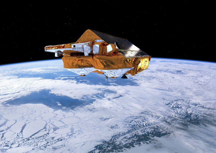
Bonus Result: CryoSat Accurately Measures Coastal Sea Levels
Scientists from the Norwegian University of Life Sciences report that the European Space Agency's CryoSat satellite and its radar altimeter can map coastal sea levels much closer than previous satellite-based methods.
Is Britain on the Move?
Australia has recently announced a 1.8m shift in its mapping coordinates, to compensate for the country’s 7.5cm shift north each year. Inevitably the question is why, and could the same thing happen here? In Australia, the shift is to take into account the growing...
Drone Operators Can Take to the Skies with New senseFly Financing and Insurance Packages
LONDON, August 2, 2016 – Today senseFly is enabling professional U.S. drone operators to take to the skies faster than ever before. By partnering with Ascentium Capital and Transport Risk Management, senseFly is offering new drone insurance, finance and leasing...
