Smoke from several large wildfires in Canada was so thick and widespread that it was easily visible from 1.5 million kilometers (1 million miles) away from Earth.

Smoke from several large wildfires in Canada was so thick and widespread that it was easily visible from 1.5 million kilometers (1 million miles) away from Earth.
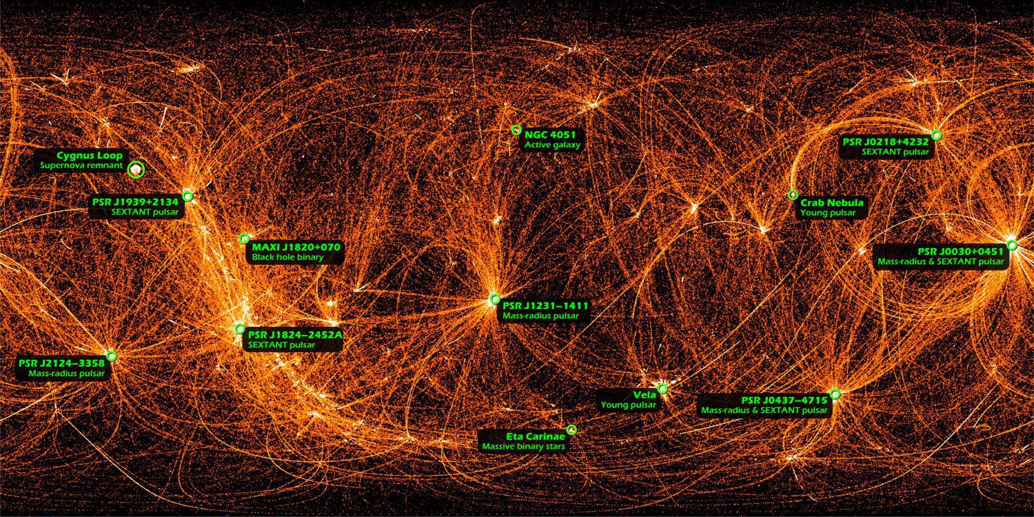
This is a map of the entire sky in X-rays recorded by NASA's Neutron star Interior Composition Explorer (NICER), a payload on the International Space Station.
Montreal, Canada, June 4th, 2019 – SimActive Inc., a world-leading developer of photogrammetry software, announces the release of Correlator3D™ version 8.2 with advanced processing capabilities of multispectral imagery.  Supported sensors include the MicaSense...
Kleos Space S.A. (ASX: KSS, Frankfurt: KS1), a space-powered Radio Frequency Reconnaissance data provider, will exhibit at United States Geospatial Intelligence Foundation’s (USGIF) GEOINT 2019 Symposium (GEOINT) at the Henry B Gonzalez Convention Centre in San...
Herndon, VA – Skyline Software Systems Inc. announced today that it has released TerraExplorer™ for Desktop 7.1 as part of its robust suite of 3D geospatial mapping solutions. This latest update contains enhancements and features that include improved integration...
SAN ANTONIO- Today at the USGIF-sponsored GEOINT Symposium in San Antonio, BlackSky, a leading provider of geospatial intelligence, satellite imaging, and global monitoring services, announced it has signed an agreement with HawkEye 360, the first commercial company...
Utah State University’s Space Dynamics Laboratory announced today that Robert Cardillo has been appointed to its Guidance Council. The announcement was made during the United States Geospatial-Intelligence Foundations’ GEOINT Symposium. Cardillo is a distinguished...
WASHINGTON -Â As a not-for-profit serving the defense and intelligence communities, Riverside Research is excited to exhibit in this year's 2019 Geospatial Intelligence (GEOINT) Symposium and present two lightning talks during the event. GEOINT takes place at the...
SANTA MONICA, Calif. - Today, AirMap, the leading global unmanned aerial systems traffic management (UTM) platform, announced the appointment of Tom Wheeler, former Chairman of the Federal Communications Commission (FCC), to the company's Board of Directors. Mr....
ARLINGTON, Virginia- BAE Systems, Inc. has announced the purchase of the key assets of Riptide Autonomous Solutions (Riptide), a Plymouth, Massachusetts-based provider of innovative, affordable unmanned underwater vehicle (UUV) technology and solutions....
