Captured by the Copernicus Sentinel-2 mission on Aug. 21, 2019, this image features a huge raft of pumice rock drifting in the Pacific Ocean.
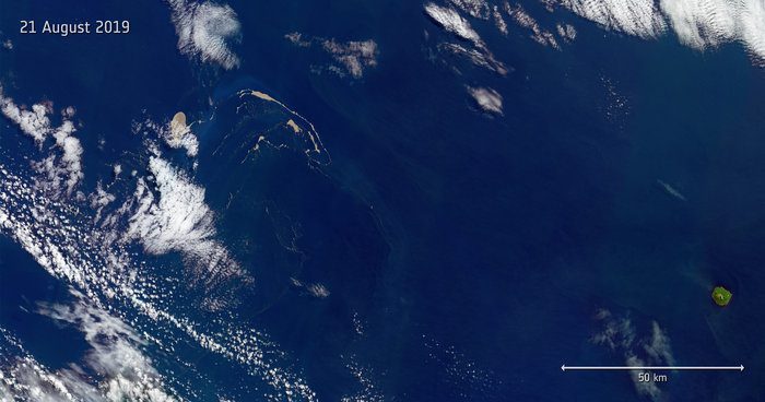
Captured by the Copernicus Sentinel-2 mission on Aug. 21, 2019, this image features a huge raft of pumice rock drifting in the Pacific Ocean.
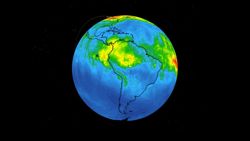
New data from NASA's Atmospheric Infrared Sounder (AIRS) instrument aboard the Aqua satellite shows the movement high in the atmosphere of carbon monoxide associated with fires in the Amazon region of Brazil.
NEWTON, MASSACHUSETTS (USA) - The National Conference of State Legislatures (NCSL) Midwest Redistricting Seminar will be held October 24-27, 2019 in Columbus, Ohio (USA). The seminar covers redistricting law, new technology, and other aspects of drawing the decennial...
STAMFORD, Conn.- Pitney Bowes Inc. (NYSE: PBI), a global technology company that provides commerce solutions in the areas of ecommerce, shipping, mailing, data, and financial services, today announced that it has entered into a definitive agreement to sell its...
NEW YORK - Microsol Resources Corporation—a recognized leader in building information modeling (BIM) technology solutions, as well as a leading Autodesk Platinum Partner serving the architectural, engineering and construction (AEC) industries—announces its most...
KANSAS CITY, MO, USA - Pivvot, a leading SaaS provider of location data and analytics solutions, recently celebrated its one-year anniversary milestone. Pivvot was launched in July of 2018 to bring innovative and disruptive technologies to the energy and...
Accurate volume measurements can be challenging but are critical to various industries nowadays. This training session will discuss how to perform accurate stockpile measurement in Correlator3D. Register here: https://bit.ly/2ZedpMj
SHENZHEN, China - Over the past years, unmanned aerial vehicle technology has been drastically applied for commercial purposes following the wide application of UAV, increasingly established AI technology, electronic and wireless control technological improvement and...
Designed to enable safe and accurate mapping, the company’s robust, easy-to-operate fixed-wing solutions can be explored at booth B3.078, Hall 3, Stuttgart, Germany; 17-19 September 2019  Cheseaux-sur-Lausanne, Switzerland – senseFly, the global leader in...
Successful mission helped place the second advanced GPS III satellite into orbit Aerojet Rocketdyne propulsion systems support every phase of mission; from boost to decommissioning Launch marked final mission for ULA Delta IV Medium launch vehicle CAPE CANAVERAL,...
