INDIANAPOLIS — Woolpert is pleased to announce that Chris Snyder has been promoted to lead its Aviation market and guide the logistical and innovative expansion of its geospatial and design practices. Snyder said the firm plans to strengthen its presence in...
FLIR Launches First Thermal Imaging Building Inspection System: FLIR MR277
FLIR MR277 Combines a Built-In Thermal Imager with Moisture Hygrometer and FLIR Multi-Spectral Dynamic Imaging to Help Users Quickly Troubleshoot Moisture Issues ARLINGTON, Va. – FLIR Systems, Inc. (NASDAQ: FLIR) announced today the FLIR MR277 building...
Nearmap Brings Precise Roof Geometry Measurement to Your Fingertips Through API Integration
DALLAS - Nearmap, a company that delivers high-resolution aerial imagery as a service to businesses across the world, announced today the coming of a new roof geometry application programming interface (API) that enables users to remotely obtain a near real-time feed...
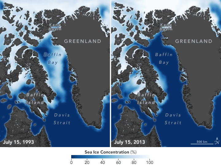
Polar Bears Struggle as Sea Ice Declines
Sea ice concentrations have declined by 13 percent each decade since 1979 due to increasing global temperatures. Arctic regions have warmed twice as fast as the rest of the world, so seasonal sea ice is also forming later in the fall and breaking up earlier in the spring.
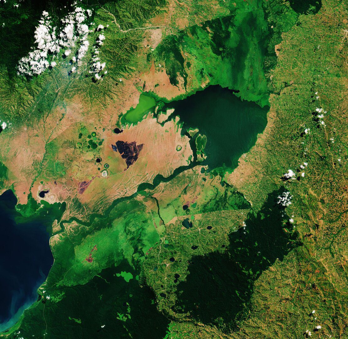
Lake George, Uganda
This Copernicus Sentinel-2 image takes us over Lake George, in western Uganda. In 1988, Lake George was designated as Uganda's first Ramsar site, given its importance as a center for biological diversity.
Phase One Industrial and AI-Survey GmbH Sign Partner Integrator Agreement
Enabling new opportunities in drone-based high-end aerial imaging  Copenhagen, Denmark and Altenkirchen, Germany – Phase One Industrial, a world-leading provider of medium format metric cameras and imaging solutions for aerial applications, today announced that...
Airbus, Hexagon sign on to Geo Connect Asia 2020
Airbus and Hexagon will be joining Geo Connect Asia 2020, South East Asia’s first-ever geospatial services and location intelligence event taking place on 18 and 19 March at Suntec Singapore. What organisers are calling an Asian event with a global audience, Geo...
URISA Announces 2020 Vanguard Cabinet of Young Professionals
URISA is pleased to announce the newest members of its Vanguard Cabinet. The Vanguard Cabinet (VC) is a URISA initiative (which debuted in 2011) to engage young GIS practitioners, increase their numbers in the organization, and better understand the concerns facing...
Cadcorp launches GIS data management tool
Cadcorp SIS ETL (Extract, Transform, Load) is a data management tool that manages and controls the flow of data between files, databases and servers. The applications of this tool include streamlining spatial data management and providing concurrent data for a cloud...
1Spatial announce the release of 1Integrate v2.6
Cambridge, UK- (www.1spatial.com) 1Spatial, the global geospatial software and solutions company, is pleased to announce the general release of 1Integrate v2.6. This release adds support for Google BigQuery, improved control when handling XYZM data, enhanced built-in...
