CALGARY – Solv3D Releases Support for Additional Datasets within SiteVisit360™ Geospatial Collaboration Platform. Solv3D, a leading provider of point cloud processing, geospatial data visualization and collaboration tools is pleased to announce, as part of their...
Spottitt Launches Cloud-Based Geospatial Data Analysis on DNV GL's Veracity Platform
HARWELL, United Kingdom – Spottitt Ltd. has launched a cloud-based workspace that puts massive satellite imagery sources and advanced analysis capabilities at the fingertips of energy, environment, and infrastructure professionals. The Spottitt service is available...
Boundless to Host and Speak at USGIF Events in St. Louis
LOUIS, Mo. –Boundless, the leader in open and scalable GIS, today announced it will present two sessions at USGIF Tech Showcase West, taking place Oct. 16-17 in St. Louis, Mo. In conjunction with Tech Showcase West, Boundless will also co-host a Geospatial Tech...
Accepting Nominations for Achievement in Lidar
International LiDAR Mapping Forum (ILMF) and Lidar Magazine are excited to host second annual Lidar Leader Awards, which will be presented at ILMF, taking place January 28-30, 2019 in Denver. This is a unique opportunity for the geospatial community to recognize the...
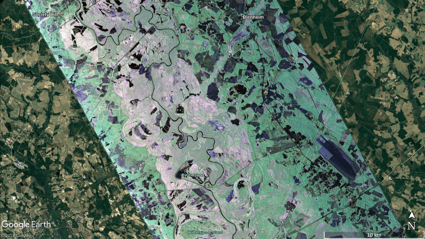
NASA Airborne Team Surveys Flooding from Hurricane Florence
In the aftermath of Hurricane Florence, which struck the Carolinas on Sept. 14, 2018, NASA quickly deployed a sophisticated airborne radar to give disaster response agencies a much-needed view of floodwaters that continued to threaten the region.
NavVis IndoorViewer Now Converts Static Scans into Immersive 360° Imagery
MUNICH, Germany – NavVis, a leading provider of indoor spatial intelligence technology, can now automatically convert E57 point cloud files into interactive, realistic 360° walkthroughs, following the latest software upgrade to IndoorViewer. NavVis IndoorViewer is...
Esri Business Partner, GEO Jobe GIS, at the 6th Annual Mississippi Geospatial Conference
OLD HICKORY, Tenn.- GEO Jobe is pleased to be involved as a supporter and sponsor of the 6th annual Mississippi Geospatial Conference, taking place October 11-12, 2018 at the University of Southern Mississippi Gulf Park Campus in Long Beach, MS. Representing GEO Jobe...
URISA Releases White Paper Defining the Boundaries of Practice Between Surveyors and GIS Professionals
In recent years, URISA's Policy Advisory Committee has facilitated several panel discussions at GIS-Pro conferences during which surveyors and GIS professionals have discussed the distinctive, yet complementary, services that each profession provides. Surveyors and...
Epson to Announce and Demonstrate New Robot Solutions at Pack Expo
CARSON, Calif.- Who: At Pack Expo, Epson Robots will be launching the SynthisTM T6 All-in-One SCARA robot as well as  Force Guide, a high performance integrated force guidance solution. The company will also showcase  various leading robots for factory automation in...
Maxar’s SSL Continues Positive Momentum in Growing U.S. Government Pipeline
PALO ALTO, CA -Â SSL, a Maxar Technologies company (formerly MacDonald, Dettwiler and Associates Ltd.) (NYSE: MAXR) (TSX: MAXR), and a leading provider of innovative satellites and spacecraft systems, has been selected as one of three companies qualified to compete...
