Sentera announced that its stand count analytics product will be immediately available for cotton crops within FieldAgent.™ This extension to Sentera’s stand count tool will help cotton growers and ag professionals make informed replant decisions via a detailed,...
West Wilson Utility District Turns to GEO Jobe for UAV Data Capture & Orthophoto Updates
NASHVILLE, Tenn. - GEO Jobe, a leading GIS software and solution provider offering UAV mapping services, has been integrating UAV / UAS data capture into a number of projects enabling quick turn-around and cost savings for clients. What this means is that in addition...
NXP Releases the Industry's Highest Power Density for RF LDMOS in Avionics
HONOLULU - IMS 2017 - NXP Semiconductors N.V. (NASDAQ:NXPI), the leader in RF power, today announced the industry's most compact RF laterally diffused metal oxide semiconductor (LDMOS) solution for the automatic dependent surveillance-broadcast (ADS-B) and unmanned...
UltiSat Awarded CTC Task Order to Provide Commercial SATCOM Services for Global Hawk UAV Operations
GAITHERSBURG, Md.-- UltiSat, Inc., a leading provider of end-to-end managed satellite network solutions, announced that Defense Information Systems Agency (DISA) Defense Information Technology Contracting Organization (DITCO) recently awarded a COMSATCOM Transponded...
Volaero UAV & Drones Corp. Joins Miami-Dade Beacon Council’s Drone Initiatives
MIAMI - Volaero Drones (www.volaerodrones.com) an investor member of the Miami-Dade Beacon Council Aviation Committee, and a sponsor exhibitor of drones at the recent Wings-of-Change Miami event, will be further presenting at the upcoming mini seminar for local...
senseFly Corridor Solution Boosts Efficiency of Linear Mapping Projects
Cheseaux, Switzerland – senseFly, the world’s leading producer of mapping drones, today announces senseFly Corridor, a new platform enhancement that vastly simplifies the drone (UAS) mapping of linear infrastructure and sites. senseFly Corridor will debut on May...

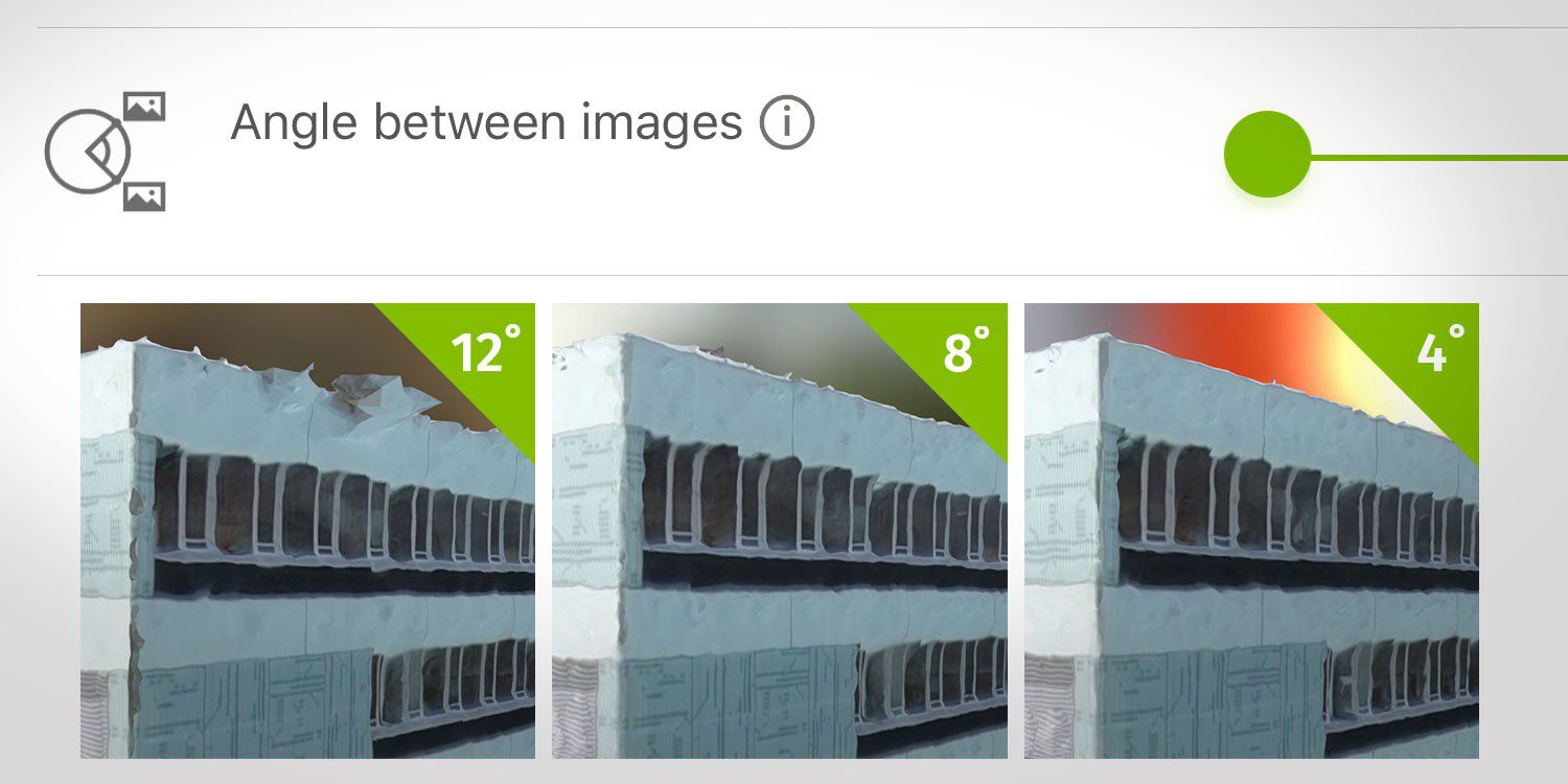
How Do I Choose the Correct Image-Capture Settings for 3D Models?
What are the effects of the angle between images setting in circular missions when it comes to 3D reconstruction?
PCI Geomatics Releases STAX for UAV
PCI Geomatics, a world-leading developer of remote sensing and photogrammetric software and systems, announced today that it has released a new UAV image alignment and analysis tool: STAX. STAX provides simple to use automated tools for aligning and analyzing UAV...
UgCS Photogrammetry Tool for UAV Land Surveying Missions
Latvia, Riga - Before the introduction of small UAVs for aerial photogrammetry, planes, helicopters and metric cameras were used. Not only was this costly, it was also complex due to the images being taken from high altitudes. UAVs have made aerial mapping more...
AeroVironment and California State University, Fresno Begin Field Research to Identify Water Stress in Almond Production Using Advanced UAV Data
MONROVIA, Calif.- AeroVironment, Inc. (NASDAQ: AVAV), a global leader in unmanned aircraft systems for both military and commercial applications, today announced it has begun a year-long study with California State University, Fresno to research how unmanned aerial...

