Lokeren, Belgium - Orbit GT launches a new update for it’s SaaS platform www.3dmapping.cloud “After support for Mobile Mapping and UAS Mapping content, we now proudly announce the support for Oblique Imagery and Aerial Point Clouds. From now on, anyone owning...
A Novel Solution for 3D Mapping Construction Sites: Put a Camera on a Crane
After making its name on the drone photogrammetry market, Pix4D is working its way into solutions designed specifically for construction–and some of those solutions are very creative. First, some background: Pix4D offers a BIM solution built on existing...
Orbit GT Launches Disruptive 3D Mapping Cloud Solution at SPAR, Houston
“Orbit GT has been preparing for a cloud based SaaS product for over 2 yearsâ€, says Peter Bonne, CEO of Orbit GT. “Being experts in the management of big data in domains of Mobile Mapping, UAS Mapping, Oblique Mapping and Indoor Mapping, a cloud based product is...
Pix4D Launches World's First Crane Camera Solution for 3D Mapping and BIM at CONEXPO-CON/AGG 2017. Now in Store
Lausanne (Switzerland), March 7, 2017 - Pix4D, a Swiss developer of drone mapping software, and Liebherr, one of the world’s largest manufacturer of tower cranes, are launching a unique crane-based mapping solution at CONEXPO-CON/AGG in Las Vegas. The solution is...

Tandem Sensors Collect 3D Data
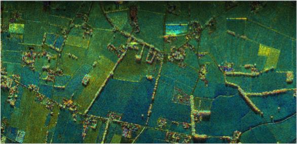
A novel airborne experiment over the flat agricultural landscape of The Netherlands recently simulated, for the first time, images that could be taken by radar satellites orbiting in tandem.
Bluesky Publishes First Online 3D Maps of Isle of Man
Aerial mapping company Bluesky has signed a contract with the Isle of Man Government to resell laser scan survey data of the British Crown dependency. Located in the Irish Sea between England and Ireland, the Isle of Man is perhaps best known for the annual motorcycle...
Cardno Provides U.S. Northwest Law Enforcement Agencies with 3D Mapping and Crime Scene Reconstruction Services
Professional infrastructure and environmental services firm Cardno has released new technology designed to help reduce man-hours required to clear an accident scene. The technology has already been used by several agencies throughout western Washington. To document...
eeGeo Launches Smart Workplace Solution
SAN FRANCISCO & LONDON, June 23rd, 2016 – Today eeGeo, the global 3D mapping company, launched its Smart Workplace solution at Silicon Valley real estate conference RealComm. The solution will enable businesses to transition to a smart workplace environment...
CartoConsult 3D Visualisations Add a Creative Edge to University Prospectus Brochures
Swindon, UK, 09 June 2016 – CartoConsult has completed a 3D mapping project for Pearson’s Business School, London. Commissioned by Hunterlodge Advertising, CartoConsult produced a range of 3D images for Pearson Business School and Escape Studio’s 2016 prospectus...
Vricon Joins Esri Partner Network to Expand Use of High-Resolution 3D Geodata
Redlands, California—February 23, 2016—Vricon, a leading provider of photo-realistic 3D mapping products and digital elevation models for the defense and security industries, is now a member of the Esri Partner Network. Vricon's partnership with Esri, the market...

