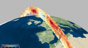
 Carrying breakthrough laser technology, the Aeolus satellite”an ESA Earth Explorer mission”was launched in August 2018. It is the first satellite mission to profile Earth's winds directly from space. Its data are not only being used to understand how wind, pressure, temperature and humidity are interlinked to contribute to climate research, but are also now being used in near-realtime for weather forecasting. This image is an example of Level-2B Rayleigh wind velocity in meters per second over Europe on May 6, 2020. The image was produced with the Aeolus virtual research platform VirES.
Image Credit: ESA/VirES

