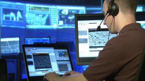
Lockheed Martin helps its customers merge traditional geospatial data with multisource data to support troops on the battlefield, intelligence agents worldwide and emergency responders at home.
Want to put the power of Geospatial Intelligence (GEOINT) in your hands? Lockheed Martin delivers capabilities and tools for actionable intelligence. We combine big data analytics with advanced geo-registration empowered by a cloud configuration. With Lockheed Martin, activity-based intelligence (ABI) is a present-day reality, not a future state.
Lockheed Martin's GeoFlixâ„¢ full-motion video application provides intelligence analysts and warfighters with a scalable, affordable motion imagery exploitation capability. This FOSS solution is based on the same internet streaming video architectures most analysts and warfighters use at home and on handheld devices every day. GeoFlixâ„¢ operates in low-bandwidth environments using internet protocols currently in use on Department of Defense and intelligence community networks. GeoFlixâ„¢ also supports multiple video formats, allowing users to analyze video from multiple platforms.
GeoMIâ„¢ provides geo-registration services to improve the accuracy of full-motion video, wide-area motion imagery, infrared imagery, synthetic aperture radar and aerial photography imagery. GeoMIâ„¢ is a feature-rich capability that enables intelligence analysts and warfighters to resolve highly accurate position data from video and imagery sources for precision missions.
LM Wisdom ITIâ„¢ provides a user-friendly and flexible multidimensional view of data to fight insider threats. Counterintelligence and security professionals receive automated analysis to evaluate employee behavior patterns, flagging individuals who exhibit high-risk characteristics. Using a holistic approach integrates multiple data sources across the enterprise and models behavioral indicators on the individual, not just cyber fingerprints. LM Wisdom ITIâ„¢ offers a comprehensive common operating picture of insider threat.
Exponential growth of available information means analysts need new capabilities to make sense of the data through smart discovery, correlations, alerts and notifications. Our ATLAS technology directly addresses big data by reducing the amount of time analysts spend sorting to identify meaningful intelligence. ATLAS delivers advanced algorithms for data collection, processing, visualization and predictive analytics. These can be applied to a broad set of use cases such as intelligence analysis, indications and warning, political environment/public sentiment, law enforcement and homeland defense.

Lockheed Martin helps its customers merge traditional geospatial data with multisource data to support troops on the battlefield, intelligence agents worldwide and emergency responders at home.
Lockheed Martin's Big Data solutions represent technologies and architecture designed to economically extract value from very large or complex data sets. We apply these technologies to make sense of the GEOINT deluge to support decision makers. Lockheed Martin advances big data processing by joining enhanced industry platforms with analytics in a cloud-agnostic configuration. This combination with mission workflows and services brings the power of ABI to your mission.
Lodestone is an electric network frequency forensic tool that extracts critical hidden intelligence from audio and video recordings by exploiting hidden power line emanations to determine WHEN and WHERE recordings are made.
Growing mission complexity coupled with increasingly tight budgets means that valuable collection assets need to be efficiently managed and optimized. Our Constellation Optimized Mission Planning and Scheduling Solution (COMPASS) provides an end-to-end solution to fly and manage a constellation of heterogeneous sensors for Earth observation, weather, military or other commercial missions. COMPASS optimizes the use of space, ground or airborne assets with an automated, user-friendly and intuitive tool suite that enhances situational awareness.


