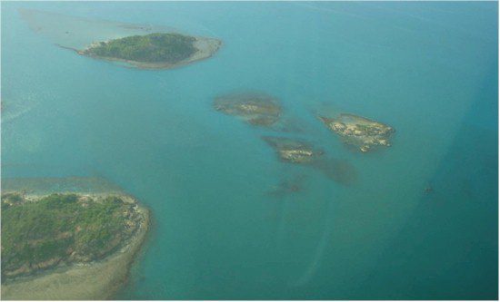
Shallow waters, changing tides and seabed instability create difficulties in nautical charting. A prime example is the Torres Strait, which separates Australia's Cape York, Queensland, from Papua New Guinea. Linking the Coral Sea to the Arafura Sea, the Torres Strait is 160 kilometers wide with an average of 12“15 meters in depth. These shallow waters are peppered with about 274 islands and hundreds of coral reefs and are prone to illegal fishing.
As part of its plan to combat illegal fishing, the Australian government took the initiative to accelerate charting of these waters under the Fisheries Protection Survey and Charting Project. The goal is to provide Royal Australian Navy (RAN) vessels with the necessary information to safely navigate these uncharted waters to carry out enforcement operations. To achieve this, the Australian Hydrographic Service, in concert with the RAN, contracted Fugro to perform survey services of the area using airborne hydrographic light detection and ranging (LiDAR) technology.
Presenting a Solution
The maze of reefs and islands and the strong currents in the Torres Strait make it difficult to navigate and to develop accurate nautical charts. Hydrographic surveying in such a dynamic environment requires a robust approach for quality control of data acquisition in the field, data processing and production. Fugro was able to provide an efficient solution to these challenges using airborne bathymetric LiDAR combined with a network of tidal gauges.
Unlike standard topographic LiDAR systems, a bathymetric LiDAR measures the return pulses from two separate lasers. One laser emits pulses in the infrared spectrum that reflect off the water's surface. The other laser emits pulses in the green spectrum that penetrate the water column and reflect off the seabed down to a depth of 50 meters, depending on water clarity. The main advantage of an airborne LiDAR approach, as opposed to a vessel-based survey, is its ability to safely collect accurate data even in shallow waters and along intricate, rocky shorelines.

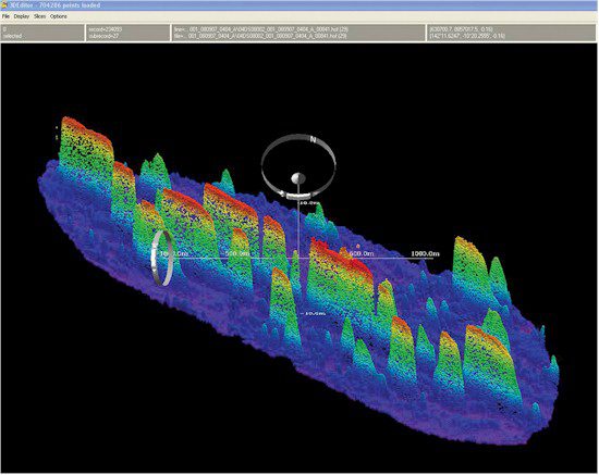
Uncharted drying reefs at depths of 11-15 meters were detected in the Torres Strait using Fugro's SHOALS 1000T bathymetric LiDAR system. Despite the sediment features among the Torres Strait's islands, Fugro's bathymetric system was able to accurately chart these waters.
Changing of the Tides
For nautical chart production purposes, accuracies had to meet International Hydrographic Organization (IHO) standards. The complexity of the tidal regime in the Torres Strait was one of the most challenging aspects of this project. To resolve the complexity of the region's tidal variations, as well as correct data referenced to a water surface that varied in level by more than 3 meters, Fugro installed 18 offshore tide gauges and four shore-based gauges with tide poles. The data were fed into the National Oceanic and Atmospheric Administration's TCARI tidal model, which was refined by Fugro specifically for this project. To adhere to International Hydrographic Organization Order 1 accuracy standards, Fugro took the output from the model and enabled all the LiDAR bathymetry data to be adjusted to a common chart datum. With these new accuracies now in place, Fugro was able to overcome a huge accuracy hurdle and still complete the project in the projected timeframe.
This 6,000+ square kilometer project demonstrated Fugro's ability to develop efficient operational solutions that allow the defense and intelligence community to obtain accurate geospatial information, even in the most challenging environments around the world. With assets stationed on five continents, we deliver end-to-end intelligence, surveillance and reconnaissance solutions to meet our clients' geospatial intelligence needs, using a broad range of state-of-the-art commercial mapping and surveying technologies, including multispectral and hyperspectral imaging; topographic and bathymetric LiDAR; foliage-penetrating IFSAR mapping (GeoSAR); high-altitude, high-resolution, and multiple angled imaging (PanoramiX); and airborne gravity and magnetics.
Fugro website


